Train station nearby Sderot Rail Station
Israel
Train station nearby Sderot Rail Station
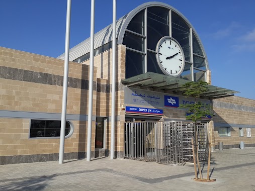
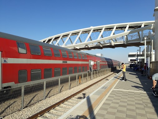
Sderot Rail Station
Ashkelon, Israel
contacts phone
:
+972
Latitude:
31.5156913
, Longitude:
34.5870988
larger map & directions
read more
nearest Train station
101 m
Sderot
Israel
Train station
read more
11.754 km
נתיבות
Israel
Train station
read more
17.976 km
Ashqelon Station
Ashkelon
Train station
read more
20.55 km
Kiryat Gat
Kiryat Gat
Train station
read more
22.023 km
אופקים
אופקים
Train station
read more
25.76 km
תחנת להבים - רהט
להבים
Train station
read more
25.76 km
Lehavim Rahat
Lehavim
Train station
read more
29.682 km
אשדוד עד הלום
אשדוד
Train station
read more
29.682 km
Ashdod Ad Halom
Ashdod
Train station
read more
35.209 km
Беэр-Шева (Север)
Be'er Sheva
Train station
read more
35.209 km
Be'er Sheba-North
Be'er Sheva
Train station
read more
36.37 km
באר שבע מרכז
באר שבע
Train station
read more
36.37 km
Беэр-Шева (Центр)
Be'er Sheva
Train station
read more
43.924 km
Yavneh Ma'arav West
Israel
Train station
read more
46.633 km
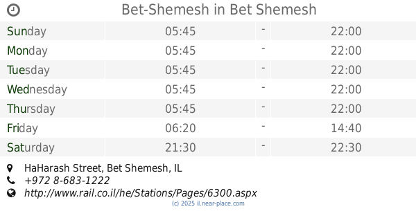
Bet-Shemesh
HaHarash Street, Bet Shemesh
Train station
read more
51.701 km
באר יעקב
Be'er Ya'akov
Train station
read more
51.701 km
Be'er Ya'akov
Be'er Ya'akov
Train station
read more
52.304 km
ראשונים
הרצל 149, ראשון לציון
Train station
read more
52.304 km
Ha - Rishonim
Herzl Street 149, Rishon LeTsiyon
Train station
read more
53.497 km
Ramla
Ramla
Train station
read more
54.895 km
פאתי מודיעין
מודיעין מכבים רעות
Train station
read more
54.975 km
Lod
Israel
Train station
read more
58.339 km
Modi'in Merkaz Station
Israel
Train station
read more
תחנת הרכבת שדרות
ישראל
Train station
read more
Sderot Rail Station
Израиль
Train station
read more
📑
all categories
Accounting
Administrative area level 1
Administrative area level 2
Airport
Amusement park
Aquarium
Art gallery
Atm
Bakery
Bank
Bar
Beauty salon
Bicycle store
Book store
Bowling alley
Bus station
Cafe
Campground
Car dealer
Car rental
Car repair
Car wash
Casino
Cemetery
Church
City hall
Clothing store
Colloquial area
Convenience store
Country
Courthouse
Dentist
Department store
Doctor
Electrician
Electronics store
Embassy
Establishment
Finance
Fire station
Florist
Food
Funeral home
Furniture store
Gas station
General contractor
Grocery or supermarket
Gym
Hair care
Hardware store
Health
Hindu Temple
Home goods store
Hospital
Insurance agency
Intersection
Jewelry store
Laundry
Lawyer
Library
Light rail station
Liquor store
Local government office
Locality
Locksmith
Lodging
Meal delivery
Meal takeaway
Mosque
Movie rental
Movie theater
Moving company
Museum
Natural feature
Neighborhood
Night club
Painter
Park
Parking
Pet store
Pharmacy
Physiotherapist
Place of worship
Plumber
Point of interest
Police
Political
Post office
Premise
Real estate agency
Restaurant
Roofing contractor
Route
Rv park, camping
School
Shoe store
Shopping mall
Spa
Stadium
Storage
Store
Subpremise
Subway station
Supermarket
Synagogue
Taxi stand
Train station
Transit station
Travel agency
University
Veterinary care
Zoo
administrative area level 3
administrative area level 4
sublocality level 1
↑