Gas station nearby רננית
Israel
Gas station nearby רננית
רננית
Israel
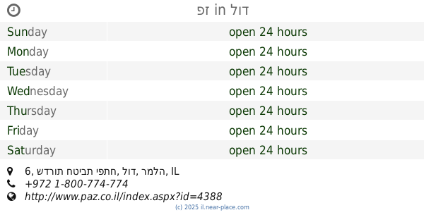
contacts phone
:
+972
Latitude:
32.035136
, Longitude:
35.013532
larger map & directions
read more
nearest Gas station
5.89 km
תחנת דלק פז
Rimon Street 1
Gas station
read more
5.895 km
תחנת דלק פז שוהם
Rimon Street 1, Tirat Yehuda
Gas station
read more
5.895 km
תחנת דלק פז שוהם
רימון 1, טירת יהודה
Gas station
read more
7.472 km
תחנת דלק
שדרת השלום 11, גבעת כ"ח
Gas station
read more
9.372 km
Dor Alon gas station
Amal Street 2, Rosh Haayin
Gas station
read more
9.861 km
كازية نعلين
Al Imam Al Bokhari
Gas station
read more
10.074 km
תחנת דלק סול זול -سول زول إنرجي ⛽️⛽️
רחוב חמזה 9, Kafr Qasim
Gas station
read more
10.633 km
Sol Gas
Ha-Yetsira Street 6-14, Rosh Haayin
Gas station
read more
11.722 km
דלק יהוד
Derech HaAtsma'ut 42, Yehud
Gas station
read more
12.77 km
Delek
Modi'in-Maccabim-Re'ut
Gas station
read more
13.071 km
דור אלון
הירקונים 1, פתח תקווה
Gas station
read more
13.284 km
Discount Gas Station
HaAluf David Marcus Street 4, Petah Tikva
Gas station
read more
13.287 km
Сонол
HaYarkonim Street 53, Petah Tikva
Gas station
read more
13.694 km
Neve Yarak
Neve Yarak
Gas station
read more
15.509 km
Паз
Derech Yitshak Rabin, Petah Tikva
Gas station
read more
15.571 km
ריחן תידלוק בעמ
אבשלום גיסין 63, פתח תקווה
Gas station
read more
15.695 km
דלק
משה דיין 14, פתח תקווה
Gas station
read more
15.829 km
תחנת דלק טן
משה דיין 72, פתח תקווה
Gas station
read more
15.942 km
דור אלון רחוב הסיבים
פתח תקווה
Gas station
read more
16.036 km
פז
שדרות חטיבת יפתח 6, לוד
Gas station
read more
16.036 km
פז
Sderot Hativat Yiftach 6, Lod
Gas station
read more
16.044 km
Mika Petakh Tikva
Petah Tikva
Gas station
read more
17.372 km
פז הוד השרון
דרך רמתיים 98, הוד השרון
Gas station
read more
17.566 km
תחנת דלק דלק נשר
רמלה
Gas station
read more
17.817 km
You Gas Station
Ramat Hasharon
Gas station
read more
📑
all categories
Accounting
Administrative area level 1
Administrative area level 2
Airport
Amusement park
Aquarium
Art gallery
Atm
Bakery
Bank
Bar
Beauty salon
Bicycle store
Book store
Bowling alley
Bus station
Cafe
Campground
Car dealer
Car rental
Car repair
Car wash
Casino
Cemetery
Church
City hall
Clothing store
Colloquial area
Convenience store
Country
Courthouse
Dentist
Department store
Doctor
Electrician
Electronics store
Embassy
Establishment
Finance
Fire station
Florist
Food
Funeral home
Furniture store
Gas station
General contractor
Grocery or supermarket
Gym
Hair care
Hardware store
Health
Hindu Temple
Home goods store
Hospital
Insurance agency
Intersection
Jewelry store
Laundry
Lawyer
Library
Light rail station
Liquor store
Local government office
Locality
Locksmith
Lodging
Meal delivery
Meal takeaway
Mosque
Movie rental
Movie theater
Moving company
Museum
Natural feature
Neighborhood
Night club
Painter
Park
Parking
Pet store
Pharmacy
Physiotherapist
Place of worship
Plumber
Point of interest
Police
Political
Post office
Premise
Real estate agency
Restaurant
Roofing contractor
Route
Rv park, camping
School
Shoe store
Shopping mall
Spa
Stadium
Storage
Store
Subpremise
Subway station
Supermarket
Synagogue
Taxi stand
Train station
Transit station
Travel agency
University
Veterinary care
Zoo
administrative area level 3
administrative area level 4
sublocality level 1
↑