Gas station nearby תחנת דלק
Israel
Gas station nearby תחנת דלק
תחנת דלק
11, שדרת השלום, גבעת כ"ח, פתח תקווה, IL ישראל
contacts phone
:
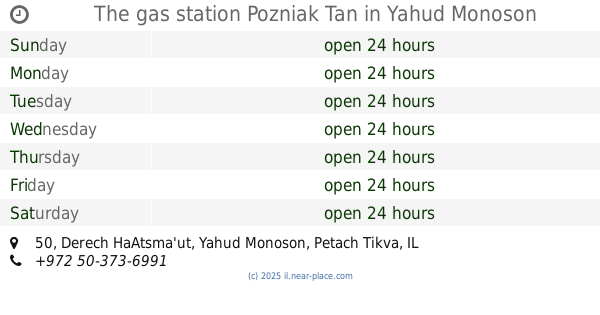
+972
Latitude:
32.0301638
, Longitude:
34.9344689
larger map & directions
read more
nearest Gas station
Gas Station
Shderat ha-Shalom 11, Giv'at Ko'ah
Gas station
read more
15 m
גבעת כח
גבעת כ"ח
Gas station
read more
3.332 km
תחנת יהוד
אלטלף 21, יהוד
Gas station
read more
3.344 km
פז יהוד
יהוד
Gas station
read more
3.419 km
דור אלון
א.ת. יהוד, אלטלף 1, יהוד
Gas station
read more
3.646 km
תחנת דלק פז
Rimon Street 1
Gas station
read more
3.651 km
תחנת דלק פז שוהם
רימון 1, טירת יהודה
Gas station
read more
3.651 km
תחנת דלק פז שוהם
Rimon Street 1, Tirat Yehuda
Gas station
read more
3.675 km
Delek
Magshimim
Gas station
read more
3.675 km
דלק מגשימים
Magshimim
Gas station
read more
3.675 km
תחנת דלק מגשימים
Magshimim
Gas station
read more
3.675 km
דלק מגשימים
מגשימים
Gas station
read more
4.139 km
The gas station Pozniak Tan
Derech HaAtsma'ut 50, Yehud
Gas station
read more
4.175 km
דניה סיבוס
Derech HaAtsma'ut 41, Yehud
Gas station
read more
4.175 km
דניה סיבוס
דרך העצמאות 41, יהוד
Gas station
read more
4.25 km
דלק יהוד
דרך העצמאות 42, יהוד
Gas station
read more
4.25 km
דלק יהוד
Derech HaAtsma'ut 42, Yehud
Gas station
read more
4.25 km
דלק יהוד העצמאות
Derech HaAtsma'ut 42, Yehud
Gas station
read more
4.807 km
סונול נחלים
נחלים
Gas station
read more
4.807 km
Сонол
Nehalim
Gas station
read more
4.807 km
Sonol Nehalim
Nehalim
Gas station
read more
4.888 km
מחסן ממן
Ben-Gurion Airport, Ha-Irusim Street, Ben-Gurion Airport
Gas station
read more
5.228 km
Дор Алон
נתב"ג
Gas station
read more
5.921 km
Delek Ben Gurion Airport
נמל התעופה בן גוריון, עגור
Gas station
read more
5.921 km
Delek Ben Gurion
נמל התעופה בן גוריון, עגור
Gas station
read more
📑
all categories
Accounting
Administrative area level 1
Administrative area level 2
Airport
Amusement park
Aquarium
Art gallery
Atm
Bakery
Bank
Bar
Beauty salon
Bicycle store
Book store
Bowling alley
Bus station
Cafe
Campground
Car dealer
Car rental
Car repair
Car wash
Casino
Cemetery
Church
City hall
Clothing store
Colloquial area
Convenience store
Country
Courthouse
Dentist
Department store
Doctor
Electrician
Electronics store
Embassy
Establishment
Finance
Fire station
Florist
Food
Funeral home
Furniture store
Gas station
General contractor
Grocery or supermarket
Gym
Hair care
Hardware store
Health
Hindu Temple
Home goods store
Hospital
Insurance agency
Intersection
Jewelry store
Laundry
Lawyer
Library
Light rail station
Liquor store
Local government office
Locality
Locksmith
Lodging
Meal delivery
Meal takeaway
Mosque
Movie rental
Movie theater
Moving company
Museum
Natural feature
Neighborhood
Night club
Painter
Park
Parking
Pet store
Pharmacy
Physiotherapist
Place of worship
Plumber
Point of interest
Police
Political
Post office
Premise
Real estate agency
Restaurant
Roofing contractor
Route
Rv park, camping
School
Shoe store
Shopping mall
Spa
Stadium
Storage
Store
Subpremise
Subway station
Supermarket
Synagogue
Taxi stand
Train station
Transit station
Travel agency
University
Veterinary care
Zoo
administrative area level 3
administrative area level 4
sublocality level 1
↑