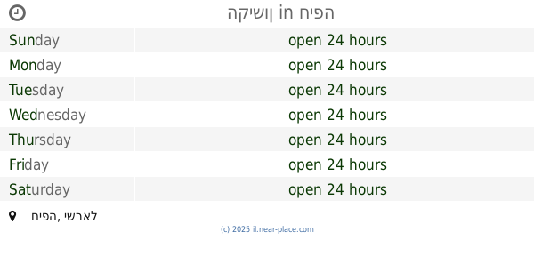
Gas station nearby Park ha-Rekhev
Israel
Gas station nearby Park ha-Rekhev
Park ha-Rekhev
Хайфа, Израиль
contacts phone
:
+972
Latitude:
32.801633
, Longitude:
35.051723
larger map & directions
read more
nearest Gas station
296 m
דלק חוצות המפרץ
שדרות ההסתדרות 163, חיפה
Gas station
read more
296 m
דלק חוצות המפרץ
HaHistadrut Avenue 163, Haifa
Gas station
read more
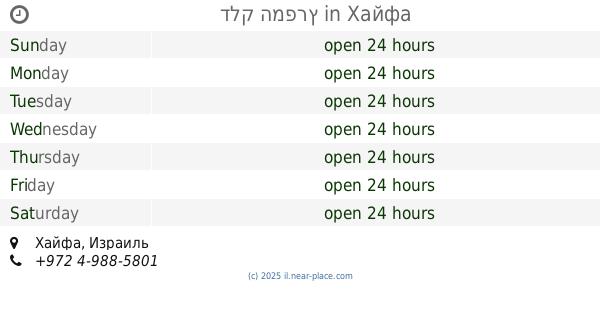
474 m
Сонол
Derech Moshe Dayan 26, Haifa
Gas station
read more
474 m
Sonol Moshe Dayan
Derech Moshe Dayan 26, Haifa
Gas station
read more
474 m
תחנת דלק סונול משה דיין
דרך משה דיין 26, חיפה
Gas station
read more
495 m
יעד
6, Derech Moshe Dayan 12, Haifa
Gas station
read more
1.042 km
תחנת דלק תבור
HaShayish Street 64, Haifa
Gas station
read more
1.063 km
Tiltan
Haifa
Gas station
read more
1.063 km
תלתן
חיפה
Gas station
read more
1.071 km
Mika Haifa
HaShayish Street 48, Haifa
Gas station
read more
1.076 km
השיש
חיפה
Gas station
read more
1.076 km
Tavor Gas Station
Haifa
Gas station
read more
1.076 km
השיש
Haifa
Gas station
read more
1.154 km
Mifrats Haifa Yeshana
Haifa
Gas station
read more
1.203 km
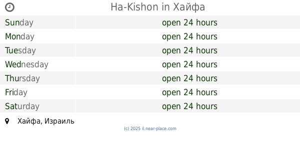
הקישון
חיפה
Gas station
read more
1.203 km
Ha-Kishon
Haifa
Gas station
read more
1.446 km
מתחם פז סנטר תדלוקורן חיפה
שדרות ההסתדרות 233 חיפה הגני ישיוואס מקוריה 055954126, HaHistadrut Avenue 233, Haifa
Gas station
read more
1.737 km
Gas Station
חיפה
Gas station
read more
1.737 km
דלק המפרץ
Haifa
Gas station
read more
1.758 km
תחנת דלק דלק חרמש
Ha-Khermesh Street 20, Haifa
Gas station
read more
1.917 km
Heart Paz bay
Derech Ha'Amakim, Haifa
Gas station
read more
1.917 km
פז לב המפרץ
דרך העמקים, חיפה
Gas station
read more
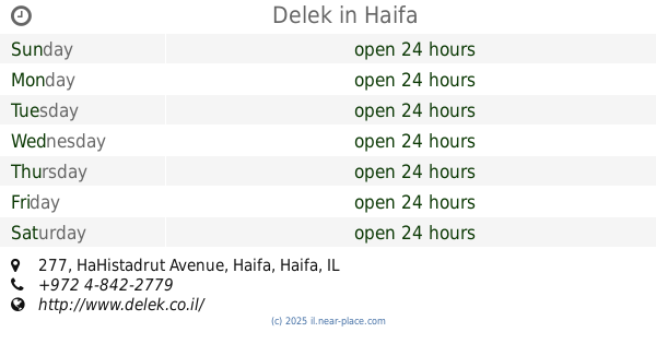
1.934 km
Delek
Tuval Street 12, Haifa
Gas station
read more
1.986 km
דרך העמקים
דרך העמקים, חיפה
Gas station
read more
2.194 km
Delek
HaHistadrut Avenue 277, Haifa
Gas station
read more
📑
all categories
Accounting
Administrative area level 1
Administrative area level 2
Airport
Amusement park
Aquarium
Art gallery
Atm
Bakery
Bank
Bar
Beauty salon
Bicycle store
Book store
Bowling alley
Bus station
Cafe
Campground
Car dealer
Car rental
Car repair
Car wash
Casino
Cemetery
Church
City hall
Clothing store
Colloquial area
Convenience store
Country
Courthouse
Dentist
Department store
Doctor
Electrician
Electronics store
Embassy
Establishment
Finance
Fire station
Florist
Food
Funeral home
Furniture store
Gas station
General contractor
Grocery or supermarket
Gym
Hair care
Hardware store
Health
Hindu Temple
Home goods store
Hospital
Insurance agency
Intersection
Jewelry store
Laundry
Lawyer
Library
Light rail station
Liquor store
Local government office
Locality
Locksmith
Lodging
Meal delivery
Meal takeaway
Mosque
Movie rental
Movie theater
Moving company
Museum
Natural feature
Neighborhood
Night club
Painter
Park
Parking
Pet store
Pharmacy
Physiotherapist
Place of worship
Plumber
Point of interest
Police
Political
Post office
Premise
Real estate agency
Restaurant
Roofing contractor
Route
Rv park, camping
School
Shoe store
Shopping mall
Spa
Stadium
Storage
Store
Subpremise
Subway station
Supermarket
Synagogue
Taxi stand
Train station
Transit station
Travel agency
University
Veterinary care
Zoo
administrative area level 3
administrative area level 4
sublocality level 1
↑