Gas station nearby محروقات ابو عمشة
Israel
Gas station nearby محروقات ابو عمشة
محروقات ابو عمشة
בידיה
contacts phone
:
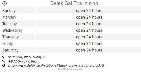
+972
Latitude:
32.1095204
, Longitude:
35.0634989
larger map & directions
read more
nearest Gas station
2.252 km
תחנת דלק סניריא
Saniriya
Gas station
read more
2.651 km
דור אלון אלקנה
אלקנה
Gas station
read more
7.629 km
סונול קרן אור יהודה
החרושת 2, אור יהודה
Gas station
read more
8.768 km
Gal ha-Shalom
Kafr Qasim
Gas station
read more
9.354 km
Dor Alon gas station
Amal Street 2, Rosh Haayin
Gas station
read more
9.435 km
Сонол
Ari'el
Gas station
read more
9.764 km
תחנת דלק סול זול -سول زول إنرجي ⛽️⛽️
רחוב חמזה 9, Kafr Qasim
Gas station
read more
11.673 km
פז חגור
כביש 444, חגור
Gas station
read more
11.674 km
Sol Gas
Ha-Yetsira Street 6-14, Rosh Haayin
Gas station
read more
13.437 km
Neve Yarak
Neve Yarak
Gas station
read more
14.625 km
תחנת דלק סונול
Unnamed Road, Kefar Sava
Gas station
read more
14.748 km
Сьём Прицепа
יוחנן הסנדלר 8, כפר סבא
Gas station
read more
14.77 km
ביסקוויט
כפר סבא
Gas station
read more
14.822 km
סופר אלונית
HaTa'as Street 1, Kefar Sava
Gas station
read more
14.825 km
תחנת דור אלון
התע"ש 1, כפר סבא
Gas station
read more
14.841 km
תחנת איצטדיון כס
HaTa'as Street 32, Kefar Sava
Gas station
read more
14.99 km
תחנת דלק פז
Rimon Street 1
Gas station
read more
15.021 km
תחנת דלק
שדרת השלום 11, גבעת כ"ח
Gas station
read more
15.035 km
גבעת כח
גבעת כ"ח
Gas station
read more
15.659 km
Tira-Nayedet
Tira
Gas station
read more
16.12 km
Delek Gal Tira
כביש 554, טירה
Gas station
read more
16.138 km
פז שרונים
בן יהודה, כפר סבא
Gas station
read more
16.201 km
תחנת דלק מ ע תדלוק
Ras Amer Street, Tira
Gas station
read more
16.514 km
Ha-Nekuda ha-Aduma
Tareq Abd el-Hai Street, Tira
Gas station
read more
17.442 km
פז טירה
כפר טירה, טירה
Gas station
read more
📑
all categories
Accounting
Administrative area level 1
Administrative area level 2
Airport
Amusement park
Aquarium
Art gallery
Atm
Bakery
Bank
Bar
Beauty salon
Bicycle store
Book store
Bowling alley
Bus station
Cafe
Campground
Car dealer
Car rental
Car repair
Car wash
Casino
Cemetery
Church
City hall
Clothing store
Colloquial area
Convenience store
Country
Courthouse
Dentist
Department store
Doctor
Electrician
Electronics store
Embassy
Establishment
Finance
Fire station
Florist
Food
Funeral home
Furniture store
Gas station
General contractor
Grocery or supermarket
Gym
Hair care
Hardware store
Health
Hindu Temple
Home goods store
Hospital
Insurance agency
Intersection
Jewelry store
Laundry
Lawyer
Library
Light rail station
Liquor store
Local government office
Locality
Locksmith
Lodging
Meal delivery
Meal takeaway
Mosque
Movie rental
Movie theater
Moving company
Museum
Natural feature
Neighborhood
Night club
Painter
Park
Parking
Pet store
Pharmacy
Physiotherapist
Place of worship
Plumber
Point of interest
Police
Political
Post office
Premise
Real estate agency
Restaurant
Roofing contractor
Route
Rv park, camping
School
Shoe store
Shopping mall
Spa
Stadium
Storage
Store
Subpremise
Subway station
Supermarket
Synagogue
Taxi stand
Train station
Transit station
Travel agency
University
Veterinary care
Zoo
administrative area level 3
administrative area level 4
sublocality level 1
↑