Gas station nearby דלק טן
Israel
Gas station nearby דלק טן
דלק טן
Явне, Израиль
contacts phone
:
+972
Latitude:
31.8928732
, Longitude:
34.7384155
larger map & directions
read more
nearest Gas station
23 m
Ten
פארן, יבנה
Gas station
read more
622 m
פז רשף יבנה
HaSanhedrin Blvd, Yavne
Gas station
read more
670 m
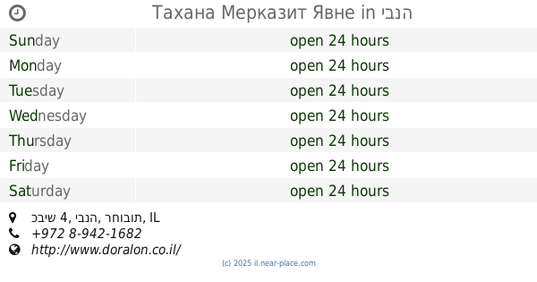
Тахана Мерказит Явне
כביש 4, יבנה
Gas station
read more
670 m
Dor Alon
כביש 4, יבנה
Gas station
read more
701 m
דלק יבנה
שדרות הסנהדרין 34, יבנה
Gas station
read more
701 m
Delek
HaSanhedrin Blvd 34, Yavne
Gas station
read more
701 m
דלק יבנה
HaSanhedrin Blvd 34, Yavne
Gas station
read more
701 m
Delek Yavne
HaSanhedrin Blvd 34, Yavne
Gas station
read more
2.844 km
Dor Alon Gas Station
כביש רחובות-יבנה
Gas station
read more
3.252 km
שער יבנה
יבנה
Gas station
read more
3.253 km
תחנת דלק פז
Ha-Meisav Street 7, Yavne
Gas station
read more
3.253 km
תחנת דלק פז
המיסב 7, יבנה
Gas station
read more
4.02 km
דלק קרית משה
Yetsira Street 4, Rehovot
Gas station
read more
4.02 km
דלק
א.ת., היצירה 4, 08-9361410
Gas station
read more
4.04 km
סופרגז רחובות
רחובות
Gas station
read more
4.16 km
מיקה התאומים
Galgal Street 17, Rehovot
Gas station
read more
4.292 km
פז רכטמן רחובות
א"ת רכטמן, קלמן גבריאלוב, רחובות
Gas station
read more
4.292 km
פז רכטמן רחובות
א"ת רכטמן, קלמן גבריאלוב פינת היצירה, רחובות
Gas station
read more
4.292 km
פז רכטמן רחובות
א"ת רכטמן, קלמן גבריאלוב פינת היצירה, Rehovot
Gas station
read more
4.719 km
תחנת דלק סונול מיקה
Rehovot
Gas station
read more
4.719 km
תחנת דלק סונול מיקה
רחובות
Gas station
read more
4.972 km
Ten Gas Station
בצלאל יפה, תל אביב יפו
Gas station
read more
5.583 km
תחנת דלק יעד
דרך יצחק רבין 26, נס ציונה
Gas station
read more
5.871 km
תחנת דלק אברך אלון למנויים
Beit Hanan
Gas station
read more
5.871 km
תחנת דלק אברך אלון למנויים
בית חנן
Gas station
read more
📑
all categories
Accounting
Administrative area level 1
Administrative area level 2
Airport
Amusement park
Aquarium
Art gallery
Atm
Bakery
Bank
Bar
Beauty salon
Bicycle store
Book store
Bowling alley
Bus station
Cafe
Campground
Car dealer
Car rental
Car repair
Car wash
Casino
Cemetery
Church
City hall
Clothing store
Colloquial area
Convenience store
Country
Courthouse
Dentist
Department store
Doctor
Electrician
Electronics store
Embassy
Establishment
Finance
Fire station
Florist
Food
Funeral home
Furniture store
Gas station
General contractor
Grocery or supermarket
Gym
Hair care
Hardware store
Health
Hindu Temple
Home goods store
Hospital
Insurance agency
Intersection
Jewelry store
Laundry
Lawyer
Library
Light rail station
Liquor store
Local government office
Locality
Locksmith
Lodging
Meal delivery
Meal takeaway
Mosque
Movie rental
Movie theater
Moving company
Museum
Natural feature
Neighborhood
Night club
Painter
Park
Parking
Pet store
Pharmacy
Physiotherapist
Place of worship
Plumber
Point of interest
Police
Political
Post office
Premise
Real estate agency
Restaurant
Roofing contractor
Route
Rv park, camping
School
Shoe store
Shopping mall
Spa
Stadium
Storage
Store
Subpremise
Subway station
Supermarket
Synagogue
Taxi stand
Train station
Transit station
Travel agency
University
Veterinary care
Zoo
administrative area level 3
administrative area level 4
sublocality level 1
↑