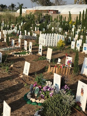
Cemetery nearby בית קברות אזורי גפן תירוש
Israel
Cemetery nearby בית קברות אזורי גפן תירוש
בית קברות אזורי גפן תירוש
ישראל
contacts phone
:
+972
Latitude:
31.7500394
, Longitude:
34.8793145
larger map & directions
read more
nearest Cemetery
4.936 km
Kfar Menakhem Cemetery
Kfar Menahem
Cemetery
read more
6.747 km
Revadim Cemetery
Ревадим
Cemetery
read more
6.94 km
בית קברות כפר הריף
ישראל
Cemetery
read more
8.357 km
Yinon Cemetery
Аинон
Cemetery
read more
8.559 km
Khafets Khayim Cemetery
Hafetz Haim
Cemetery
read more
8.688 km
Khulda Cemetery
Hulda
Cemetery
read more
9.726 km
בית קברות הראל
הראל
Cemetery
read more
10.497 km
בית עלמין
החרצית 546, קדרון
Cemetery
read more
11.267 km
Cemetery way of life Beit Shemesh
Bet Shemesh
Cemetery
read more
11.318 km
בית קברות בית שמש
בית שמש
Cemetery
read more
11.522 km
בית קברות תעוז
ישראל
Cemetery
read more
11.758 km
בית קברות בני עיש
בני עי"ש
Cemetery
read more
11.893 km
Medi-cycle pets graveyard
קדרון
Cemetery
read more
12.003 km
בית העלמין קיבוץ נתיב הלה
Netiv HaLamed Hei Cemetery, Netiv HaLamed-Heh
Cemetery
read more
12.117 km
בית קברות נחם
ישראל
Cemetery
read more
12.188 km
Karmei Yosef Cemetery
Israel
Cemetery
read more
12.371 km
Eretz HaChaim Cemetery
Israel
Cemetery
read more
12.373 km
Yerushalaim Erets HaHaim Cemetery
Израиль
Cemetery
read more
12.543 km
Kiryat Malachi Cemetery
Kiryat Malakhi
Cemetery
read more
13.303 km
בית קברות גלאון
ישראל
Cemetery
read more
13.691 km
בית קברות קרית עקרון
קרית עקרון
Cemetery
read more
13.967 km
Avigdor Cemetery
Avigdor
Cemetery
read more
15.077 km
New Gan Yavne Cemetery
Израиль
Cemetery
read more
15.077 km
New Gan Yavne Cemetery
Israel
Cemetery
read more
15.188 km
Avi'ezer Cemetery
Израиль
Cemetery
read more
📑
all categories
Accounting
Administrative area level 1
Administrative area level 2
Airport
Amusement park
Aquarium
Art gallery
Atm
Bakery
Bank
Bar
Beauty salon
Bicycle store
Book store
Bowling alley
Bus station
Cafe
Campground
Car dealer
Car rental
Car repair
Car wash
Casino
Cemetery
Church
City hall
Clothing store
Colloquial area
Convenience store
Country
Courthouse
Dentist
Department store
Doctor
Electrician
Electronics store
Embassy
Establishment
Finance
Fire station
Florist
Food
Funeral home
Furniture store
Gas station
General contractor
Grocery or supermarket
Gym
Hair care
Hardware store
Health
Hindu Temple
Home goods store
Hospital
Insurance agency
Intersection
Jewelry store
Laundry
Lawyer
Library
Light rail station
Liquor store
Local government office
Locality
Locksmith
Lodging
Meal delivery
Meal takeaway
Mosque
Movie rental
Movie theater
Moving company
Museum
Natural feature
Neighborhood
Night club
Painter
Park
Parking
Pet store
Pharmacy
Physiotherapist
Place of worship
Plumber
Point of interest
Police
Political
Post office
Premise
Real estate agency
Restaurant
Roofing contractor
Route
Rv park, camping
School
Shoe store
Shopping mall
Spa
Stadium
Storage
Store
Subpremise
Subway station
Supermarket
Synagogue
Taxi stand
Train station
Transit station
Travel agency
University
Veterinary care
Zoo
administrative area level 3
administrative area level 4
sublocality level 1
↑