Cemetery nearby Avigdor Cemetery
Israel
Cemetery nearby Avigdor Cemetery
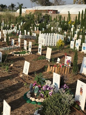
Avigdor Cemetery
Avigdor, Израиль
contacts phone
:
+972
Latitude:
31.7008136
, Longitude:
34.7434333
larger map & directions
read more
nearest Cemetery
2.196 km
Timorim Cemetery
Timorim
Cemetery
read more
3.079 km
בית קברות כפר ורבורג
כפר ורבורג
Cemetery
read more
3.766 km
Nir Banim Cemetery
Израиль
Cemetery
read more
3.766 km
Nir Banim Cemetery
Israel
Cemetery
read more
3.766 km
Nir Banim Cemetery
Izrael
Cemetery
read more
4.112 km
Be'er Tuvya Cemetery
באר טוביה
Cemetery
read more
4.13 km
Orot Be'er Tuvya Common Cemetery
Be'er Tuvia
Cemetery
read more
4.13 km
בית קברות באר טוביה אורות
באר טוביה
Cemetery
read more
4.212 km
אוהל ארבעת הצדיקים
Kiryat Malakhi
Cemetery
read more
4.212 km
אוהל ארבעת הצדיקים
קרית מלאכי
Cemetery
read more
4.236 km
בית קברות קרית מלאכי
קרית מלאכי
Cemetery
read more
4.236 km
Kiryat Malachi Cemetery
Kiryat Malakhi
Cemetery
read more
4.659 km
Kfar Akhim Regional Cemetery
Izrael
Cemetery
read more
4.659 km
בית קברות אזורי כפר אחים
ישראל
Cemetery
read more
5.614 km
Masu'ot Yitshak Regional Cemetery
Izrael
Cemetery
read more
5.912 km
בית קברות ינון
ינון
Cemetery
read more
5.912 km
Yinon Cemetery
Аинон
Cemetery
read more
9.361 km
Nir Yisra'el Cemetery
Nir Yisrael
Cemetery
read more
10.243 km
Hodaya Cemetery
Израиль
Cemetery
read more
11.161 km
בית קברות כוכב מיכאל שובל
ישראל
Cemetery
read more
11.491 km
Khafets Khayim Cemetery
Hafetz Haim
Cemetery
read more
11.638 km
בית קברות משען
משען
Cemetery
read more
14.3 km
Adivi cemetery
Sderot HaTa'asiya, Ashkelon
Cemetery
read more
14.646 km
Medi-cycle pets graveyard
קדרון
Cemetery
read more
19.487 km
Khulda Cemetery
Hulda
Cemetery
read more
📑
all categories
Accounting
Administrative area level 1
Administrative area level 2
Airport
Amusement park
Aquarium
Art gallery
Atm
Bakery
Bank
Bar
Beauty salon
Bicycle store
Book store
Bowling alley
Bus station
Cafe
Campground
Car dealer
Car rental
Car repair
Car wash
Casino
Cemetery
Church
City hall
Clothing store
Colloquial area
Convenience store
Country
Courthouse
Dentist
Department store
Doctor
Electrician
Electronics store
Embassy
Establishment
Finance
Fire station
Florist
Food
Funeral home
Furniture store
Gas station
General contractor
Grocery or supermarket
Gym
Hair care
Hardware store
Health
Hindu Temple
Home goods store
Hospital
Insurance agency
Intersection
Jewelry store
Laundry
Lawyer
Library
Light rail station
Liquor store
Local government office
Locality
Locksmith
Lodging
Meal delivery
Meal takeaway
Mosque
Movie rental
Movie theater
Moving company
Museum
Natural feature
Neighborhood
Night club
Painter
Park
Parking
Pet store
Pharmacy
Physiotherapist
Place of worship
Plumber
Point of interest
Police
Political
Post office
Premise
Real estate agency
Restaurant
Roofing contractor
Route
Rv park, camping
School
Shoe store
Shopping mall
Spa
Stadium
Storage
Store
Subpremise
Subway station
Supermarket
Synagogue
Taxi stand
Train station
Transit station
Travel agency
University
Veterinary care
Zoo
administrative area level 3
administrative area level 4
sublocality level 1
↑