Shopping mall nearby Sha'ar Ha-Ir Shopping Center
Israel
Shopping mall nearby Sha'ar Ha-Ir Shopping Center
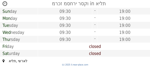
Sha'ar Ha-Ir Shopping Center
Эйлат, Израиль
contacts phone
:
+972
Latitude:
29.5563347
, Longitude:
34.9540721
larger map & directions
read more
nearest Shopping mall
מרכז מסחרי שער העיר
אילת
Shopping mall
read more
124 m
מרכז שלום
שדרות התמרים 2, אילת
Shopping mall
read more
167 m
קניון השלום
שדרות התמרים 2, אילת
Shopping mall
read more
218 m
מרכז מסחרי רכטר
אילת
Shopping mall
read more
219 m
חנויות עציון
Sderot HaTmarim Boulevard 1, אילת
Shopping mall
read more
357 m
מרכז מסחרי אלמוגים
אילת
Shopping mall
read more
568 m
מרכז מסחרי רסקו
אילת
Shopping mall
read more
635 m
מרכז מסחרי צופית
אילת
Shopping mall
read more
638 m
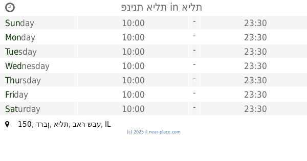
פנינת אילת
דרבן 150, אילת
Shopping mall
read more
638 m
Pninat Eilat
Durban Street 150, Eilat
Shopping mall
read more
641 m
B.G Outlet
Tarshish Street 7, Eilat
Shopping mall
read more
829 m
Dekel commercial center
Eilat
Shopping mall
read more
847 m
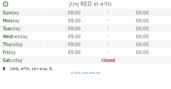
קניון RED
HaMayim Street, Eilat
Shopping mall
read more
847 m
קניון RED
המים, אילת
Shopping mall
read more
855 m
Eilat Bazar
דרך פעמי השלום, אילת
Shopping mall
read more
865 m
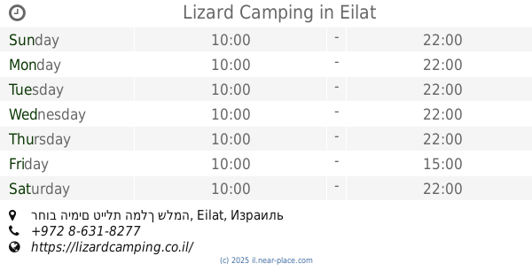
Lizard Camping
רחוב הימים טיילת המלך שלמה, Eilat
Shopping mall
read more
867 m
רונן חן אילת
HaMayim Street 9051, Eilat
Shopping mall
read more
886 m
COOKIES -קוקיס
אנפה 1, אילת
Shopping mall
read more
917 m
מרכז מסחרי איזידור
אילת
Shopping mall
read more
939 m
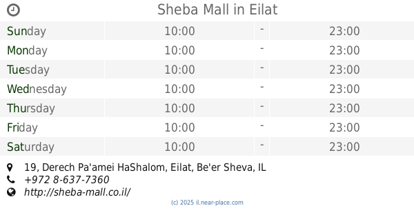
Sheba Mall
Derech Pa'amei HaShalom 19, Eilat
Shopping mall
read more
939 m
קניון שבע
דרך פעמי השלום 19, אילת
Shopping mall
read more
979 m
Shderat ha-Khanuyot Mall
Eilat
Shopping mall
read more
980 m
Ofir Shopping Center
Shkhoret Street, Eilat
Shopping mall
read more
992 m
מרכז מסחרי יעלים
Eilat
Shopping mall
read more
1.113 km
מרכז מסחרי דגניה
אילת
Shopping mall
read more
📑
all categories
Accounting
Administrative area level 1
Administrative area level 2
Airport
Amusement park
Aquarium
Art gallery
Atm
Bakery
Bank
Bar
Beauty salon
Bicycle store
Book store
Bowling alley
Bus station
Cafe
Campground
Car dealer
Car rental
Car repair
Car wash
Casino
Cemetery
Church
City hall
Clothing store
Colloquial area
Convenience store
Country
Courthouse
Dentist
Department store
Doctor
Electrician
Electronics store
Embassy
Establishment
Finance
Fire station
Florist
Food
Funeral home
Furniture store
Gas station
General contractor
Grocery or supermarket
Gym
Hair care
Hardware store
Health
Hindu Temple
Home goods store
Hospital
Insurance agency
Intersection
Jewelry store
Laundry
Lawyer
Library
Light rail station
Liquor store
Local government office
Locality
Locksmith
Lodging
Meal delivery
Meal takeaway
Mosque
Movie rental
Movie theater
Moving company
Museum
Natural feature
Neighborhood
Night club
Painter
Park
Parking
Pet store
Pharmacy
Physiotherapist
Place of worship
Plumber
Point of interest
Police
Political
Post office
Premise
Real estate agency
Restaurant
Roofing contractor
Route
Rv park, camping
School
Shoe store
Shopping mall
Spa
Stadium
Storage
Store
Subpremise
Subway station
Supermarket
Synagogue
Taxi stand
Train station
Transit station
Travel agency
University
Veterinary care
Zoo
administrative area level 3
administrative area level 4
sublocality level 1
↑