Museum nearby Ancient Water System
Israel
Museum nearby Ancient Water System
Ancient Water System
Israel
contacts phone
:
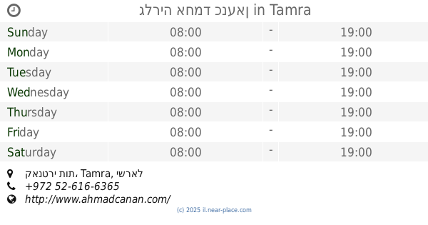
+972
Latitude:
32.747279
, Longitude:
35.293539
larger map & directions
read more
nearest Museum
1.318 km
Mosaic
Tsipori
Museum
read more
1.318 km
פסיפס
ציפורי
Museum
read more
4.64 km
Holy Caves
Nazareth
Museum
read more
4.64 km
Holy Caves
נצרת
Museum
read more
4.969 km
International Marian Centre
אל בישארה 13, נצרת
Museum
read more
4.993 km
Museum Of Ancient Nazareth
נצרת
Museum
read more
5.059 km
The Basilica of the Annunciation
Al-Bishara Street, Nazareth
Museum
read more
5.437 km
And skin touch Gallery
Kfar HaHoresh
Museum
read more
8.706 km
Alsyar Neighbourhood
Bu'eine Nujeidat
Museum
read more
8.706 km
Alsyar Neighbourhood
בועיינה-נוג'ידאת
Museum
read more
10.052 km
מוזיאון א גרוייסע מציאה
יפעת
Museum
read more
10.052 km
מוזיאון א גרוייסע מציאה
Yifat
Museum
read more
10.38 km
מוזיאון העמק, קיבוץ יפעת
יפעת
Museum
read more
10.976 km
Annunciation Church
Nazareth
Museum
read more
11.415 km
Golani Museum
Israel
Museum
read more
11.415 km
מוזיאון גולני
Israel
Museum
read more
12.539 km
חצר דאוד
I'billin
Museum
read more
14.207 km
Students Monument
Kharuv Street, Afula
Museum
read more
14.31 km
The Circassian Museum
חנלאשה, כפר כמא
Museum
read more
14.333 km
מוזיאון המרציפן
חוות היין, שדרות קק"ל, כפר תבור
Museum
read more
14.333 km
Marzipan Museum
חוות היין, שדרות קק"ל, כפר תבור
Museum
read more
14.481 km
מוזיאון אדם ותכשיט
14, Shadmot Dvora
Museum
read more
15.115 km
Beit Hankin
35, Kfar Yehoshua
Museum
read more
15.134 km
בית חנקין
כפר יהושע
Museum
read more
16.907 km
גלריה אחמד כנעאן
קאנטרי תות, Tamra
Museum
read more
📑
all categories
Accounting
Administrative area level 1
Administrative area level 2
Airport
Amusement park
Aquarium
Art gallery
Atm
Bakery
Bank
Bar
Beauty salon
Bicycle store
Book store
Bowling alley
Bus station
Cafe
Campground
Car dealer
Car rental
Car repair
Car wash
Casino
Cemetery
Church
City hall
Clothing store
Colloquial area
Convenience store
Country
Courthouse
Dentist
Department store
Doctor
Electrician
Electronics store
Embassy
Establishment
Finance
Fire station
Florist
Food
Funeral home
Furniture store
Gas station
General contractor
Grocery or supermarket
Gym
Hair care
Hardware store
Health
Hindu Temple
Home goods store
Hospital
Insurance agency
Intersection
Jewelry store
Laundry
Lawyer
Library
Light rail station
Liquor store
Local government office
Locality
Locksmith
Lodging
Meal delivery
Meal takeaway
Mosque
Movie rental
Movie theater
Moving company
Museum
Natural feature
Neighborhood
Night club
Painter
Park
Parking
Pet store
Pharmacy
Physiotherapist
Place of worship
Plumber
Point of interest
Police
Political
Post office
Premise
Real estate agency
Restaurant
Roofing contractor
Route
Rv park, camping
School
Shoe store
Shopping mall
Spa
Stadium
Storage
Store
Subpremise
Subway station
Supermarket
Synagogue
Taxi stand
Train station
Transit station
Travel agency
University
Veterinary care
Zoo
administrative area level 3
administrative area level 4
sublocality level 1
↑