Museum nearby Beit Hankin
Coronavirus disease (COVID-19) Situation
confirmed cases
4841772
deaths
12707
Israel
Museum nearby Beit Hankin
Beit Hankin
35, Kfar Yehoshua, Израиль
contacts phone
:
+972
Latitude:
32.6815109
, Longitude:
35.1521228
larger map & directions
read more
nearest Museum
22 m
בית חנקין
Kfar Yehoshua
Museum
read more
22 m
בית חנקין
כפר יהושע
Museum
read more
4.39 km
great mini world עולם קטן גדול
ha'tzmicha 1, yokne'am ilit
Museum
read more
4.405 km
עולם קטן גדול, מוזיאון מיניאטורות
Ha-Tsmikha Street 1, Yokne'am Illit
Museum
read more
4.405 km
עולם קטן גדול, מוזיאון מיניאטורות
הצמיחה 1, יוקנעם עילית
Museum
read more
4.497 km
עולם קטן גדול
Ezor Yokne'am
Museum
read more
5.073 km
Asian art museum
הזורע
Museum
read more
5.073 km
Asian art museum
HaZore'a
Museum
read more
5.235 km
Wilfried Israel Museum
HaZore'a
Museum
read more
6.879 km
מוזיאון העמק, קיבוץ יפעת
יפעת
Museum
read more
9.001 km
Druze Heritage Center
3 Street, Isfiya
Museum
read more
10.873 km
קָמִין מְלֶאכֶת מַחֲשֶׁבֶת-Kamin
call:+972(0)050-6860890, עין השופט
Museum
read more
13.806 km
International Marian Centre
אל בישארה 13, נצרת
Museum
read more
14.118 km
Holy Caves
Nazareth
Museum
read more
14.382 km
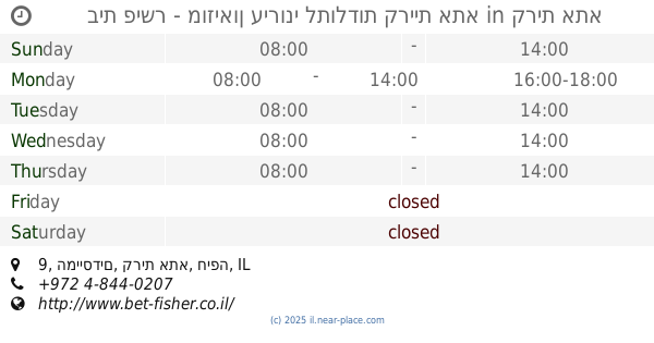
בית פישר - מוזיאון עירוני לתולדות קריית אתא
המייסדים 9, קרית אתא
Museum
read more
14.416 km
פסיפס
ציפורי
Museum
read more
14.416 km
Mosaic
Tsipori
Museum
read more
14.449 km
Students Monument
Kharuv Street, Afula
Museum
read more
15.486 km
תחנה ½4 נשר
המסילה 21, נשר
Museum
read more
15.486 km
תחנה ½4 נשר
Ha-Mesila Street 21, Nesher
Museum
read more
16.333 km
The israeli personal computer museum
Haifa
Museum
read more
16.703 km
אקבן חיפה
Ze'ev Vilnai Street 2, Haifa
Museum
read more
19.705 km
Hermann Struck Museum
ארלוזרוב 23, חיפה
Museum
read more
20.418 km
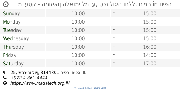
מדעטק - המוזיאון הלאומי למדע, טכנולוגיה וחלל, חיפה
שמריהו לוין 25, חיפה
Museum
read more
20.418 km
Израильский национальный музей науки
Shmaryahu Levin Street 25, Haifa
Museum
read more
📑
all categories
Accounting
Administrative area level 1
Administrative area level 2
Airport
Amusement park
Aquarium
Art gallery
Atm
Bakery
Bank
Bar
Beauty salon
Bicycle store
Book store
Bowling alley
Bus station
Cafe
Campground
Car dealer
Car rental
Car repair
Car wash
Casino
Cemetery
Church
City hall
Clothing store
Colloquial area
Convenience store
Country
Courthouse
Dentist
Department store
Doctor
Electrician
Electronics store
Embassy
Establishment
Finance
Fire station
Florist
Food
Funeral home
Furniture store
Gas station
General contractor
Grocery or supermarket
Gym
Hair care
Hardware store
Health
Hindu Temple
Home goods store
Hospital
Insurance agency
Intersection
Jewelry store
Laundry
Lawyer
Library
Light rail station
Liquor store
Local government office
Locality
Locksmith
Lodging
Meal delivery
Meal takeaway
Mosque
Movie rental
Movie theater
Moving company
Museum
Natural feature
Neighborhood
Night club
Painter
Park
Parking
Pet store
Pharmacy
Physiotherapist
Place of worship
Plumber
Point of interest
Police
Political
Post office
Premise
Real estate agency
Restaurant
Roofing contractor
Route
Rv park, camping
School
Shoe store
Shopping mall
Spa
Stadium
Storage
Store
Subpremise
Subway station
Supermarket
Synagogue
Taxi stand
Train station
Transit station
Travel agency
University
Veterinary care
Zoo
administrative area level 3
administrative area level 4
sublocality level 1
↑