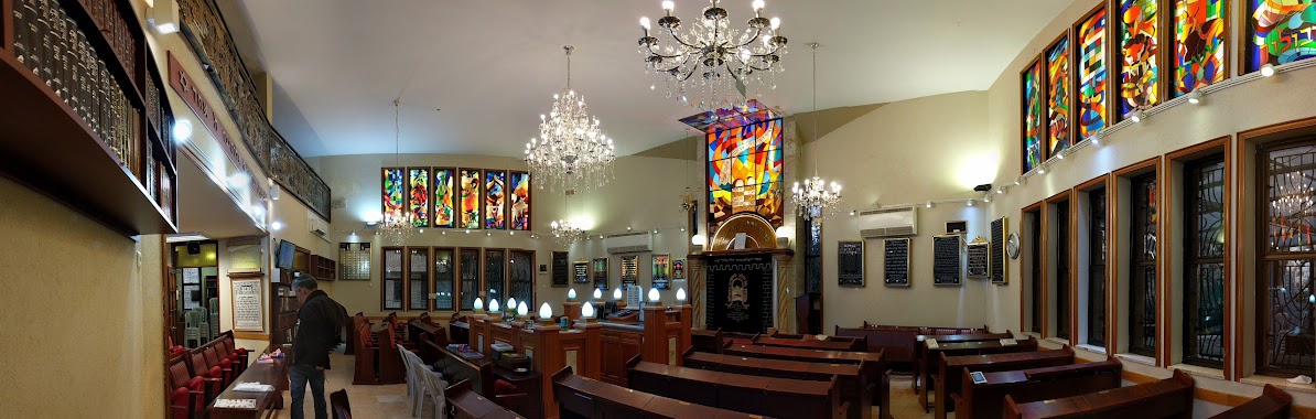
Synagogue nearby סטודיו זהבה בנימין
Israel
Synagogue nearby סטודיו זהבה בנימין
סטודיו זהבה בנימין
המוסכים 3 תלפיות ירושלים, ירושלים, 9342016, ישראל
contacts phone
:
+972 2-579-1898
Latitude:
31.752153
, Longitude:
35.212527
larger map & directions
read more
nearest Synagogue
193 m
בית הכנסת מקור חיים
Jerusalem
Synagogue
read more
241 m
בית כנסת המרכזי
מקור חיים 42, ירושלים
Synagogue
read more
413 m
קהילת באורך
גנרל פייר קניג 14, ירושלים
Synagogue
read more
504 m
בית כנסת תפארת אליהו
Rashbag Street 39, Jerusalem
Synagogue
read more
527 m
בית כנסת ישועת ישראל
Derech Beit Lehem 103, Jerusalem
Synagogue
read more
546 m
בית קהילת ידידיה
נחום ליפשיץ 12, ירושלים
Synagogue
read more
564 m
בית הכנסת קול ששון
ירושלים
Synagogue
read more
564 m
Kol Sason Synagogue
Jerusalem
Synagogue
read more
569 m
Beit Shlomo Synagogue
Jerusalem
Synagogue
read more
632 m
Mishkan Moshe Synagogue
Ma'agalei Yavne Street 8, Jerusalem
Synagogue
read more
632 m
בית כנסת משכן משה
Ma'agalei Yavne Street 8, Jerusalem
Synagogue
read more
647 m
Rama Synagogue
Jerusalem
Synagogue
read more
647 m
ביכ רמה
ירושלים
Synagogue
read more
666 m
Or Yesharim Synagogue
Jerusalem
Synagogue
read more
682 m
בית כנסת אדמונד ספרא
ירושלים
Synagogue
read more
816 m
Kheilat Nitzanim
Asher Street 3, Jerusalem
Synagogue
read more
816 m
קהילת ניצנים
אשר 3, ירושלים
Synagogue
read more
835 m
Ha-Gra Synagogue
Jerusalem
Synagogue
read more
845 m
Nitsanim Synagogue
Asher Street 3, Jerusalem
Synagogue
read more
860 m
היכל ברוך
Yehuda Street 20, Jerusalem
Synagogue
read more
891 m
ביכ גאולה
ירושלים
Synagogue
read more
914 m
בית כנסת החורשה
12,, Beit Ha-'arava Street 4, Jerusalem
Synagogue
read more
1.072 km
בית כנסת תפארת ישראל ע״ש ש״י עגנון
Leib Yafe Street 11, Jerusalem
Synagogue
read more
1.139 km
קהילת מבקשי דרך
שדרות ש"י עגנון 22, ירושלים
Synagogue
read more
1.248 km
בית כנסת ע''ש בעל שם טוב, עמק רפאים
דרך בית לחם, ירושלים
Synagogue
read more
📑
all categories
Accounting
Administrative area level 1
Administrative area level 2
Airport
Amusement park
Aquarium
Art gallery
Atm
Bakery
Bank
Bar
Beauty salon
Bicycle store
Book store
Bowling alley
Bus station
Cafe
Campground
Car dealer
Car rental
Car repair
Car wash
Casino
Cemetery
Church
City hall
Clothing store
Colloquial area
Convenience store
Country
Courthouse
Dentist
Department store
Doctor
Electrician
Electronics store
Embassy
Establishment
Finance
Fire station
Florist
Food
Funeral home
Furniture store
Gas station
General contractor
Grocery or supermarket
Gym
Hair care
Hardware store
Health
Hindu Temple
Home goods store
Hospital
Insurance agency
Intersection
Jewelry store
Laundry
Lawyer
Library
Light rail station
Liquor store
Local government office
Locality
Locksmith
Lodging
Meal delivery
Meal takeaway
Mosque
Movie rental
Movie theater
Moving company
Museum
Natural feature
Neighborhood
Night club
Painter
Park
Parking
Pet store
Pharmacy
Physiotherapist
Place of worship
Plumber
Point of interest
Police
Political
Post office
Premise
Real estate agency
Restaurant
Roofing contractor
Route
Rv park, camping
School
Shoe store
Shopping mall
Spa
Stadium
Storage
Store
Subpremise
Subway station
Supermarket
Synagogue
Taxi stand
Train station
Transit station
Travel agency
University
Veterinary care
Zoo
administrative area level 3
administrative area level 4
sublocality level 1
↑