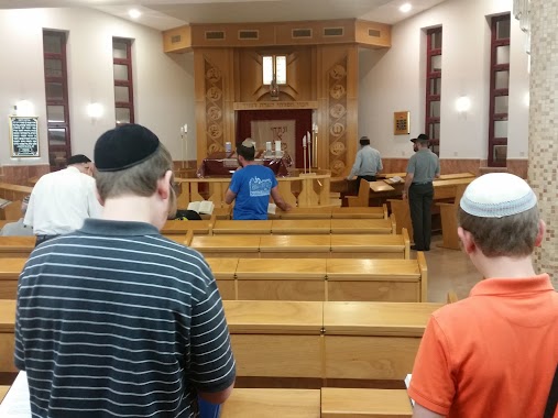
Synagogue nearby Gabriel synagogue Ohel Avraham
Israel
Synagogue nearby Gabriel synagogue Ohel Avraham
Gabriel synagogue Ohel Avraham
Иерусалим
contacts phone
:
+972
Latitude:
31.8323689
, Longitude:
35.246624
larger map & directions
read more
nearest Synagogue
בית הכנסת אוהל גבריאל ואברהם
ירושלים
Synagogue
read more
399 m
בית הכנסת בית יעקוב
ירושלים
Synagogue
read more
399 m
Temple Beth Jacob
Jerusalem
Synagogue
read more
489 m
Mishkan Israel Synagogue
Jerusalem
Synagogue
read more
559 m
בית הכנסת משכן יצחק
Ha-Gdud ha-Khamishi Street 3, Jerusalem
Synagogue
read more
640 m
בית הכנסת האשכנזי
Kheil ha-Kesher Street, Jerusalem
Synagogue
read more
881 m
בית הכנסת ''שערי תורה''
Ha-Rav Zevin Street 67, Jerusalem
Synagogue
read more
903 m
בית חבד משפחת בוטמן
מעגלות הרב פרדס 57, ירושלים
Synagogue
read more
903 m
בית חבד משפחת בוטמן
Ma'agalot HaRav Pardes Street 57, Jerusalem
Synagogue
read more
984 m
Khayei Adam Synagogue
Jerusalem
Synagogue
read more
984 m
ביכ חיי אדם
ירושלים
Synagogue
read more
1.064 km
בית חבד נווה יעקב
ויקטור ויוליוס 607, ירושלים
Synagogue
read more
1.064 km
בית חבד נווה יעקב
Victor ve-Yulius Street 607, Jerusalem
Synagogue
read more
1.072 km
בית הכנסת זכור לאברהם
Mazal Tal'e Street 1, Jerusalem
Synagogue
read more
1.088 km
מגן אברהם ואהבת ישראל
HaRav Moshe Shauli Cohen Street, Jerusalem
Synagogue
read more
1.088 km
מגן אברהם ואהבת ישראל
הרב משה שאולי כהן, ירושלים
Synagogue
read more
1.094 km
בית הכנסת ובית מדרש אוהל יוסף
ירושלים
Synagogue
read more
1.256 km
בית הכנסת אהל שרה
ירושלים
Synagogue
read more
1.269 km
בית כנסת אדמון ספרא
ירושלים
Synagogue
read more
1.319 km
בית אבות
ירושלים
Synagogue
read more
1.326 km
Beit Yitzhak Synagogue
Moshe Gvirtsman Street 5, Jerusalem
Synagogue
read more
1.443 km
בית הכנסת פסגת רם
David Niv Street, Jerusalem
Synagogue
read more
1.566 km
ביכ אוהל יוסף ושרה
Yitskhak Tunik Street 24, Jerusalem
Synagogue
read more
1.618 km
Pisgat Moriya Synagogue
Jerusalem
Synagogue
read more
1.971 km
בית הכנסת משכן אברהם
ירושלים
Synagogue
read more
📑
all categories
Accounting
Administrative area level 1
Administrative area level 2
Airport
Amusement park
Aquarium
Art gallery
Atm
Bakery
Bank
Bar
Beauty salon
Bicycle store
Book store
Bowling alley
Bus station
Cafe
Campground
Car dealer
Car rental
Car repair
Car wash
Casino
Cemetery
Church
City hall
Clothing store
Colloquial area
Convenience store
Country
Courthouse
Dentist
Department store
Doctor
Electrician
Electronics store
Embassy
Establishment
Finance
Fire station
Florist
Food
Funeral home
Furniture store
Gas station
General contractor
Grocery or supermarket
Gym
Hair care
Hardware store
Health
Hindu Temple
Home goods store
Hospital
Insurance agency
Intersection
Jewelry store
Laundry
Lawyer
Library
Light rail station
Liquor store
Local government office
Locality
Locksmith
Lodging
Meal delivery
Meal takeaway
Mosque
Movie rental
Movie theater
Moving company
Museum
Natural feature
Neighborhood
Night club
Painter
Park
Parking
Pet store
Pharmacy
Physiotherapist
Place of worship
Plumber
Point of interest
Police
Political
Post office
Premise
Real estate agency
Restaurant
Roofing contractor
Route
Rv park, camping
School
Shoe store
Shopping mall
Spa
Stadium
Storage
Store
Subpremise
Subway station
Supermarket
Synagogue
Taxi stand
Train station
Transit station
Travel agency
University
Veterinary care
Zoo
administrative area level 3
administrative area level 4
sublocality level 1
↑