Synagogue nearby בית כנסת היכל רפאל
Israel
Synagogue nearby בית כנסת היכל רפאל
בית כנסת היכל רפאל
Гимзо, Израиль
contacts phone
:
+972
Latitude:
31.9273875
, Longitude:
34.9434492
larger map & directions
read more
nearest Synagogue
11 m
בית הכנסת החסידי גמזו
גמזו
Synagogue
read more
399 m
ביכ משכן שלום
גמזו
Synagogue
read more
1.208 km
בית הכנסת כפר דניאל
Kfar Daniel
Synagogue
read more
1.208 km
בית הכנסת כפר דניאל
כפר דניאל
Synagogue
read more
4.393 km
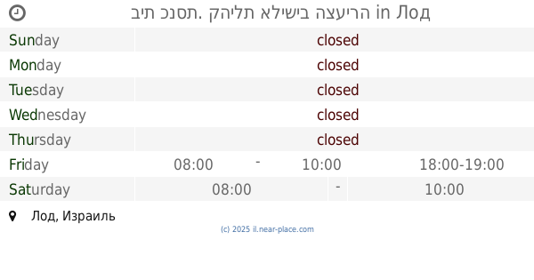
בית כנסת בית יוסף
לוד
Synagogue
read more
4.665 km
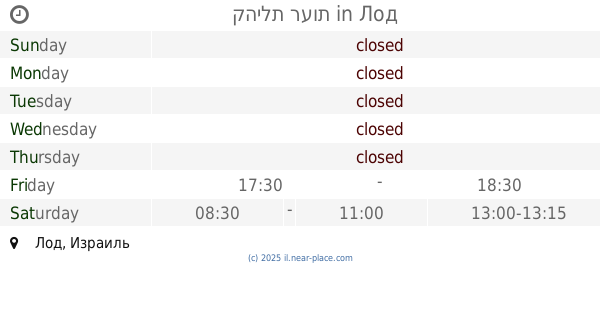
Sha'arei Aliya Synagogue
Lod
Synagogue
read more
4.823 km
Shomrei Israel Synagogue
Lod
Synagogue
read more
4.833 km
בית כנסת נצח ישראל
האירוס 97, חדיד
Synagogue
read more
4.853 km
Matityahu ve-bnav Tomb
Israel
Synagogue
read more
4.922 km
בית כנסת תפארת ישראל
Derekh Mishmar Nof 1, Lod
Synagogue
read more
4.943 km
Yeshua Synagogue soon
Gil'ad Street 13, Lod
Synagogue
read more
5.054 km
בית הכנסת בית חשמונאי
Beit Hashmonai
Synagogue
read more
5.115 km
בית כנסת דוסא
21,, He-Khaluts Street 19, Lod
Synagogue
read more
5.115 km
Dossa synagogue
21,, He-Khaluts Street 19, Lod
Synagogue
read more
5.119 km
בית כנסת שבת אחים
Lod
Synagogue
read more
5.226 km
בית כנסת ליוצאי פז
Rambam Street 102, Yad Rambam
Synagogue
read more
5.27 km
בית כנסת בית אליהו
לוד
Synagogue
read more
5.306 km
Synagogue salvation of God
Lod
Synagogue
read more
5.362 km
Abir Ya'akov Synagogue
Lod
Synagogue
read more
5.426 km
בית כנסת התנא רבי שמעון בר יוחאי
לוד
Synagogue
read more
5.504 km
בית כנסת. קהילת אלישיב הצעירה
Lod
Synagogue
read more
5.518 km
בית כנסת חושן מודיעין
מודיעין מכבים רעות
Synagogue
read more
5.588 km
בית כנסת בית ישראל
Sderot Shlomo HaMelech 105, Lod
Synagogue
read more
5.593 km
קהילת רעות
Lod
Synagogue
read more
5.6 km
Ha-Rama Synagogue
Lod
Synagogue
read more
📑
all categories
Accounting
Administrative area level 1
Administrative area level 2
Airport
Amusement park
Aquarium
Art gallery
Atm
Bakery
Bank
Bar
Beauty salon
Bicycle store
Book store
Bowling alley
Bus station
Cafe
Campground
Car dealer
Car rental
Car repair
Car wash
Casino
Cemetery
Church
City hall
Clothing store
Colloquial area
Convenience store
Country
Courthouse
Dentist
Department store
Doctor
Electrician
Electronics store
Embassy
Establishment
Finance
Fire station
Florist
Food
Funeral home
Furniture store
Gas station
General contractor
Grocery or supermarket
Gym
Hair care
Hardware store
Health
Hindu Temple
Home goods store
Hospital
Insurance agency
Intersection
Jewelry store
Laundry
Lawyer
Library
Light rail station
Liquor store
Local government office
Locality
Locksmith
Lodging
Meal delivery
Meal takeaway
Mosque
Movie rental
Movie theater
Moving company
Museum
Natural feature
Neighborhood
Night club
Painter
Park
Parking
Pet store
Pharmacy
Physiotherapist
Place of worship
Plumber
Point of interest
Police
Political
Post office
Premise
Real estate agency
Restaurant
Roofing contractor
Route
Rv park, camping
School
Shoe store
Shopping mall
Spa
Stadium
Storage
Store
Subpremise
Subway station
Supermarket
Synagogue
Taxi stand
Train station
Transit station
Travel agency
University
Veterinary care
Zoo
administrative area level 3
administrative area level 4
sublocality level 1
↑