Synagogue nearby בית הכנסת
Israel
Synagogue nearby בית הכנסת
בית הכנסת
Ramat Gan, Israel
contacts phone
:
+972
Latitude:
32.080223
, Longitude:
34.820184
larger map & directions
read more
nearest Synagogue
280 m
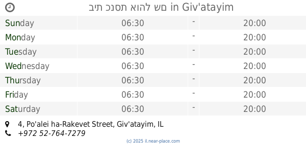
בית כנסת אוהל שם
Po'alei ha-Rakevet Street 4, Giv'atayim
Synagogue
read more
360 m
בית הכנסת היכל מרדכי
רמת גן
Synagogue
read more
492 m
מודעות בית חב"ד תפילה וחסד
106 הרוא"ה, רמת גן
Synagogue
read more
571 m
בית כנסת המרכזי לספרדים
הנגיד 2, רמת גן
Synagogue
read more
585 m
בית הכנסת הגדול רמת גן
Herzl Street 47, Ramat Gan
Synagogue
read more
681 m
בית כנסת הגדול רמת יצחק
Ramat Gan
Synagogue
read more
681 m
בית כנסת הגדול רמת יצחק
רמת גן
Synagogue
read more
746 m
בית כנסת הפועל המזרחי
הרב מוהליבר 10, בני ברק
Synagogue
read more
748 m
בית כנסת אשכנז
ההלכה 9, רמת גן
Synagogue
read more
751 m
בית הכנסת התחיה
Sderot Nehama, Ramat Gan
Synagogue
read more
773 m
אגודת אלימלך
אלימלך 17, רמת גן
Synagogue
read more
794 m
Young Israel
Ha-Rav Avraham Yitskhak ha-Cohen Kook Street 29, Bnei Brak
Synagogue
read more
861 m
בית הכנסת הרב חיים כהן
גלבוע 11, גבעתיים
Synagogue
read more
900 m
בית כנסת בית אל הישן
הרב הרצוג 43, בני ברק
Synagogue
read more
933 m
בית כנסת קהל חסידים
חולדה הנביאה 10, בני ברק
Synagogue
read more
992 m
היכל זאב
מנחם 25, בני ברק
Synagogue
read more
1.03 km
בית כנסת תפארת בחורים
ד"ר כהן 18, רמת גן
Synagogue
read more
1.047 km
בית כנסת אשלג
Shadal Street 4, Bnei Brak
Synagogue
read more
1.061 km
בית כנסת שטרן
Ha-Rav Avraham Yitskhak ha-Cohen Kook Street 3, Bnei Brak
Synagogue
read more
1.075 km
בית החסידים גור
Rabi Tarfon Street 3, Bnei Brak
Synagogue
read more
1.075 km
בית כנסת אחדות
רבי טרפון 3, בני ברק
Synagogue
read more
1.112 km
Belz Institutions
האדמו"ר מבעלזא, 5, בני ברק
Synagogue
read more
1.148 km
Bais Medrash Chasidei Lelov, Kolel Ohr Menachem
רבי עקיבא 65, בני ברק
Synagogue
read more
1.226 km
בית מדרש ברסלב
HaRav Maimon Street 20, Bnei Brak
Synagogue
read more
1.319 km
Synagogue faith Mordechai Givatayim
Tsahal Street 7, Giv'atayim
Synagogue
read more
📑
all categories
Accounting
Administrative area level 1
Administrative area level 2
Airport
Amusement park
Aquarium
Art gallery
Atm
Bakery
Bank
Bar
Beauty salon
Bicycle store
Book store
Bowling alley
Bus station
Cafe
Campground
Car dealer
Car rental
Car repair
Car wash
Casino
Cemetery
Church
City hall
Clothing store
Colloquial area
Convenience store
Country
Courthouse
Dentist
Department store
Doctor
Electrician
Electronics store
Embassy
Establishment
Finance
Fire station
Florist
Food
Funeral home
Furniture store
Gas station
General contractor
Grocery or supermarket
Gym
Hair care
Hardware store
Health
Hindu Temple
Home goods store
Hospital
Insurance agency
Intersection
Jewelry store
Laundry
Lawyer
Library
Light rail station
Liquor store
Local government office
Locality
Locksmith
Lodging
Meal delivery
Meal takeaway
Mosque
Movie rental
Movie theater
Moving company
Museum
Natural feature
Neighborhood
Night club
Painter
Park
Parking
Pet store
Pharmacy
Physiotherapist
Place of worship
Plumber
Point of interest
Police
Political
Post office
Premise
Real estate agency
Restaurant
Roofing contractor
Route
Rv park, camping
School
Shoe store
Shopping mall
Spa
Stadium
Storage
Store
Subpremise
Subway station
Supermarket
Synagogue
Taxi stand
Train station
Transit station
Travel agency
University
Veterinary care
Zoo
administrative area level 3
administrative area level 4
sublocality level 1
↑