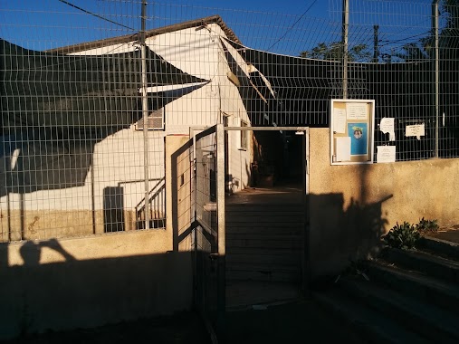
Synagogue nearby בית הכנסת משואת שלום
Israel
Synagogue nearby בית הכנסת משואת שלום
בית הכנסת משואת שלום
17, Arye Dultsin Street, Jerusalem, IL Израиль
contacts phone
:
+972 54-788-7064
website:
plus.google.com
Latitude:
31.749811
, Longitude:
35.1697144
larger map & directions
read more
nearest Synagogue
בית הכנסת משואת שלום
אריה דולצ'ין 17, ירושלים
Synagogue
read more
61 m
בית כנסת אביר יעקב-נוסח מרוקו
2, Shmu'el Natan Street 4, Jerusalem
Synagogue
read more
294 m
אוהל שמעון
Costa Rica Street 46, Jerusalem
Synagogue
read more
439 m
בית הכנסת אגודת מורה נבוכים אלמליח
הנורית 21, ירושלים
Synagogue
read more
440 m
בית הכנסת ״תפילה למשה״
HaNurit Street 21, Jerusalem
Synagogue
read more
445 m
אגודת מורה נבוכים ( אלמליח )
הנורית 21, ירושלים
Synagogue
read more
513 m
בית כנסת ר' חי טייב
ירושלים
Synagogue
read more
513 m
בית כנסת ר' חי טייב
Jerusalem
Synagogue
read more
593 m
Shirat Ganim Synagogue
HaSavyon Street 9, Jerusalem
Synagogue
read more
625 m
בית הכנסת קהילת צעירי עיר גנים
קוסטה ריקה 2, ירושלים
Synagogue
read more
627 m
בית כנסת קיבוץ ראשית
Costa Rica Street 2, Jerusalem
Synagogue
read more
685 m
בית כנסת שערי רפואה
Jerusalem
Synagogue
read more
820 m
בית כנסת צעירי קרית מנחם
3, Dahomey Street 1, Jerusalem
Synagogue
read more
855 m
בית מדרש חניכי ישיבות
איסלנד 2, ירושלים
Synagogue
read more
855 m
בית מדרש חניכי ישיבות
Iceland Street 2, Jerusalem
Synagogue
read more
858 m
בית כנסת אוהל מלכה
איסלנד 2, ירושלים
Synagogue
read more
904 m
בית כנסת דוד ומשה (רביבו)
איסלנד 3, ירושלים
Synagogue
read more
904 m
Synagogue David and Moses (Revivo)
Iceland Street 3, Jerusalem
Synagogue
read more
909 m
The Rose and Isaac H. Taylor Synagogue
Jerusalem
Synagogue
read more
984 m
בית הכנסת זכור לאברהם
ירושלים
Synagogue
read more
1.011 km
בית כנסת המ״ג
איסלנד 7, ירושלים
Synagogue
read more
1.03 km
בית הכנסת זכור לאברהם
29, Colombia Street 15, Jerusalem
Synagogue
read more
1.166 km
בית הכנסת זכרון קדושים
ירושלים
Synagogue
read more
1.166 km
בית הכנסת זכרון קדושים
Jerusalem
Synagogue
read more
1.262 km
בית כנסת תפארת ישרים
14,, Guatemala Street 12, Jerusalem
Synagogue
read more
📑
all categories
Accounting
Administrative area level 1
Administrative area level 2
Airport
Amusement park
Aquarium
Art gallery
Atm
Bakery
Bank
Bar
Beauty salon
Bicycle store
Book store
Bowling alley
Bus station
Cafe
Campground
Car dealer
Car rental
Car repair
Car wash
Casino
Cemetery
Church
City hall
Clothing store
Colloquial area
Convenience store
Country
Courthouse
Dentist
Department store
Doctor
Electrician
Electronics store
Embassy
Establishment
Finance
Fire station
Florist
Food
Funeral home
Furniture store
Gas station
General contractor
Grocery or supermarket
Gym
Hair care
Hardware store
Health
Hindu Temple
Home goods store
Hospital
Insurance agency
Intersection
Jewelry store
Laundry
Lawyer
Library
Light rail station
Liquor store
Local government office
Locality
Locksmith
Lodging
Meal delivery
Meal takeaway
Mosque
Movie rental
Movie theater
Moving company
Museum
Natural feature
Neighborhood
Night club
Painter
Park
Parking
Pet store
Pharmacy
Physiotherapist
Place of worship
Plumber
Point of interest
Police
Political
Post office
Premise
Real estate agency
Restaurant
Roofing contractor
Route
Rv park, camping
School
Shoe store
Shopping mall
Spa
Stadium
Storage
Store
Subpremise
Subway station
Supermarket
Synagogue
Taxi stand
Train station
Transit station
Travel agency
University
Veterinary care
Zoo
administrative area level 3
administrative area level 4
sublocality level 1
↑