Stadium nearby Municipal Soccer Stadium
Israel
Stadium nearby Municipal Soccer Stadium
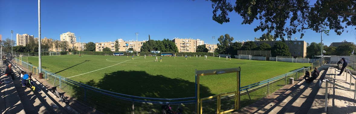
Municipal Soccer Stadium
Safed, Izrael
contacts phone
:
+972
Latitude:
32.959785
, Longitude:
35.5023245
larger map & directions
read more
nearest Stadium
4.979 km
Stadium
Hatzor HaGlilit
Stadium
read more
18.179 km
Tiberias Football Stadium
Tiberias
Stadium
read more
18.179 km
Tiberias Football Stadium
Тверия
Stadium
read more
18.179 km
איצטדיון עירוני
טבריה
Stadium
read more
18.476 km
Stadium
Qatsrin
Stadium
read more
18.476 km
איצטדיון
קצרין
Stadium
read more
19.378 km
Стадион
Karmiel
Stadium
read more
19.378 km
איצטדיון
כרמיאל
Stadium
read more
19.461 km
איצטדיון כפר סמיע
כיסרא סומיע
Stadium
read more
21.591 km
Soccer Stadium
Маалот-Таршиха
Stadium
read more
22.774 km
Soccer Stadium
Ma'alot-Tarshiha
Stadium
read more
28.439 km
Kiryat Shmona football stadium
Qiryat Shemona
Stadium
read more
28.446 km
Soccer Stadium
קרית שמונה
Stadium
read more
28.446 km
Soccer Stadium
Кирьят-Шмона
Stadium
read more
34.918 km
Green Stadium Nazareth Illit
Нацрат-Иллит
Stadium
read more
34.982 km
Nazareth Municipal Stadium
Назарет
Stadium
read more
37.939 km
Municipal Stadium
Нагария
Stadium
read more
39.331 km
Tzur Shalom Stadium
Kiryat Bialik
Stadium
read more
39.979 km
Soccer Stadium
קרית אתא
Stadium
read more
39.979 km
Soccer Stadium
Kiryat Atta
Stadium
read more
40.71 km
Municipal Stadium
Migdal haEmek
Stadium
read more
43.866 km
Kiryat Haim Stadium
Qiryat haim
Stadium
read more
44.555 km
Soccer Stadium
עפולה
Stadium
read more
45.869 km
איצטדיון אתלטיקה
עין חרוד מאוחד
Stadium
read more
48.722 km
אצטדיון תענך גוש יעל/אסי גלבוע
יעל
Stadium
read more
📑
all categories
Accounting
Administrative area level 1
Administrative area level 2
Airport
Amusement park
Aquarium
Art gallery
Atm
Bakery
Bank
Bar
Beauty salon
Bicycle store
Book store
Bowling alley
Bus station
Cafe
Campground
Car dealer
Car rental
Car repair
Car wash
Casino
Cemetery
Church
City hall
Clothing store
Colloquial area
Convenience store
Country
Courthouse
Dentist
Department store
Doctor
Electrician
Electronics store
Embassy
Establishment
Finance
Fire station
Florist
Food
Funeral home
Furniture store
Gas station
General contractor
Grocery or supermarket
Gym
Hair care
Hardware store
Health
Hindu Temple
Home goods store
Hospital
Insurance agency
Intersection
Jewelry store
Laundry
Lawyer
Library
Light rail station
Liquor store
Local government office
Locality
Locksmith
Lodging
Meal delivery
Meal takeaway
Mosque
Movie rental
Movie theater
Moving company
Museum
Natural feature
Neighborhood
Night club
Painter
Park
Parking
Pet store
Pharmacy
Physiotherapist
Place of worship
Plumber
Point of interest
Police
Political
Post office
Premise
Real estate agency
Restaurant
Roofing contractor
Route
Rv park, camping
School
Shoe store
Shopping mall
Spa
Stadium
Storage
Store
Subpremise
Subway station
Supermarket
Synagogue
Taxi stand
Train station
Transit station
Travel agency
University
Veterinary care
Zoo
administrative area level 3
administrative area level 4
sublocality level 1
↑