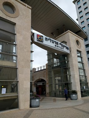
Shopping mall nearby Tzamarot Center
Israel
Shopping mall nearby Tzamarot Center
Tzamarot Center
עצלדא, Hertsliya, Israel
contacts phone
:
+972
Latitude:
32.1517163
, Longitude:
34.842569
larger map & directions
read more
nearest Shopping mall
267 m
CAMERA MIA
80, HaSharon Street, Ramat Hasharon
Shopping mall
read more
267 m
CAMERA MIA
HaSharon Street 80, Ramat Hasharon
Shopping mall
read more
690 m
מרכז קניות גני הרצליה
Herzliya
Shopping mall
read more
808 m
Sokolov Center
Ramat Hasharon
Shopping mall
read more
1.158 km
היפר זול
גליל ים
Shopping mall
read more
1.169 km
Shopping
Sokolov Street 34, Ramat Hasharon
Shopping mall
read more
1.506 km
Elo nitzan
אוסישקין 5, רמת השרון
Shopping mall
read more
1.506 km
Elo nitzan
Ussishkin Street 5, Ramat Hasharon
Shopping mall
read more
1.659 km
City Center Mall
Herzliya
Shopping mall
read more
1.752 km
פרי שופ בעמ
HaNadiv Street 3, Herzliya
Shopping mall
read more
1.752 km
פרי שופ בעמ
הנדיב 3, הרצליה
Shopping mall
read more
2.282 km
Balls Outlet LTD
Berel Katzenelson Street 27, Herzliya
Shopping mall
read more
2.287 km
Seven Stars Mall
Shiv'at Hakohavim Boulevard 8, Herzliya
Shopping mall
read more
2.287 km
קניון שבעת הכוכבים
שדרות שבעת הכוכבים 8, הרצליה
Shopping mall
read more
2.317 km
גרייד שייפ קניון שבעת הכוכבים הרצליה
Herzliya
Shopping mall
read more
2.317 km
גרייד שייפ קניון שבעת הכוכבים הרצליה
הרצליה
Shopping mall
read more
3.025 km
Lev HaMashtela
Tel Aviv-Yafo
Shopping mall
read more
3.2 km
מרכזים 2001
Maskit Street 33, Herzliya
Shopping mall
read more
3.285 km
שוז אנד הוז
Kiryat Shaul Street 20, Tel Aviv-Yafo
Shopping mall
read more
3.285 km
שוז אנד הוז
קרית שאול 20, תל אביב יפו
Shopping mall
read more
3.403 km
Business Park
Herzliya
Shopping mall
read more
3.403 km
ביזנס פארק
הרצליה
Shopping mall
read more
3.433 km
Аутлет Герцлия
Maskit Street 2-8, Herzliya
Shopping mall
read more
5.037 km
קניון מספרים הוד השרון
Yehoshua Ben Gamla Street 28, Hod Hasharon
Shopping mall
read more
5.689 km
Mitchel New Students Union Building
Tel Aviv-Yafo
Shopping mall
read more
📑
all categories
Accounting
Administrative area level 1
Administrative area level 2
Airport
Amusement park
Aquarium
Art gallery
Atm
Bakery
Bank
Bar
Beauty salon
Bicycle store
Book store
Bowling alley
Bus station
Cafe
Campground
Car dealer
Car rental
Car repair
Car wash
Casino
Cemetery
Church
City hall
Clothing store
Colloquial area
Convenience store
Country
Courthouse
Dentist
Department store
Doctor
Electrician
Electronics store
Embassy
Establishment
Finance
Fire station
Florist
Food
Funeral home
Furniture store
Gas station
General contractor
Grocery or supermarket
Gym
Hair care
Hardware store
Health
Hindu Temple
Home goods store
Hospital
Insurance agency
Intersection
Jewelry store
Laundry
Lawyer
Library
Light rail station
Liquor store
Local government office
Locality
Locksmith
Lodging
Meal delivery
Meal takeaway
Mosque
Movie rental
Movie theater
Moving company
Museum
Natural feature
Neighborhood
Night club
Painter
Park
Parking
Pet store
Pharmacy
Physiotherapist
Place of worship
Plumber
Point of interest
Police
Political
Post office
Premise
Real estate agency
Restaurant
Roofing contractor
Route
Rv park, camping
School
Shoe store
Shopping mall
Spa
Stadium
Storage
Store
Subpremise
Subway station
Supermarket
Synagogue
Taxi stand
Train station
Transit station
Travel agency
University
Veterinary care
Zoo
administrative area level 3
administrative area level 4
sublocality level 1
↑