School nearby גן יעלי
Israel
School nearby גן יעלי
גן יעלי
Rachel HaMeshoreret Street 19, Kefar Sava Израиль
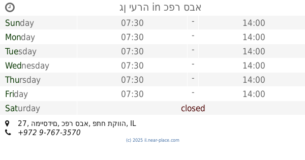
contacts phone
:
+972
Latitude:
32.1786642
, Longitude:
34.9111799
read more
nearest School
117 m
גן חרצית
כפר סבא
School
read more
117 m
גן חרצית
Kefar Sava
School
read more
140 m
קייטנת תורה בכפר בבר אילן כפר סבא
בר אילן 2, כפר סבא
School
read more
254 m
גן ימית
עציון 9, כפר סבא
School
read more
254 m
גן ימית
Etsyon Street 9, Kefar Sava
School
read more
328 m
גן יערה
המייסדים 27, כפר סבא
School
read more
337 m
גן נרקיס
המייסדים 25, כפר סבא
School
read more
365 m
חינוך לכל כיס
המייסדים 21, כפר סבא
School
read more
365 m
חינוך לכל כיס
Ha-Meyasdim Street 21, Kefar Sava
School
read more
418 m
אולפנית הראל
Tel-Hay Street 70, Kefar Sava
School
read more
558 m
בית ספר עש הנריאטה סאלד
בר אילן 35, כפר סבא
School
read more
576 m
מכללת תהילה לרפואה משלימה
נחשון 15, כפר סבא
School
read more
612 m
בית חינוך הרצוג
אז"ר 49, כפר סבא
School
read more
641 m
ביס מפתן
כפר סבא
School
read more
651 m
גן תדהר
טירת צבי 13, כפר סבא
School
read more
663 m
גן צאלון
הרב שמחה אסף 15, כפר סבא
School
read more
695 m
Katznelson High School
Azar Street 43, Kefar Sava
School
read more
734 m
תיכון עמל
כפר סבא
School
read more
788 m
מעון חבד כפר סבא
זמנהוף 5, כפר סבא
School
read more
809 m
Bar-Lev Junior High School
Tel-Hay Street 102, Kefar Sava
School
read more
858 m
Детский сад Маленькая страна
התחייה 18, כפר סבא
School
read more
864 m
אגדת הגן
ניצנים 11, כפר סבא
School
read more
868 m
גן בדולח
Rothschild Street 4-22, Kefar Sava
School
read more
938 m
Ulpenat Amana - Amana Religious High School
Tel-Hay Street 6, Kefar Sava
School
read more
1.132 km
גן אורנים
יגאל ידין 2, כפר סבא
School
read more
📑
all categories
Accounting
Administrative area level 1
Administrative area level 2
Airport
Amusement park
Aquarium
Art gallery
Atm
Bakery
Bank
Bar
Beauty salon
Bicycle store
Book store
Bowling alley
Bus station
Cafe
Campground
Car dealer
Car rental
Car repair
Car wash
Casino
Cemetery
Church
City hall
Clothing store
Colloquial area
Convenience store
Country
Courthouse
Dentist
Department store
Doctor
Electrician
Electronics store
Embassy
Establishment
Finance
Fire station
Florist
Food
Funeral home
Furniture store
Gas station
General contractor
Grocery or supermarket
Gym
Hair care
Hardware store
Health
Hindu Temple
Home goods store
Hospital
Insurance agency
Intersection
Jewelry store
Laundry
Lawyer
Library
Light rail station
Liquor store
Local government office
Locality
Locksmith
Lodging
Meal delivery
Meal takeaway
Mosque
Movie rental
Movie theater
Moving company
Museum
Natural feature
Neighborhood
Night club
Painter
Park
Parking
Pet store
Pharmacy
Physiotherapist
Place of worship
Plumber
Point of interest
Police
Political
Post office
Premise
Real estate agency
Restaurant
Roofing contractor
Route
Rv park, camping
School
Shoe store
Shopping mall
Spa
Stadium
Storage
Store
Subpremise
Subway station
Supermarket
Synagogue
Taxi stand
Train station
Transit station
Travel agency
University
Veterinary care
Zoo
administrative area level 3
administrative area level 4
sublocality level 1
↑