School nearby בית ספר א''ד גורדון
Israel
School nearby בית ספר א''ד גורדון
בית ספר א''ד גורדון
43, זלמן ארן, חיפה, חיפה, IL ישראל
contacts phone
:
+972 4-873-1814
website:
pschools.haifanet.org.il
Latitude:
32.833506
, Longitude:
35.0596422
larger map & directions
read more
nearest School
204 m
גן אורלי
Avigdor Eshet Street 71, Qiryat haim
School
read more
278 m
Mada-Kat Scientific Pre-Schools
Haifa
School
read more
278 m
Mada-Kat Scientific Pre-Schools
חיפה
School
read more
451 m
בית ספר דגניה
שדרות דגניה 33, חיפה
School
read more
451 m
בית ספר דגניה
Sderot Deganya 33, Haifa
School
read more
497 m
גן בוסל
Abarbanel Street 10, Haifa
School
read more
522 m
חטב עמלנית רגבים
שדרות דגניה 53, Qiryat haim
School
read more
625 m
ביס בנות אהרון הראה
שדרות הרוא"ה 10, חיפה
School
read more
675 m
מעון אמונה
Sderot HaRo'e 12, Haifa
School
read more
762 m
גן עירית
Y.L. Perets Street 24, Kiryat Yam
School
read more
762 m
גן יקינטון
Y.L. Perets Street 24, Kiryat Yam
School
read more
831 m
Aharon school Barhi
Haifa
School
read more
864 m
גן שיטה
Yitshak Ben Zvi Street 28, Kiryat Yam
School
read more
864 m
גן ברוש
יצחק בן צבי 28, קרית ים
School
read more
913 m
גן שושן
Yisra'el Yesha'ayahu Street 4, Kiryat Yam
School
read more
914 m
גן שיזף
Yisra'el Yesha'ayahu Street 4, Kiryat Yam
School
read more
935 m
Yamit School
זבוטניסקי 40, קרית ים
School
read more
935 m
בי"ס ימית
זבוטניסקי 40, קרית ים
School
read more
997 m
גני עיריה שנהב יקינטון תלתן
בכור שטרית 1, חיפה
School
read more
1.044 km
גן צבעוני
שדרות הרצל 71, קרית ים
School
read more
1.044 km
גן ניצן
שדרות הרצל 71, קרית ים
School
read more
1.044 km
גן צבעוני
Sderot Herzl 71, Kiryat Yam
School
read more
1.111 km
גן הרדוף
Sderot Herzl 85, Kiryat Yam
School
read more
1.111 km
גן הרדוף
שדרות הרצל 85, קרית ים
School
read more
1.167 km
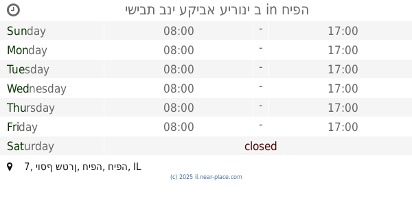
ישיבת בני עקיבא עירוני ב
יוסף שטרן 7, חיפה
School
read more
📑
all categories
Accounting
Administrative area level 1
Administrative area level 2
Airport
Amusement park
Aquarium
Art gallery
Atm
Bakery
Bank
Bar
Beauty salon
Bicycle store
Book store
Bowling alley
Bus station
Cafe
Campground
Car dealer
Car rental
Car repair
Car wash
Casino
Cemetery
Church
City hall
Clothing store
Colloquial area
Convenience store
Country
Courthouse
Dentist
Department store
Doctor
Electrician
Electronics store
Embassy
Establishment
Finance
Fire station
Florist
Food
Funeral home
Furniture store
Gas station
General contractor
Grocery or supermarket
Gym
Hair care
Hardware store
Health
Hindu Temple
Home goods store
Hospital
Insurance agency
Intersection
Jewelry store
Laundry
Lawyer
Library
Light rail station
Liquor store
Local government office
Locality
Locksmith
Lodging
Meal delivery
Meal takeaway
Mosque
Movie rental
Movie theater
Moving company
Museum
Natural feature
Neighborhood
Night club
Painter
Park
Parking
Pet store
Pharmacy
Physiotherapist
Place of worship
Plumber
Point of interest
Police
Political
Post office
Premise
Real estate agency
Restaurant
Roofing contractor
Route
Rv park, camping
School
Shoe store
Shopping mall
Spa
Stadium
Storage
Store
Subpremise
Subway station
Supermarket
Synagogue
Taxi stand
Train station
Transit station
Travel agency
University
Veterinary care
Zoo
administrative area level 3
administrative area level 4
sublocality level 1
↑