Restaurant nearby מפגש ביתר
Israel
Restaurant nearby מפגש ביתר
מפגש ביתר
מנחם בגין 83, בית דגן ישראל
contacts phone
:
+972
Latitude:
32.005517
, Longitude:
34.83469
read more
nearest Restaurant
Mifgash Beitar
מנחם בגין 83, בית דגן
Restaurant
read more
599 m
פלאפל חיים
שבזי 13, בית דגן
Restaurant
read more
995 m
Cafe Jo
Israel
Restaurant
read more
1.539 km
אסא
תחנת דלק, ראשון לציון
Restaurant
read more
1.897 km
שניצל בכפר
102, Kfar Habad
Restaurant
read more
1.897 km
שניצל בכפר
102, כפר חב"ד
Restaurant
read more
1.97 km
סושי בכפר , כפר חבד
שערי תשובה, Kfar Habad
Restaurant
read more
1.97 km
סושי בכפר , כפר חבד
שערי תשובה, כפר חב"ד
Restaurant
read more
2.153 km
On the way- Food Express
גאולה 1, Kfar Habad
Restaurant
read more
2.153 km
על הדרך- אוכל אקספרס
גאולה 1, כפר חב"ד
Restaurant
read more
2.222 km
מסעדת מוגרבי
צעירי אגודת חב"ד, כפר חב"ד
Restaurant
read more
2.222 km
Mugrabi Restaurant
Tzeria Agudat Chabad Street, Kfar Habad
Restaurant
read more
2.229 km
דארלינג המסעדה
צעירי אגודת חב"ד 3, כפר חב"ד
Restaurant
read more
2.229 km
Darling restaurant
Tzeria Agudat Chabad Street 3, Kfar Habad
Restaurant
read more
2.229 km
דארלינג המסעדה
כפר חב"ד
Restaurant
read more
2.663 km
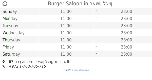
Burger Saloon
תחנת דלק פז, דרך המכבים 67, ראשון לציון
Restaurant
read more
2.8 km
פינה חמה חולון
14, Hahofer Street, Holon
Restaurant
read more
2.83 km
Burgerim
אבי ואביב, אור יהודה
Restaurant
read more
2.858 km
שיפודי יוסי
Ayelet HaShahar Street 18, Or Yehuda
Restaurant
read more
2.895 km
River
Ariel Sharon Boulevard 3, Or Yehuda
Restaurant
read more
2.927 km
לחם בית-מטבח טריפוליטאי לובי
Sderot Mordehai Ben Porat 58, Or Yehuda
Restaurant
read more
3.092 km
מוקפץ אור יהודה
Yehezkel Kazaz Street 12, Or Yehuda
Restaurant
read more
3.13 km
Hataberna Shel Dino
יחזקאל קזז 17, אור יהודה
Restaurant
read more
3.626 km
שמחה קולינארית
שפרינצק 12, אזור
Restaurant
read more
3.924 km
פונדק משה
אור יהודה
Restaurant
read more
📑
all categories
Accounting
Administrative area level 1
Administrative area level 2
Airport
Amusement park
Aquarium
Art gallery
Atm
Bakery
Bank
Bar
Beauty salon
Bicycle store
Book store
Bowling alley
Bus station
Cafe
Campground
Car dealer
Car rental
Car repair
Car wash
Casino
Cemetery
Church
City hall
Clothing store
Colloquial area
Convenience store
Country
Courthouse
Dentist
Department store
Doctor
Electrician
Electronics store
Embassy
Establishment
Finance
Fire station
Florist
Food
Funeral home
Furniture store
Gas station
General contractor
Grocery or supermarket
Gym
Hair care
Hardware store
Health
Hindu Temple
Home goods store
Hospital
Insurance agency
Intersection
Jewelry store
Laundry
Lawyer
Library
Light rail station
Liquor store
Local government office
Locality
Locksmith
Lodging
Meal delivery
Meal takeaway
Mosque
Movie rental
Movie theater
Moving company
Museum
Natural feature
Neighborhood
Night club
Painter
Park
Parking
Pet store
Pharmacy
Physiotherapist
Place of worship
Plumber
Point of interest
Police
Political
Post office
Premise
Real estate agency
Restaurant
Roofing contractor
Route
Rv park, camping
School
Shoe store
Shopping mall
Spa
Stadium
Storage
Store
Subpremise
Subway station
Supermarket
Synagogue
Taxi stand
Train station
Transit station
Travel agency
University
Veterinary care
Zoo
administrative area level 3
administrative area level 4
sublocality level 1
↑