places in Ramallah
Israel
Ramallah
Ramallah
Administrative Region:
Judea and Samaria Area
population:
38 998
calling code:
+972-2
postcode:
P606
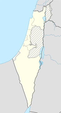
Location on the map of Israel
Ramallah
Local government office
Ministry of Interior
Khalil al-Wazir, Al-Masyoun, Palestine, رام الله
Local government office
read more
Zone Tecnologies
Al Madaen Street, Masrouji Building, 4th Floor Al Bireh Ramallah
Local government office
read more
Ministry Of Telecom And IT
ME. ST. Al Bireh
Local government office
read more
بلدية البيرة ، البيرة
Be'er Sheva Street, Jerusalem
Local government office
read more
فلسطيني
Rukab Street, رام الله
Local government office
read more
وزارة الاشغال العامة والاسكان
دوار محمود درويش،1 مجمع الوزارت، المصيون، رام الله،
Local government office
read more
Star 2000
An-Nuzha Street Ramallah
Local government office
read more
Ministry of Foreign Affairs
Al-Ayyam Street, Amman
Local government office
read more
بلدية البيرة ، البيرة
באר שבע, ירושלים
Local government office
read more
masrouji
Al Madaen Street, Masrouji Building, 1st Floor Al Bireh Ramallah
Local government office
read more
Psychological services, the Binyamin
Local government office
read more
Mosque
مسجد عابدين رام الله
jaffa st., Ramallah
Mosque
read more
مسجد الفرقان
Elbistan
Mosque
read more
مسجد الفرقان
אלביסטן
Mosque
read more
Beitunia Grand Mosque
South Petunia Street, Pharr
Mosque
read more
Al kholfaa مسجد الخلفاء
Khulafa Street, Baghdad
Mosque
read more
Natural feature
`Ayn al Masyunah
Ramallah
Natural feature
read more
`Ayn Umm `Ayshah
Israel
Natural feature
read more
`Ayn Umm `Ayshah
ישראל
Natural feature
read more
Al Bank at Tijari al Filastini
رام الله
Natural feature
read more
Birkat Sibahat as Sanawbar
رام الله
Natural feature
read more
Al Bank al `Arabi
رام الله
Natural feature
read more
`Ayn Abu Iskandar
רמאללה
Natural feature
read more
`Ayn al Mizrab
רמאללה
Natural feature
read more
Bank Filastin al Mahdud
رام الله
Natural feature
read more
Bank al Ittihad lil Iddikhar wa al Istithmar
رام الله
Natural feature
read more
`Ayn ad Dulbiyah
ישראל
Natural feature
read more
Bank Jrindil
رام الله
Natural feature
read more
`Ayn Sim`an
Ramallah
Natural feature
read more
Bank al Urdunn wa al Khalij
رام الله
Natural feature
read more
Al Bank al Istithmar al Filastini
رام الله
Natural feature
read more
Park
منتزة بلدية بيتونيا
Yafa Street, رام الله
Park
read more
Al-bireh Childhood Development Center
al-bireh municipality
Park
read more
Ramallah's public park
Yafa Street, رام الله
Park
read more
Shopping mall
Abdeen elite Home عابدين اليت هوم
Jafa st Ramallah
Shopping mall
read more
مجمع المالكي التجاري بلدية البيرة
Ramallah
Shopping mall
read more
سوبر ماركت الدباس
Beitunia
Shopping mall
read more
اسعيد لمواد البناء
Ramallah Street, Jerusalem
Shopping mall
read more
Al Nassar household
Ramallah, رام الله
Shopping mall
read more
Nijmeh Mall
Universal Street, Warri
Shopping mall
read more
مجمع رمون التجاري
شارع المعاهد
Shopping mall
read more
last added
TNB ATM
W633+V9X, رام الله - شارع ركب - العسعس مقابل الوردة الحمراء, Ramallah
Atm
Finance
Point of interest
Establishment
read more
TNB ATM البنك الوطني صراف الي
W654+2J7, رام االه - شارع الارسال - عمارة الماسة, Ramallah
Atm
Finance
Point of interest
Establishment
read more
📑
Ramallah all categories
Administrative area level 1
Atm
Bakery
Bank
Bar
Beauty salon
Bus station
Cafe
Car dealer
Car repair
Church
Clothing store
Dentist
Doctor
Electronics store
Embassy
Establishment
Finance
Florist
Food
Furniture store
Gas station
General contractor
Grocery or supermarket
Gym
Hair care
Health
Home goods store
Hospital
Jewelry store
Local government office
Locality
Lodging
Meal takeaway
Mosque
Movie theater
Museum
Natural feature
Neighborhood
Night club
Park
Parking
Pharmacy
Physiotherapist
Point of interest
Restaurant
School
Shoe store
Shopping mall
Stadium
Store
Supermarket
Synagogue
Transit station
Travel agency
University
↑