Parking nearby Mori Hdark position (eye Harunh)
Israel
Parking nearby Mori Hdark position (eye Harunh)
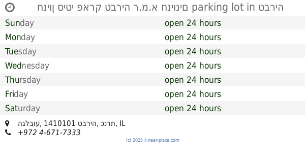
Mori Hdark position (eye Harunh)
Israel
contacts phone
:
+972
Latitude:
32.713653
, Longitude:
35.473359
larger map & directions
read more
nearest Parking
6.866 km
Extreme Park
Jordan River Village, Giv'at Avni
Parking
read more
8.434 km
Tverya Schweitz Forest Parking
Israel
Parking
read more
8.699 km
Lavi Forest Parking
Israel
Parking
read more
8.779 km
חניה ראשית - קיבוץ לביא
לביא
Parking
read more
8.792 km
עמית ריהוט רחוב וגן
Sderot Sapir 3, Tiberias
Parking
read more
10.143 km
ר.מ.א חניונים
408 Street, Tiberias
Parking
read more
10.154 km
Galei Kinneret parking - parking R.m.a Tiberias Parking Lot
רחוב הגליל, Tiberias
Parking
read more
10.154 km
חניון הכנרת טבריה - ר.מ.א חניונים Parking Lot
רחוב הגליל, טבריה
Parking
read more
10.18 km
חניון
טבריה
Parking
read more
10.18 km
חניון
Tiberias
Parking
read more
10.215 km
חניון סיטי פארק טבריה ר.מ.א חניונים parking lot
Ha-Gilbo'a Street, Tiberias
Parking
read more
10.215 km
חניון סיטי פארק טבריה ר.מ.א חניונים parking lot
הגלבוע, טבריה
Parking
read more
10.261 km
אוטוסטרט מוסך
Tiberias
Parking
read more
11.069 km
חניון
Israel
Parking
read more
11.497 km
Parking tomb Nitai Arbelite
Arbel
Parking
read more
12.708 km
חניה ליד כנסיית החתונה
כפר כנא
Parking
read more
12.708 km
Parking at the church wedding
Kafr Kanna
Parking
read more
12.929 km
Migdala Campsite
Migdal
Parking
read more
12.929 km
חניון מגדלה
מגדל
Parking
read more
13.75 km
חניון
HaOn
Parking
read more
13.909 km
Kokhav ha-Yarden Parking
Israel
Parking
read more
14.428 km
חניון תמר
Migdal
Parking
read more
19.547 km
Har Ahim Parking Lot
Israel
Parking
read more
21.392 km
Nakhal Meitsar Reserve Parking
Israel
Parking
read more
22.73 km
Dugit Resort
Israel
Parking
read more
📑
all categories
Accounting
Administrative area level 1
Administrative area level 2
Airport
Amusement park
Aquarium
Art gallery
Atm
Bakery
Bank
Bar
Beauty salon
Bicycle store
Book store
Bowling alley
Bus station
Cafe
Campground
Car dealer
Car rental
Car repair
Car wash
Casino
Cemetery
Church
City hall
Clothing store
Colloquial area
Convenience store
Country
Courthouse
Dentist
Department store
Doctor
Electrician
Electronics store
Embassy
Establishment
Finance
Fire station
Florist
Food
Funeral home
Furniture store
Gas station
General contractor
Grocery or supermarket
Gym
Hair care
Hardware store
Health
Hindu Temple
Home goods store
Hospital
Insurance agency
Intersection
Jewelry store
Laundry
Lawyer
Library
Light rail station
Liquor store
Local government office
Locality
Locksmith
Lodging
Meal delivery
Meal takeaway
Mosque
Movie rental
Movie theater
Moving company
Museum
Natural feature
Neighborhood
Night club
Painter
Park
Parking
Pet store
Pharmacy
Physiotherapist
Place of worship
Plumber
Point of interest
Police
Political
Post office
Premise
Real estate agency
Restaurant
Roofing contractor
Route
Rv park, camping
School
Shoe store
Shopping mall
Spa
Stadium
Storage
Store
Subpremise
Subway station
Supermarket
Synagogue
Taxi stand
Train station
Transit station
Travel agency
University
Veterinary care
Zoo
administrative area level 3
administrative area level 4
sublocality level 1
↑