Park nearby Tel Hazor National Park - גן לאומי תל חצור-כולל מוזיאון
Israel
Park nearby Tel Hazor National Park - גן לאומי תל חצור-כולל מוזיאון
Tel Hazor National Park - גן לאומי תל חצור-כולל מוזיאון
Ayelet HaShahar, Израиль
contacts phone
:
+972 4-693-7290
website:
www.parks.org.il
Latitude:
33.017442
, Longitude:
35.56818
larger map & directions
read more
nearest Park
Tel Hazor National Park - גן לאומי תל חצור-כולל מוזיאון
איילת השחר
Park
read more
96 m
Тель-Хацор
כביש 90, ראש פינה
Park
read more
96 m
גן לאומי תל חצור
כביש 90, ראש פינה
Park
read more
96 m
Chasor
כביש 90, ראש פינה
Park
read more
2.778 km
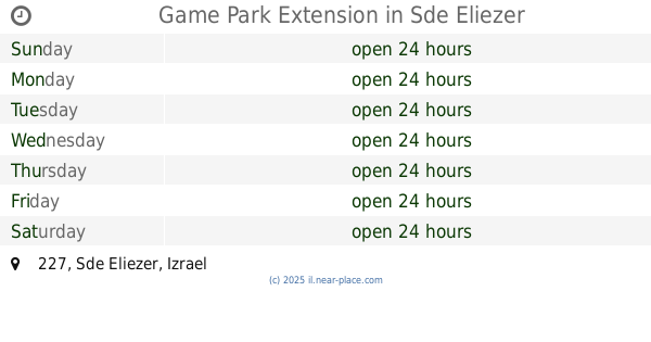
Game Park Extension
227, Sde Eliezer
Park
read more
4.016 km
גן הגת
חצור הגלילית
Park
read more
4.016 km
HaGat Garden
Chacor ha-Gelilit
Park
read more
4.6 km
Khatsor HaGlilit Community Forest
Hatzor HaGlilit
Park
Post office
Premise
Finance
Point of interest
Establishment
read more
4.6 km
Khatsor HaGlilit Community Forest
Хацор-ха-Глилит
Park
read more
4.6 km
יער קהילתי חצור הגלילית
חצור הגלילית
Park
read more
4.6 km
Khatsor HaGlilit Community Forest
Chacor ha-Gelilit
Park
read more
4.735 km
גן הידידות
חצור הגלילית
Park
read more
4.735 km
Ha-Yedidut Garden
Chacor ha-Gelilit
Park
read more
4.735 km
Ha-Yedidut Garden
Хацор-ха-Глилит
Park
read more
4.974 km
HaAndarta Garden
Хацор-ха-Глилит
Park
read more
4.974 km
HaAndarta Garden
Hatzor HaGlilit
Park
read more
4.974 km
גן האנדרטה
חצור הגלילית
Park
read more
5.534 km
קיימא : טבע סביבה וקהילה
Haveradim Street, Yesud HaMa'ala
Park
read more
5.534 km
קיימא : טבע סביבה וקהילה
הורדים, יסוד המעלה
Park
read more
7.774 km
Mordehai Pizam Garden
Safed
Park
read more
9.646 km
שמורת נחל שוח
Israel
Park
read more
9.646 km
Nahal Shu'ach Reserve
Israel
Park
read more
10.103 km
מטע קקל מאגר דלתון
Israel
Park
read more
13.169 km
שמורת נחל חמדל
Israel
Park
read more
17.402 km
Reches Livnim Reserve
Israel
Park
read more
📑
all categories
Accounting
Administrative area level 1
Administrative area level 2
Airport
Amusement park
Aquarium
Art gallery
Atm
Bakery
Bank
Bar
Beauty salon
Bicycle store
Book store
Bowling alley
Bus station
Cafe
Campground
Car dealer
Car rental
Car repair
Car wash
Casino
Cemetery
Church
City hall
Clothing store
Colloquial area
Convenience store
Country
Courthouse
Dentist
Department store
Doctor
Electrician
Electronics store
Embassy
Establishment
Finance
Fire station
Florist
Food
Funeral home
Furniture store
Gas station
General contractor
Grocery or supermarket
Gym
Hair care
Hardware store
Health
Hindu Temple
Home goods store
Hospital
Insurance agency
Intersection
Jewelry store
Laundry
Lawyer
Library
Light rail station
Liquor store
Local government office
Locality
Locksmith
Lodging
Meal delivery
Meal takeaway
Mosque
Movie rental
Movie theater
Moving company
Museum
Natural feature
Neighborhood
Night club
Painter
Park
Parking
Pet store
Pharmacy
Physiotherapist
Place of worship
Plumber
Point of interest
Police
Political
Post office
Premise
Real estate agency
Restaurant
Roofing contractor
Route
Rv park, camping
School
Shoe store
Shopping mall
Spa
Stadium
Storage
Store
Subpremise
Subway station
Supermarket
Synagogue
Taxi stand
Train station
Transit station
Travel agency
University
Veterinary care
Zoo
administrative area level 3
administrative area level 4
sublocality level 1
↑