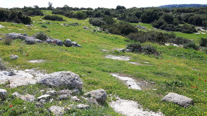
Park nearby حديقة الزهراء العامة
Israel
Park nearby حديقة الزهراء العامة
حديقة الزهراء العامة
חברון, אריאל
contacts phone
:
+972
Latitude:
31.5197273
, Longitude:
35.1109836
larger map & directions
read more
nearest Park
2.26 km
Park
Ain Sarah, Hebron
Park
read more
2.599 km
Peace Park
مربعة, Ceuta
Park
read more
2.911 km
الحديقة التكنولوجية Bgz
Fire Tower Road, Hebron
Park
read more
4.138 km
גן אביחי
חגי
Park
read more
5.178 km
Palm - Hebron Park
الخليل تفوح
Park
read more
5.869 km
منتزه لوزا بارك
G2GX+3Q2, Luza
Campground
Lodging
Park
Point of interest
Establishment
read more
11.741 km
גן אברהם
עותניאל
Park
read more
13.02 km
חאן משק מן חניון לילה קמפינג
מעון
Campground
Lodging
Park
Food
Point of interest
Establishment
read more
13.403 km
Municipality Samu Park
as-Samu
Park
read more
14.216 km
גן הזיכרון
כפר עציון
Park
read more
14.216 km
HaZikaron Garden
Kfar Ezion
Park
read more
14.685 km
גבעת הסלעים - מצפה נחל צופית
Kfar Ezion
Park
read more
15.305 km
HaTikva Grove Garden
Эфрат
Park
read more
15.305 km
גן חורשת התקווה
אפרת
Park
read more
17.365 km
גן אברהם
שמעה
Park
read more
18.235 km
HaBanim Park
Tekoa
Park
read more
18.582 km
Khirbet Burgin - secret tunnels
Judean Foothills
Park
read more
18.731 km
Sha'ul Garden
Nokdim
Park
read more
18.731 km
גן שאול
נוקדים
Park
read more
18.768 km
צימר החרוב
Unnamed Road
Campground
Lodging
Park
Point of interest
Establishment
read more
18.798 km
Khirbet Burgin
Nehusha
Park
read more
19.88 km
פארק מערות עדולם
Israel
Park
read more
27.23 km
Archeological Park
Bet Shemesh
Park
read more
27.527 km
פארק בריטניה
Israel
Park
read more
27.801 km
Va'aknin Garden
Beit Shemesh
Park
read more
📑
all categories
Accounting
Administrative area level 1
Administrative area level 2
Airport
Amusement park
Aquarium
Art gallery
Atm
Bakery
Bank
Bar
Beauty salon
Bicycle store
Book store
Bowling alley
Bus station
Cafe
Campground
Car dealer
Car rental
Car repair
Car wash
Casino
Cemetery
Church
City hall
Clothing store
Colloquial area
Convenience store
Country
Courthouse
Dentist
Department store
Doctor
Electrician
Electronics store
Embassy
Establishment
Finance
Fire station
Florist
Food
Funeral home
Furniture store
Gas station
General contractor
Grocery or supermarket
Gym
Hair care
Hardware store
Health
Hindu Temple
Home goods store
Hospital
Insurance agency
Intersection
Jewelry store
Laundry
Lawyer
Library
Light rail station
Liquor store
Local government office
Locality
Locksmith
Lodging
Meal delivery
Meal takeaway
Mosque
Movie rental
Movie theater
Moving company
Museum
Natural feature
Neighborhood
Night club
Painter
Park
Parking
Pet store
Pharmacy
Physiotherapist
Place of worship
Plumber
Point of interest
Police
Political
Post office
Premise
Real estate agency
Restaurant
Roofing contractor
Route
Rv park, camping
School
Shoe store
Shopping mall
Spa
Stadium
Storage
Store
Subpremise
Subway station
Supermarket
Synagogue
Taxi stand
Train station
Transit station
Travel agency
University
Veterinary care
Zoo
administrative area level 3
administrative area level 4
sublocality level 1
↑