Park nearby גן הוואדי
Israel
Park nearby גן הוואדי
גן הוואדי
ירושלים, ישראל
contacts phone
:
+972
Latitude:
31.7847476
, Longitude:
35.1748687
larger map & directions
read more
nearest Park
Havadi Garden
Jerusalem
Park
read more
113 m
גן הדוד
ירושלים
Park
read more
113 m
HaDod Garden
Иерусалим
Park
read more
225 m
גן עובדיה לוי
ירושלים
Park
read more
225 m
Ovadya Levi Garden
Jerusalem
Park
read more
225 m
Ovadya Levi Garden
Jerusalén
Park
read more
312 m
יער ירושלים ,הר נוף
Ha-Rav Shim'on Agasi Street 33, Jerusalem
Park
read more
312 m
יער ירושלים ,הר נוף
הרב שמעון אגסי 33, ירושלים
Park
read more
1.049 km
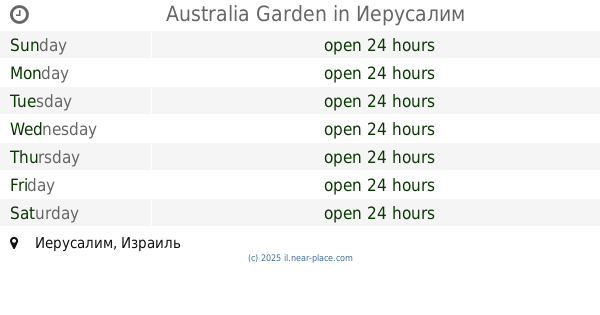
גן אוסטרליה
David Mordekhai Mae'ir Street, Jerusalem
Park
read more
1.055 km
Australia Garden
Jerusalem
Park
read more
1.055 km
גן אוסטרליה
ירושלים
Park
read more
1.085 km
גן זיכרון
ירושלים
Park
read more
1.085 km
Memory Garden
Jerusalem
Park
read more
1.152 km
Motsa Garden
Иерусалим
Park
read more
1.152 km
גן מוצא
ירושלים
Park
read more
1.17 km
גן זאב מרגליות
Jerusalem
Park
read more
1.17 km
גן זאב מרגליות
ירושלים
Park
read more
1.561 km
Ha-Arazim Garden
Motza Illit
Park
read more
1.809 km
Leon Kimkhi Municipal Garden
Jerusalem
Park
read more
1.863 km
Green Garden
Ben Tsiyon Street 8, Jerusalem
Park
read more
1.864 km
גן האחים
Jerusalem
Park
read more
1.977 km
Borochov Garden
Jerozolima
Park
read more
2.004 km
היתה לאשר פינה
בן ציון 14-16, ירושלים
Park
read more
2.164 km
Flori Shemtov Garden
Jerusalem
Park
read more
2.214 km
Avraham Garden
Jerozolima
Park
read more
📑
all categories
Accounting
Administrative area level 1
Administrative area level 2
Airport
Amusement park
Aquarium
Art gallery
Atm
Bakery
Bank
Bar
Beauty salon
Bicycle store
Book store
Bowling alley
Bus station
Cafe
Campground
Car dealer
Car rental
Car repair
Car wash
Casino
Cemetery
Church
City hall
Clothing store
Colloquial area
Convenience store
Country
Courthouse
Dentist
Department store
Doctor
Electrician
Electronics store
Embassy
Establishment
Finance
Fire station
Florist
Food
Funeral home
Furniture store
Gas station
General contractor
Grocery or supermarket
Gym
Hair care
Hardware store
Health
Hindu Temple
Home goods store
Hospital
Insurance agency
Intersection
Jewelry store
Laundry
Lawyer
Library
Light rail station
Liquor store
Local government office
Locality
Locksmith
Lodging
Meal delivery
Meal takeaway
Mosque
Movie rental
Movie theater
Moving company
Museum
Natural feature
Neighborhood
Night club
Painter
Park
Parking
Pet store
Pharmacy
Physiotherapist
Place of worship
Plumber
Point of interest
Police
Political
Post office
Premise
Real estate agency
Restaurant
Roofing contractor
Route
Rv park, camping
School
Shoe store
Shopping mall
Spa
Stadium
Storage
Store
Subpremise
Subway station
Supermarket
Synagogue
Taxi stand
Train station
Transit station
Travel agency
University
Veterinary care
Zoo
administrative area level 3
administrative area level 4
sublocality level 1
↑