Mosque nearby The Old Masjid
Israel
Mosque nearby The Old Masjid
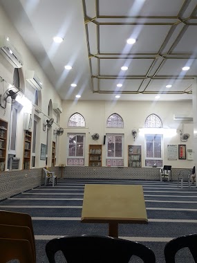
The Old Masjid
Old Town Street, Turmus Ayya
contacts phone
:
+972
Latitude:
32.0345492
, Longitude:
35.2859995
larger map & directions
read more
nearest Mosque
4.825 km
Jalud mosque
Jalud
Mosque
read more
11.076 km
Birzeit Grand Mosque
7 8، Шумен
Mosque
read more
12.043 km
Qoza Mosque
Nablus Street, Madaba
Mosque
read more
12.766 km
Mosque of Omar ibn al-Khattab
Nablus Street, Madaba
Mosque
read more
13.022 km
Hawara Grand Mosque
حوارة نابلس - الشارع الرئيسي
Mosque
read more
13.912 km
مسجد دير دبوان الكبير
Dayr Dibwan
Mosque
read more
13.918 km
Mosque of Ali bin Abi Talib
Nablus Street, Madaba
Mosque
read more
15.758 km
קבר סאלימן אל פארסי
יצהר
Mosque
read more
18.138 km
مسجد عابدين رام الله
jaffa st., Ramallah
Mosque
read more
18.434 km
קבר שייח' נבי ע'יית
Israel
Mosque
read more
19.708 km
Beitunia Grand Mosque
South Petunia Street, Pharr
Mosque
read more
19.896 km
مسجد رجال العامرد
نابلس عمان الأردن
Mosque
read more
20.476 km
مسجد الحاج معزوز المصري Masjid
Faysal Street, Ar Raqqah
Mosque
read more
20.944 km
مسجد الحاجة أمينة
askar, nablus,
Mosque
read more
21.303 km
مسجد طيبه
דבוריה
Mosque
read more
21.478 km
Masjid Al Salam
شارع المنتزه
Mosque
read more
23.26 km
Masjed Aldaoa
Halil A-Sakakini Street, Jerusalem
Mosque
read more
23.545 km
Shuman Masjed
Jerusalem
Mosque
read more
24.069 km
Abu Khalil Mousqe
32°15'02.1"N 35°16'10.0"E
Mosque
read more
24.425 km
Salah al-Din Mosque
Saniriya
Mosque
read more
24.428 km
Salah Al-Din Mosque
Main St, Saniriya
Mosque
read more
24.771 km
مسجد الرحمن ،دير قديس
رام الله دير قديس
Mosque
read more
25.076 km
Ali ibn Abi Talib Mosque
Derech Beit Hanina, Jerusalem
Mosque
read more
25.076 km
Ali ibn Abi Talib Mosque
דרך בית חנינא, ירושלים
Mosque
read more
25.726 km
שייח' נבי לימון
Israel
Mosque
read more
📑
all categories
Accounting
Administrative area level 1
Administrative area level 2
Airport
Amusement park
Aquarium
Art gallery
Atm
Bakery
Bank
Bar
Beauty salon
Bicycle store
Book store
Bowling alley
Bus station
Cafe
Campground
Car dealer
Car rental
Car repair
Car wash
Casino
Cemetery
Church
City hall
Clothing store
Colloquial area
Convenience store
Country
Courthouse
Dentist
Department store
Doctor
Electrician
Electronics store
Embassy
Establishment
Finance
Fire station
Florist
Food
Funeral home
Furniture store
Gas station
General contractor
Grocery or supermarket
Gym
Hair care
Hardware store
Health
Hindu Temple
Home goods store
Hospital
Insurance agency
Intersection
Jewelry store
Laundry
Lawyer
Library
Light rail station
Liquor store
Local government office
Locality
Locksmith
Lodging
Meal delivery
Meal takeaway
Mosque
Movie rental
Movie theater
Moving company
Museum
Natural feature
Neighborhood
Night club
Painter
Park
Parking
Pet store
Pharmacy
Physiotherapist
Place of worship
Plumber
Point of interest
Police
Political
Post office
Premise
Real estate agency
Restaurant
Roofing contractor
Route
Rv park, camping
School
Shoe store
Shopping mall
Spa
Stadium
Storage
Store
Subpremise
Subway station
Supermarket
Synagogue
Taxi stand
Train station
Transit station
Travel agency
University
Veterinary care
Zoo
administrative area level 3
administrative area level 4
sublocality level 1
↑