Lodging nearby ספארו
Israel
Lodging nearby ספארו
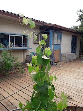
ספארו
9, 1623009, נצרת, עכו, IL ישראל
contacts phone
:
+972 52-798-2114
Latitude:
32.80585
, Longitude:
35.257476
larger map & directions
read more
nearest Lodging
Sparoo
9 Street, Nazareth
Lodging
Point of interest
Establishment
read more
663 m
Manda Homestay
מנדא 248, Kafr Manda
Lodging
read more
663 m
אירוח ביתי מנדא
מנדא 248, כפר מנדא
Lodging
read more
903 m
الحديقة الخضراء הגן הירוק
63 Street 12،, كفر مندا،
Park
Lodging
Point of interest
Establishment
read more
1.147 km
مطعم مندلاوي
Unnamed Road, Kafr Manda
Lodging
Point of interest
Establishment
read more
2.278 km
בקתות יונתן
Ari'el Street 273, נווה
Lodging
Point of interest
Establishment
read more
2.57 km
Hosting Kibbutz Hannaton
Hanaton
Lodging
read more
3.361 km
ביית לארוח בגליל
הכרמל, Moreshet
Lodging
Point of interest
Establishment
read more
3.363 km
דירת גן
ירושלים 8, מורשת
Lodging
read more
3.363 km
Garden Apartment
Yerushalayim Street 8, Moreshet
Lodging
read more
4.316 km
Yael tent
7955, Yodfat
Lodging
Point of interest
Establishment
read more
10.056 km
מול היער
בית קברות אלוני אבא.בית לחם הגלילית, בית לחם הגלילית
Lodging
read more
10.944 km
Farm Altsufem
Israel
Lodging
read more
11.241 km
גלילאקו
7, Hararit
Lodging
read more
11.852 km
אל בישארה גסט האוס
כיכר הבישופ, נצרת
Lodging
read more
12.022 km
ציפורי נוף הגליל
Tsipori Street 55-35, Nof HaGalil
Campground
Park
Lodging
Point of interest
Establishment
read more
12.073 km
Religieuses de Nazareth
Nazareth
Lodging
read more
12.516 km
kassabri old house
רחוב 5122 נצרת 4, Nazareth
Lodging
read more
13.009 km
Dream caravan rental
Sderot Ma'ale Yitshak 1, Nazareth Iliit
Lodging
read more
15.014 km
חוות בריאות מגדליה
Ha-Kharuv Street 50, Migdal HaEmek
Lodging
read more
15.2 km
המקום של מאשה ומישה
בית פרטי ברחוב הדס, טל אל
Lodging
read more
16.167 km
הבית של יעל
ת.ד. 51, הרחבה א' מגרש 14, בית קשת
Lodging
read more
16.56 km
קדמת עדן
Shezor
Lodging
read more
16.692 km
צימר וילה במעלה ההר
Maghar
Lodging
read more
20.423 km
Mount Tabor
Kfar Tavor
Lodging
read more
📑
all categories
Accounting
Administrative area level 1
Administrative area level 2
Airport
Amusement park
Aquarium
Art gallery
Atm
Bakery
Bank
Bar
Beauty salon
Bicycle store
Book store
Bowling alley
Bus station
Cafe
Campground
Car dealer
Car rental
Car repair
Car wash
Casino
Cemetery
Church
City hall
Clothing store
Colloquial area
Convenience store
Country
Courthouse
Dentist
Department store
Doctor
Electrician
Electronics store
Embassy
Establishment
Finance
Fire station
Florist
Food
Funeral home
Furniture store
Gas station
General contractor
Grocery or supermarket
Gym
Hair care
Hardware store
Health
Hindu Temple
Home goods store
Hospital
Insurance agency
Intersection
Jewelry store
Laundry
Lawyer
Library
Light rail station
Liquor store
Local government office
Locality
Locksmith
Lodging
Meal delivery
Meal takeaway
Mosque
Movie rental
Movie theater
Moving company
Museum
Natural feature
Neighborhood
Night club
Painter
Park
Parking
Pet store
Pharmacy
Physiotherapist
Place of worship
Plumber
Point of interest
Police
Political
Post office
Premise
Real estate agency
Restaurant
Roofing contractor
Route
Rv park, camping
School
Shoe store
Shopping mall
Spa
Stadium
Storage
Store
Subpremise
Subway station
Supermarket
Synagogue
Taxi stand
Train station
Transit station
Travel agency
University
Veterinary care
Zoo
administrative area level 3
administrative area level 4
sublocality level 1
↑