Light rail station nearby Yekuti'el Adam
Israel
Light rail station nearby Yekuti'el Adam
Yekuti'el Adam
Jerusalem
contacts phone
:
+972
Latitude:
31.81978
, Longitude:
35.240191
larger map & directions
read more
nearest Light rail station
יקותיאל אדם
ירושלים
Light rail station
read more
5 m
Yekutiel Adam
Light rail station
read more
5 m
יקותיאל אדם
Light rail station
read more
424 m
קרית חינוך
ירושלים
Light rail station
read more
424 m
Educational Campus
Jerusalem
Light rail station
read more
501 m
Pisgat Ze'ev Center
Light rail station
read more
693 m
Dukhifat
Jerusalem
Light rail station
read more
694 m
סיירת דוכיפת
Light rail station
read more
1.02 km
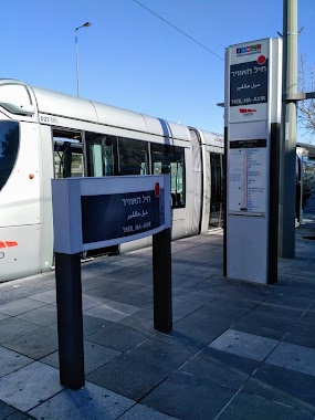
Kheil ha-Avir
Jerusalem
Light rail station
read more
1.02 km
חיל האויר
ירושלים
Light rail station
read more
1.038 km
Heil Ha'avir
Light rail station
read more
1.048 km
בית חנינא
Light rail station
read more
1.049 km
Bet Hanina
Light rail station
read more
1.141 km
Shoefat
Light rail station
read more
1.143 km
שועפאת מרכז
ירושלים
Light rail station
read more
1.187 km
שועפאת דרום
ירושלים
Light rail station
read more
1.188 km
א-סהל
Light rail station
read more
1.676 km
Giv'at HaMivtar
Light rail station
read more
1.687 km
גבעת המבתר
ירושלים
Light rail station
read more
1.687 km
Giv'at ha-Mivtar
Jerusalem
Light rail station
read more
2.432 km
גבעת התחמושת
Light rail station
read more
3.223 km
שמעון הצדיק
Light rail station
read more
3.225 km
Shim'on ha-Tsadik
Jerusalem
Light rail station
read more
3.225 km
שמעון הצדיק
ירושלים
Light rail station
read more
6.184 km
He-Khaluts
Jerusalem
Light rail station
read more
📑
all categories
Accounting
Administrative area level 1
Administrative area level 2
Airport
Amusement park
Aquarium
Art gallery
Atm
Bakery
Bank
Bar
Beauty salon
Bicycle store
Book store
Bowling alley
Bus station
Cafe
Campground
Car dealer
Car rental
Car repair
Car wash
Casino
Cemetery
Church
City hall
Clothing store
Colloquial area
Convenience store
Country
Courthouse
Dentist
Department store
Doctor
Electrician
Electronics store
Embassy
Establishment
Finance
Fire station
Florist
Food
Funeral home
Furniture store
Gas station
General contractor
Grocery or supermarket
Gym
Hair care
Hardware store
Health
Hindu Temple
Home goods store
Hospital
Insurance agency
Intersection
Jewelry store
Laundry
Lawyer
Library
Light rail station
Liquor store
Local government office
Locality
Locksmith
Lodging
Meal delivery
Meal takeaway
Mosque
Movie rental
Movie theater
Moving company
Museum
Natural feature
Neighborhood
Night club
Painter
Park
Parking
Pet store
Pharmacy
Physiotherapist
Place of worship
Plumber
Point of interest
Police
Political
Post office
Premise
Real estate agency
Restaurant
Roofing contractor
Route
Rv park, camping
School
Shoe store
Shopping mall
Spa
Stadium
Storage
Store
Subpremise
Subway station
Supermarket
Synagogue
Taxi stand
Train station
Transit station
Travel agency
University
Veterinary care
Zoo
administrative area level 3
administrative area level 4
sublocality level 1
↑