Library nearby ספריית בני יהודה
Israel
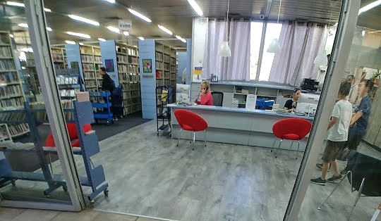
Library nearby ספריית בני יהודה
ספריית בני יהודה
מצפה גולן, בני יהודה, 12944
contacts phone
:
+972 4-660-5320
website:
www.hasifria.org.il
Latitude:
32.7997776
, Longitude:
35.6887217
larger map & directions
read more
nearest Library
13.805 km
הספרית האקדמית, המכללה האקדמית כנרת
Israel
Library
read more
14.849 km
הספרייה העירונית
טבריה
Library
read more
14.869 km
Tiberias Municipal Library
Bialik Street 13, Tiberias
Library
read more
17.217 km
סיפריה
31, Neviot Street, Kfar Hittim
Library
read more
23.272 km
Rosh Pina Public Library
מעלה גיא אוני, ראש פינה, Rosh Pinna
Library
read more
24.425 km
The Everett Library
מעלה חוני המעגל 38-39, חצור הגלילית
Library
read more
24.425 km
Библиотека Эверетт
Ma'ale Honi HaMe'agel Street 38-39, Hatzor HaGlilit
Library
read more
25.536 km
The Tsfat Legacy Center
3 1320198, Keren ha-Yesod Street, Safed
Library
read more
25.536 km
The Tsfat Legacy Center
3 1320198, קרן היסוד, צפת
Library
read more
26.183 km
סיפריה מכללת צפת
צפת
Library
read more
26.262 km
Edyth Geiger English Library
Jerusalem Street 38, Safed
Library
read more
26.317 km
The Keith Frankel Center
Keren ha-Yesod Street 1000, Safed
Library
read more
29.153 km
المكتبة العامة طرعان
טורעאן
Library
read more
33.339 km
ספרית אל נור
ג'יש
Library
read more
33.339 km
ספרית אל נור
Jish
Library
read more
38.035 km
ספריית אביבים
אביבים
Library
read more
38.201 km
Karmiel Library
צה"ל 107, כרמיאל
Library
read more
38.201 km
Библиотека Кармиэль
Tsahal Street 107, Karmiel
Library
read more
40.014 km
ספריית אורט בראודה
כרמיאל
Library
read more
40.217 km
Library Almoatz
Kafr Manda
Library
read more
40.578 km
Misgav Regional Council Library
Misgav
Library
read more
42.194 km
הספרייה העירונית
שד' רבין 1, עפולה
Library
read more
44.343 km
ספריה עירונית
הזית 24, מגדל העמק
Library
read more
45.004 km
Scout Center
Fassuta
Library
read more
47.462 km
ספרית אלעין
Unnamed Road,, Yarka
Library
read more
📑
all categories
Accounting
Administrative area level 1
Administrative area level 2
Airport
Amusement park
Aquarium
Art gallery
Atm
Bakery
Bank
Bar
Beauty salon
Bicycle store
Book store
Bowling alley
Bus station
Cafe
Campground
Car dealer
Car rental
Car repair
Car wash
Casino
Cemetery
Church
City hall
Clothing store
Colloquial area
Convenience store
Country
Courthouse
Dentist
Department store
Doctor
Electrician
Electronics store
Embassy
Establishment
Finance
Fire station
Florist
Food
Funeral home
Furniture store
Gas station
General contractor
Grocery or supermarket
Gym
Hair care
Hardware store
Health
Hindu Temple
Home goods store
Hospital
Insurance agency
Intersection
Jewelry store
Laundry
Lawyer
Library
Light rail station
Liquor store
Local government office
Locality
Locksmith
Lodging
Meal delivery
Meal takeaway
Mosque
Movie rental
Movie theater
Moving company
Museum
Natural feature
Neighborhood
Night club
Painter
Park
Parking
Pet store
Pharmacy
Physiotherapist
Place of worship
Plumber
Point of interest
Police
Political
Post office
Premise
Real estate agency
Restaurant
Roofing contractor
Route
Rv park, camping
School
Shoe store
Shopping mall
Spa
Stadium
Storage
Store
Subpremise
Subway station
Supermarket
Synagogue
Taxi stand
Train station
Transit station
Travel agency
University
Veterinary care
Zoo
administrative area level 3
administrative area level 4
sublocality level 1
↑