Health nearby רפואה סינית קהילתית בהוד השרון
Israel
Health nearby רפואה סינית קהילתית בהוד השרון
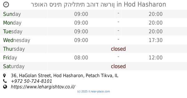
רפואה סינית קהילתית בהוד השרון
הגולן 36, הוד השרון ישראל
contacts phone
:
+972
Latitude:
32.1590241
, Longitude:
34.9236916
read more
nearest Health
רפואה סינית קהילתית בהוד השרון
HaGolan Street 36, Hod Hasharon
Health
read more
423 m
תחנת פיס לבריאות השן
הוד השרון
Health
read more
470 m
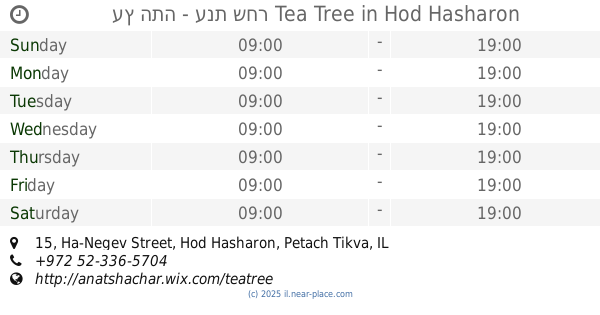
עץ התה - ענת שחר Tea Tree
Ha-Negev Street 15, Hod Hasharon
Health
read more
470 m
עץ התה - ענת שחר Tea Tree
הנגב 15, הוד השרון
Health
read more
585 m
White Crane Israel
Ha-Patish Street 11, Hod Hasharon
Health
read more
671 m
אורטוקין - טיפול בשחיקת סחוסים ללא ניתוח
Shnat HaYovel Street 54, Hod Hasharon
Hospital
Health
Point of interest
Establishment
read more
805 m
כללית גיל עמל
Eli Cohen Street 8, Hod Hasharon
Health
read more
805 m
כללית גיל עמל
אלי כהן 8, הוד השרון
Health
read more
805 m
Поликлиника Клалит
Eli Cohen Street 8, Hod Hasharon
Health
read more
842 m
Hand Touch - Massage Therapists
Sheshet ha-Yamim Street 5, Hod Hasharon
Health
read more
842 m
יד המגע - עיסוי רפואי
ששת הימים 5, הוד השרון
Health
read more
852 m
סוניה נעמני פסיכולוגית קלינית
אלי כהן 3, הוד השרון
Health
read more
852 m
סוניה נעמני פסיכולוגית קלינית
Eli Cohen Street 3, Hod Hasharon
Health
read more
858 m
Pro-Therapy
Sheshet ha-Yamim Street 5, Hod Hasharon
Health
read more
858 m
Pro-Therapy
ששת הימים 5, הוד השרון
Health
read more
📑
all categories
Accounting
Administrative area level 1
Administrative area level 2
Airport
Amusement park
Aquarium
Art gallery
Atm
Bakery
Bank
Bar
Beauty salon
Bicycle store
Book store
Bowling alley
Bus station
Cafe
Campground
Car dealer
Car rental
Car repair
Car wash
Casino
Cemetery
Church
City hall
Clothing store
Colloquial area
Convenience store
Country
Courthouse
Dentist
Department store
Doctor
Electrician
Electronics store
Embassy
Establishment
Finance
Fire station
Florist
Food
Funeral home
Furniture store
Gas station
General contractor
Grocery or supermarket
Gym
Hair care
Hardware store
Health
Hindu Temple
Home goods store
Hospital
Insurance agency
Intersection
Jewelry store
Laundry
Lawyer
Library
Light rail station
Liquor store
Local government office
Locality
Locksmith
Lodging
Meal delivery
Meal takeaway
Mosque
Movie rental
Movie theater
Moving company
Museum
Natural feature
Neighborhood
Night club
Painter
Park
Parking
Pet store
Pharmacy
Physiotherapist
Place of worship
Plumber
Point of interest
Police
Political
Post office
Premise
Real estate agency
Restaurant
Roofing contractor
Route
Rv park, camping
School
Shoe store
Shopping mall
Spa
Stadium
Storage
Store
Subpremise
Subway station
Supermarket
Synagogue
Taxi stand
Train station
Transit station
Travel agency
University
Veterinary care
Zoo
administrative area level 3
administrative area level 4
sublocality level 1
↑