Gas station nearby كازية السلام
Israel
Gas station nearby كازية السلام
كازية السلام
Al Salam Street, Abu Dhabi
contacts phone
:
+972
Latitude:
31.5320454
, Longitude:
35.0890788
larger map & directions
read more
nearest Gas station
36 m
Al-Salam Investment Group
Hebron، Al-ٍSalam street، شارع السلام
Gas station
Cafe
Car dealer
Car repair
Food
Point of interest
Store
Establishment
read more
791 m
Mecca Fuel Station
طلعة ادعيس الخليل،
Gas station
read more
877 m
محطة الانصار للمحروقات
El-Khaleel, Cairo
Gas station
read more
2.568 km
محطة الهلال للمحروقات
חברון, אריאל
Gas station
read more
2.783 km
النخبة للمحروقات والتجارةbgz
Municipal Colony Road, Thanjavur
Gas station
read more
2.845 km
Sh Gas Station
Ras Aljora, Hebron
Gas station
read more
2.937 km
محطة التحرير للمحروقات
חברון, אריאל
Gas station
read more
2.937 km
محطة التحرير للمحروقات
Hebron Street, Ari'el
Gas station
read more
2.979 km
محطة أولى للمحروقات
חברון, אריאל
Gas station
read more
2.979 km
محطة أولى للمحروقات
Hebron Street, Ari'el
Gas station
read more
3.26 km
Zaid Petrol Station
Ras Aljora, Hebron
Gas station
read more
3.386 km
محطة الأندلس للمحروقات
חברון, אריאל
Gas station
read more
4.218 km
פז
כביש 60, קרית ארבע
Gas station
read more
8.751 km
كازية نصار
Hammamat Ma'in Street
Gas station
read more
12.968 km
كازية صوريف للمحروقات
Al-Madares Street
Gas station
read more
13.166 km
Asas Fuel Station
مفرق قرية خربة الحياة، خريبة
Gas station
read more
14.48 km
Dignity Fuel Company
as-Samu
Gas station
read more
14.66 km
Abuallan Gas Station
Main Street, Truxton
Gas station
read more
15.773 km
Boss Petrol
Essamou - Esfai - Mara7Al7atab
Gas station
read more
25.868 km
Delek
Jerusalem
Gas station
read more
25.987 km
סונול
דרך דוד בנבנישתי, ירושלים
Gas station
read more
26.385 km
Сонол
Yig'al Alon Ave 22, Bet Shemesh
Gas station
read more
26.811 km
פז תלפיות
הסדנא, ירושלים
Gas station
read more
27.768 km
Paz Allenby
Hebron Road 99, Jerusalem
Gas station
read more
30.633 km
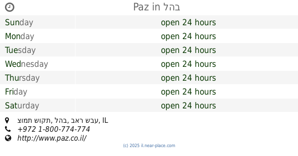
Paz
צומת שוקת, להב
Gas station
read more
📑
all categories
Accounting
Administrative area level 1
Administrative area level 2
Airport
Amusement park
Aquarium
Art gallery
Atm
Bakery
Bank
Bar
Beauty salon
Bicycle store
Book store
Bowling alley
Bus station
Cafe
Campground
Car dealer
Car rental
Car repair
Car wash
Casino
Cemetery
Church
City hall
Clothing store
Colloquial area
Convenience store
Country
Courthouse
Dentist
Department store
Doctor
Electrician
Electronics store
Embassy
Establishment
Finance
Fire station
Florist
Food
Funeral home
Furniture store
Gas station
General contractor
Grocery or supermarket
Gym
Hair care
Hardware store
Health
Hindu Temple
Home goods store
Hospital
Insurance agency
Intersection
Jewelry store
Laundry
Lawyer
Library
Light rail station
Liquor store
Local government office
Locality
Locksmith
Lodging
Meal delivery
Meal takeaway
Mosque
Movie rental
Movie theater
Moving company
Museum
Natural feature
Neighborhood
Night club
Painter
Park
Parking
Pet store
Pharmacy
Physiotherapist
Place of worship
Plumber
Point of interest
Police
Political
Post office
Premise
Real estate agency
Restaurant
Roofing contractor
Route
Rv park, camping
School
Shoe store
Shopping mall
Spa
Stadium
Storage
Store
Subpremise
Subway station
Supermarket
Synagogue
Taxi stand
Train station
Transit station
Travel agency
University
Veterinary care
Zoo
administrative area level 3
administrative area level 4
sublocality level 1
↑