Clothing store nearby MARC CAIN
Israel
Clothing store nearby MARC CAIN
MARC CAIN
ירושלים
contacts phone
:
+972 2-941-8108
website:
www.facebook.com
Latitude:
31.7774135
, Longitude:
35.2256579
larger map & directions
read more
nearest Clothing store
66 m
Dorin Frankfurt
יצחק קריב 6, ירושלים
Clothing store
read more
73 m
Columbia
Jerusalem
Clothing store
read more
287 m
סלון ענבר
מצודת דוד 7, Jerusalem
Clothing store
read more
675 m
Gabrieli Weaving
Yo'el Moshe Salomon Street 6, Jerusalem
Clothing store
read more
781 m
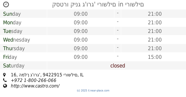
קסטרו
Ben Yehuda 1, Jerusalem
Clothing store
read more
868 m
כורש - Coresh
Yafo Street 46, Jerusalem
Clothing store
read more
885 m
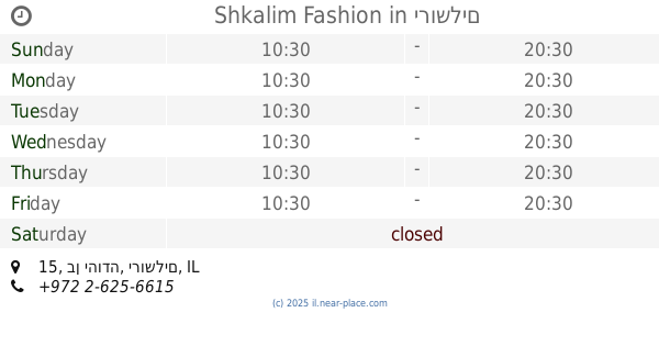
Shkalim Fashion
בן יהודה 15, ירושלים
Clothing store
read more
885 m
MISS LAGOTTE
רמב"ן 8, ירושלים
Clothing store
read more
905 m
רק בנות
הלל 11, ירושלים
Clothing store
read more
912 m
Zig-zag professional seamstress and tailor
Ya'avets Street 2, Jerusalem
Clothing store
read more
941 m
שש
Hillel Street 4, Jerusalem
Clothing store
read more
948 m
Fashions Lawrence
Ya'avets Street 6, Jerusalem
Clothing store
read more
976 m
Miss lagotte
King George Street 3, Jerusalem
Clothing store
read more
978 m
קמליון
King George Street 6, Jerusalem
Clothing store
read more
978 m
קמליון
המלך ג'ורג' 6, ירושלים
Clothing store
read more
990 m
Crazy line
8,, King George Street 2, Jerusalem
Clothing store
read more
995 m
מלכאן
Yafo Street 51, Jerusalem
Clothing store
read more
997 m
קסטרו קינג ג'ורג' ירושלים
המלך ג'ורג' 16, ירושלים
Clothing store
read more
999 m
שירה בגדי מעצבים
Shats Street 4, Jerusalem
Clothing store
read more
1.021 km
פור מי פי
Natan Strauss Street 8, Jerusalem
Clothing store
read more
1.08 km
לידר
יפו 61, Jerusalem
Clothing store
read more
1.133 km
מסדה בוטיק
יפו 75, ירושלים
Clothing store
read more
1.162 km
מרכז התפירה והברכה
Yafo Street 68, Jerusalem
Clothing store
read more
1.186 km
לריסה סלון כלות
ישעיהו 10 ירושלים IL 84703, Yisha'ayahu Street 10, Jerusalem
Clothing store
read more
1.238 km
Sde Bar שדה בר
יפו 72, ירושלים
Clothing store
read more
📑
all categories
Accounting
Administrative area level 1
Administrative area level 2
Airport
Amusement park
Aquarium
Art gallery
Atm
Bakery
Bank
Bar
Beauty salon
Bicycle store
Book store
Bowling alley
Bus station
Cafe
Campground
Car dealer
Car rental
Car repair
Car wash
Casino
Cemetery
Church
City hall
Clothing store
Colloquial area
Convenience store
Country
Courthouse
Dentist
Department store
Doctor
Electrician
Electronics store
Embassy
Establishment
Finance
Fire station
Florist
Food
Funeral home
Furniture store
Gas station
General contractor
Grocery or supermarket
Gym
Hair care
Hardware store
Health
Hindu Temple
Home goods store
Hospital
Insurance agency
Intersection
Jewelry store
Laundry
Lawyer
Library
Light rail station
Liquor store
Local government office
Locality
Locksmith
Lodging
Meal delivery
Meal takeaway
Mosque
Movie rental
Movie theater
Moving company
Museum
Natural feature
Neighborhood
Night club
Painter
Park
Parking
Pet store
Pharmacy
Physiotherapist
Place of worship
Plumber
Point of interest
Police
Political
Post office
Premise
Real estate agency
Restaurant
Roofing contractor
Route
Rv park, camping
School
Shoe store
Shopping mall
Spa
Stadium
Storage
Store
Subpremise
Subway station
Supermarket
Synagogue
Taxi stand
Train station
Transit station
Travel agency
University
Veterinary care
Zoo
administrative area level 3
administrative area level 4
sublocality level 1
↑