Cafe nearby קפה גרג מעלה אדומים
Israel
Cafe nearby קפה גרג מעלה אדומים
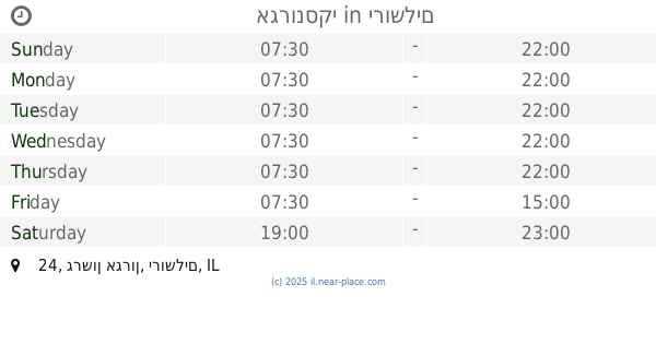
קפה גרג מעלה אדומים
הרכס 31, מעלה אדומים ישראל
contacts phone
:
+972
Latitude:
31.7808759
, Longitude:
35.3103406
read more
nearest Cafe
קפה גרג מעלה אדומים
HaReches Street 31, Ma'ale Adumim
Cafe
read more
528 m
Aroma Espresso Bar ארומה אספרסו בר
Derech Kedem 5, Ma'ale Adumim
Cafe
Food
Point of interest
Store
Establishment
read more
528 m
ארומה Aroma
Derech Kedem 5, Ma'ale Adumim
Cafe
read more
1.404 km
Ma'ale Adumim loyal pastry Paz
הר מיכוור 2, מעלה אדומים
Bakery
Cafe
Point of interest
Food
Store
Establishment
read more
1.517 km
ארומה
דרך קדם 5, מעלה אדומים
Cafe
read more
1.517 km
ארומה
Derech Kedem 5, Ma'ale Adumim
Cafe
read more
1.677 km
קפית באגם- קפית מעלה אדומים
דרך הר הצופים، פארק קק"ל מעלה אדומים، מעלה אדומים
Restaurant
Cafe
Food
Point of interest
Establishment
read more
1.709 km
קפית באגם
דרך הר הצופים
Cafe
read more
2.552 km
Eden Carmel
17 פריגן מעלה אדומים
Cafe
read more
2.552 km
מאפית עדן לכרמל
17 פריגן מעלה אדומים
Cafe
read more
5.404 km
חליטת'ה
Jerusalem
Cafe
read more
8.345 km
Chaim Yona's Chill
Yosef Karo Street 25, Jerusalem
Cafe
read more
8.482 km
אגרונסקי
גרשון אגרון 24, ירושלים
Cafe
read more
8.525 km
Aroma
Jaffa Street 40, Jerusalem
Cafe
read more
8.553 km
SOS Cafe
ירושלים
Cafe
read more
8.844 km
Ben-Ami
Emek Refa'im Street 38, Jerusalem
Bakery
Cafe
Restaurant
Food
Point of interest
Store
Establishment
read more
9.165 km
פינוקית
מרדכי נרקיס 6, ירושלים
Cafe
read more
9.624 km
בייגל קפה
פייר קניג 26 קניון הדר
Cafe
read more
10.185 km
Cofizz
Yafo Street 226, Jerusalem
Cafe
read more
10.23 km
Habutke
אנטיגנוס 26, ירושלים
Cafe
read more
10.887 km
Central Cafe
ראם, ירושלים
Cafe
read more
11.317 km
משק עפאים
בית הכרם 19, ירושלים
Cafe
read more
14.729 km
مقهى الربيع
Aqabat Jabr
Cafe
read more
17.274 km
Arabs cafe
رام الله التحتا
Cafe
read more
17.346 km
Eiffil Cafe
Rukab Street, رام الله
Cafe
read more
📑
all categories
Accounting
Administrative area level 1
Administrative area level 2
Airport
Amusement park
Aquarium
Art gallery
Atm
Bakery
Bank
Bar
Beauty salon
Bicycle store
Book store
Bowling alley
Bus station
Cafe
Campground
Car dealer
Car rental
Car repair
Car wash
Casino
Cemetery
Church
City hall
Clothing store
Colloquial area
Convenience store
Country
Courthouse
Dentist
Department store
Doctor
Electrician
Electronics store
Embassy
Establishment
Finance
Fire station
Florist
Food
Funeral home
Furniture store
Gas station
General contractor
Grocery or supermarket
Gym
Hair care
Hardware store
Health
Hindu Temple
Home goods store
Hospital
Insurance agency
Intersection
Jewelry store
Laundry
Lawyer
Library
Light rail station
Liquor store
Local government office
Locality
Locksmith
Lodging
Meal delivery
Meal takeaway
Mosque
Movie rental
Movie theater
Moving company
Museum
Natural feature
Neighborhood
Night club
Painter
Park
Parking
Pet store
Pharmacy
Physiotherapist
Place of worship
Plumber
Point of interest
Police
Political
Post office
Premise
Real estate agency
Restaurant
Roofing contractor
Route
Rv park, camping
School
Shoe store
Shopping mall
Spa
Stadium
Storage
Store
Subpremise
Subway station
Supermarket
Synagogue
Taxi stand
Train station
Transit station
Travel agency
University
Veterinary care
Zoo
administrative area level 3
administrative area level 4
sublocality level 1
↑