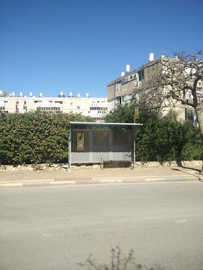
Bus station nearby Netanya Central Station
Israel
Bus station nearby Netanya Central Station
Netanya Central Station
Нетания, Израиль
contacts phone
:
+972
Latitude:
32.326689
, Longitude:
34.859446
larger map & directions
read more
nearest Bus station
70 m
Netanya Central Station/Platforms
Israel
Bus station
read more
239 m
Herzl/Razi'el Road
Israel
Bus station
read more
285 m
Herzl/Mintz
Israel
Bus station
read more
314 m
דרך רזיאל/היהלום
Israel
Bus station
read more
392 m
Urban Market
Israel
Bus station
read more
397 m
שד. בנימין/שד. ירושלים
Israel
Bus station
read more
499 m
שד.ירושלים/שד. בנימין
Israel
Bus station
read more
591 m
Petah Tikva/Tiomkin
Israel
Bus station
read more
592 m
Netanya Interchange
Israel
Bus station
read more
644 m
Dizengoff/David Remez
Israel
Bus station
read more
719 m
הרב יצחק ניסנבוים/משה גליקסון
Israel
Bus station
read more
766 m
יוספטל/גליקסון
Israel
Bus station
read more
774 m
Razi'el Road/HaRav Reines
Israel
Bus station
read more
808 m
אוסישקין/ראשון לציון
Israel
Bus station
read more
826 m
Binyamin Blvd/Tahkemoni
Israel
Bus station
read more
855 m
Weizmann/Shapira Moshe
Israel
Bus station
read more
886 m
Brenner/Haim Weizmann Blvd
Israel
Bus station
read more
972 m
Jabotinsky/Carlebach
Israel
Bus station
read more
981 m
Petah Tikva/Ben Avi
Israel
Bus station
read more
995 m
Ben Avi Blvd/Binyamin Blvd
Israel
Bus station
read more
1.047 km
Andrius/HaRav Kook
Israel
Bus station
read more
1.047 km
אנדריוס/הרב קוק
Israel
Bus station
read more
1.053 km
סמילנסקי/ירמיהו הלפרין
Israel
Bus station
read more
1.092 km
אנדריוס/שלמה המלך
Israel
Bus station
read more
1.111 km
Eliezer Ben Yehuda/Avraham Abu Shdid
Israel
Bus station
read more
📑
all categories
Accounting
Administrative area level 1
Administrative area level 2
Airport
Amusement park
Aquarium
Art gallery
Atm
Bakery
Bank
Bar
Beauty salon
Bicycle store
Book store
Bowling alley
Bus station
Cafe
Campground
Car dealer
Car rental
Car repair
Car wash
Casino
Cemetery
Church
City hall
Clothing store
Colloquial area
Convenience store
Country
Courthouse
Dentist
Department store
Doctor
Electrician
Electronics store
Embassy
Establishment
Finance
Fire station
Florist
Food
Funeral home
Furniture store
Gas station
General contractor
Grocery or supermarket
Gym
Hair care
Hardware store
Health
Hindu Temple
Home goods store
Hospital
Insurance agency
Intersection
Jewelry store
Laundry
Lawyer
Library
Light rail station
Liquor store
Local government office
Locality
Locksmith
Lodging
Meal delivery
Meal takeaway
Mosque
Movie rental
Movie theater
Moving company
Museum
Natural feature
Neighborhood
Night club
Painter
Park
Parking
Pet store
Pharmacy
Physiotherapist
Place of worship
Plumber
Point of interest
Police
Political
Post office
Premise
Real estate agency
Restaurant
Roofing contractor
Route
Rv park, camping
School
Shoe store
Shopping mall
Spa
Stadium
Storage
Store
Subpremise
Subway station
Supermarket
Synagogue
Taxi stand
Train station
Transit station
Travel agency
University
Veterinary care
Zoo
administrative area level 3
administrative area level 4
sublocality level 1
↑