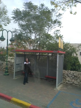
Bus station nearby מעלה הקסטל/ראשונים
Israel
Bus station nearby מעלה הקסטל/ראשונים
מעלה הקסטל/ראשונים
מבשרת ציון, ישראל
contacts phone
:
+972
Latitude:
31.794098
, Longitude:
35.143718
larger map & directions
read more
nearest Bus station
114 m
פלמ''ח/מבוא סיירים
Israel
Bus station
read more
114 m
Palmach/Mevo Sayarim
Israel
Bus station
read more
164 m
שד. החוצבים/מעלה הקסטל
Israel
Bus station
read more
191 m
מועצה
Israel
Bus station
read more
205 m
מצפה הבירה/שדרות החוצבים
Israel
Bus station
read more
310 m
פלמ''ח/שבטי ישראל
Israel
Bus station
read more
334 m
הפלמ''ח
Israel
Bus station
read more
373 m
Kramim/Gefen
Israel
Bus station
read more
415 m
פלמ''ח/מבוא ספיר
Israel
Bus station
read more
441 m
מחלף הראל/שדרות החוצבים
Israel
Bus station
read more
508 m
HaBira Lookout/Kramim
Israel
Bus station
read more
578 m
HaBosem/Kinamon Lane
Israel
Bus station
read more
578 m
הבושם/סמטת קינמון
Israel
Bus station
read more
584 m
שבע אחיות/מבוא שזיף
Israel
Bus station
read more
626 m
Kramim/Zayit
Israel
Bus station
read more
634 m
מחלף הראל
Israel
Bus station
read more
749 m
יסמין/מבוא טללים
Israel
Bus station
read more
758 m
Kramim/Te'ena
Israel
Bus station
read more
769 m
הראל/יסמין
Israel
Bus station
read more
784 m
3985/דיור מוגן מעון הרופא
Israel
Bus station
read more
862 m
HaBosem/Mevo Ktoret
Israel
Bus station
read more
932 m
יסמין
Israel
Bus station
read more
932 m
Yasmin
Israel
Bus station
read more
943 m
מרכז קליטה/הראל
Israel
Bus station
read more
1.235 km
Oren/Havatselet
Israel
Bus station
read more
📑
all categories
Accounting
Administrative area level 1
Administrative area level 2
Airport
Amusement park
Aquarium
Art gallery
Atm
Bakery
Bank
Bar
Beauty salon
Bicycle store
Book store
Bowling alley
Bus station
Cafe
Campground
Car dealer
Car rental
Car repair
Car wash
Casino
Cemetery
Church
City hall
Clothing store
Colloquial area
Convenience store
Country
Courthouse
Dentist
Department store
Doctor
Electrician
Electronics store
Embassy
Establishment
Finance
Fire station
Florist
Food
Funeral home
Furniture store
Gas station
General contractor
Grocery or supermarket
Gym
Hair care
Hardware store
Health
Hindu Temple
Home goods store
Hospital
Insurance agency
Intersection
Jewelry store
Laundry
Lawyer
Library
Light rail station
Liquor store
Local government office
Locality
Locksmith
Lodging
Meal delivery
Meal takeaway
Mosque
Movie rental
Movie theater
Moving company
Museum
Natural feature
Neighborhood
Night club
Painter
Park
Parking
Pet store
Pharmacy
Physiotherapist
Place of worship
Plumber
Point of interest
Police
Political
Post office
Premise
Real estate agency
Restaurant
Roofing contractor
Route
Rv park, camping
School
Shoe store
Shopping mall
Spa
Stadium
Storage
Store
Subpremise
Subway station
Supermarket
Synagogue
Taxi stand
Train station
Transit station
Travel agency
University
Veterinary care
Zoo
administrative area level 3
administrative area level 4
sublocality level 1
↑