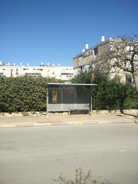
Bus station nearby Milhemet Sheshet HaYamim/Israel Zangvil
Coronavirus disease (COVID-19) Situation
confirmed cases
4841772
deaths
12707
Israel
Bus station nearby Milhemet Sheshet HaYamim/Israel Zangvil
Milhemet Sheshet HaYamim/Israel Zangvil
Нетания, Израиль
contacts phone
:
+972
Latitude:
32.331517
, Longitude:
34.861524
larger map & directions
read more
nearest Bus station
272 m
Razi'el Road/HaRav Reines
Israel
Bus station
read more
278 m
Urban Market
Israel
Bus station
read more
305 m
דרך רזיאל/היהלום
Israel
Bus station
read more
337 m
הרב יצחק ניסנבוים/משה גליקסון
Israel
Bus station
read more
375 m
Weizmann/Shapira Moshe
Israel
Bus station
read more
411 m
Brenner/Haim Weizmann Blvd
Israel
Bus station
read more
526 m
Herzl/Razi'el Road
Israel
Bus station
read more
530 m
Herzl/Mintz
Israel
Bus station
read more
567 m
יוספטל/גליקסון
Israel
Bus station
read more
577 m
Netanya Central Station/Platforms
Israel
Bus station
read more
686 m
Andrius/Borochov
Israel
Bus station
read more
709 m
Weizmann Boulevard/Yehuda HaNassi
Israel
Bus station
read more
735 m
אנדריוס/הרב קוק
Israel
Bus station
read more
735 m
Andrius/HaRav Kook
Israel
Bus station
read more
774 m
Dov Hoz/Reines
Israel
Bus station
read more
793 m
Netanya Interchange
Israel
Bus station
read more
821 m
אנדריוס/שלמה המלך
Israel
Bus station
read more
835 m
Emek Hefer/Eliyahu Golomb
Israel
Bus station
read more
931 m
Dizengoff/David Remez
Israel
Bus station
read more
953 m
שד. בנימין/שד. ירושלים
Israel
Bus station
read more
989 m
אוסישקין/ראשון לציון
Israel
Bus station
read more
1.039 km
שד.ירושלים/שד. בנימין
Israel
Bus station
read more
1.045 km
Elkalai/Yiftah HaGil'adi
Israel
Bus station
read more
1.045 km
אלקלעי/יפתח הגלעדי
Israel
Bus station
read more
1.378 km
Hadarim Mall
Israel
Bus station
read more
📑
all categories
Accounting
Administrative area level 1
Administrative area level 2
Airport
Amusement park
Aquarium
Art gallery
Atm
Bakery
Bank
Bar
Beauty salon
Bicycle store
Book store
Bowling alley
Bus station
Cafe
Campground
Car dealer
Car rental
Car repair
Car wash
Casino
Cemetery
Church
City hall
Clothing store
Colloquial area
Convenience store
Country
Courthouse
Dentist
Department store
Doctor
Electrician
Electronics store
Embassy
Establishment
Finance
Fire station
Florist
Food
Funeral home
Furniture store
Gas station
General contractor
Grocery or supermarket
Gym
Hair care
Hardware store
Health
Hindu Temple
Home goods store
Hospital
Insurance agency
Intersection
Jewelry store
Laundry
Lawyer
Library
Light rail station
Liquor store
Local government office
Locality
Locksmith
Lodging
Meal delivery
Meal takeaway
Mosque
Movie rental
Movie theater
Moving company
Museum
Natural feature
Neighborhood
Night club
Painter
Park
Parking
Pet store
Pharmacy
Physiotherapist
Place of worship
Plumber
Point of interest
Police
Political
Post office
Premise
Real estate agency
Restaurant
Roofing contractor
Route
Rv park, camping
School
Shoe store
Shopping mall
Spa
Stadium
Storage
Store
Subpremise
Subway station
Supermarket
Synagogue
Taxi stand
Train station
Transit station
Travel agency
University
Veterinary care
Zoo
administrative area level 3
administrative area level 4
sublocality level 1
↑