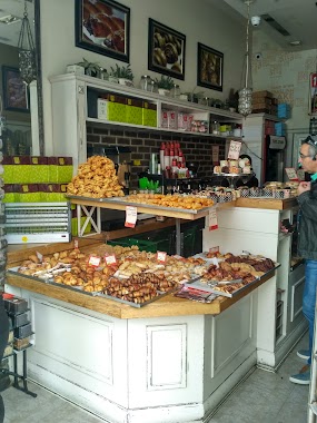
Bakery nearby Bakery Avihayil (1981) Ltd.
Israel
Bakery nearby Bakery Avihayil (1981) Ltd.
Bakery Avihayil (1981) Ltd.
8, Pri Hadash Street, Jerusalem, IL Israel
contacts phone
:
+972 2-538-5556
Latitude:
31.787222
, Longitude:
35.2174949
larger map & directions
read more
nearest Bakery
174 m
מאפית יעלה
Malkei Israel Street 6, Jerusalem
Bakery
read more
311 m
סאם בייגלס
מלכי ישראל 26, ירושלים
Bakery
read more
327 m
Sam Bagels
Malkei Israel Street 26, Jerusalem
Bakery
Restaurant
Food
Point of interest
Store
Establishment
read more
385 m
Sweetouch - מיטל בוסקילה
צפניה 12, ירושלים
Bakery
read more
489 m
Berman’s Bakery
Agripas Street 42, Jerusalem
Bakery
read more
502 m
Haba
Jaffa Street 119, Jerusalem
Bakery
read more
515 m
Maafiyat Kalderon
13 Etz hachaim St, Jerusalem
Bakery
read more
520 m
מאפית גיבעקס
Me'a She'arim Street 42, Jerusalem
Bakery
read more
529 m
Nechama Bakery
Ha-Rav Zonenfeld Street 3, Jerusalem
Bakery
read more
552 m
מאפיית האחים- סביח/סמבוסק
Agripas Street 54, Jerusalem
Bakery
read more
585 m
קלדרון
Jaffa Street 117, Jerusalem
Bakery
read more
589 m
מאפית בריזל
מאה שערים 68, ירושלים
Bakery
read more
596 m
בית מאפה יהודה (1994) - Gagou De Paris
King George Street 14, Jerusalem
Bakery
read more
603 m
אינגליש קייק
אגריפס 103, ירושלים
Bakery
read more
609 m
מאפה נאמן
ההסתדרות 2, ירושלים
Bakery
read more
617 m
Sambooki
18, Ha-Histadrut Street 2, Jerusalem
Bakery
read more
640 m
מאפיית עבאדי
Ha-Dekel Street 3, Jerusalem
Bakery
read more
652 m
לחם תושיה
בן יהודה 21, ירושלים
Bakery
read more
684 m
English Cake
King George Street 7, Jerusalem
Bakery
read more
684 m
אינגליש קייק
המלך ג'ורג' 7, ירושלים
Bakery
read more
715 m
אירית עוגות עוגיות מעוצבות
יפו 153, ירושלים
Bakery
read more
721 m
מאפיית וקסלשטיין
שבתאי פטרושקה, ירושלים
Bakery
read more
932 m
מאפית גרליץ
חנה 2, ירושלים
Bakery
read more
1.158 km
מאפית שובע שמחות
17, Shamgar Street, Jerusalem
Bakery
read more
1.213 km
מוישס
שמגר, ירושלים
Bakery
read more
📑
all categories
Accounting
Administrative area level 1
Administrative area level 2
Airport
Amusement park
Aquarium
Art gallery
Atm
Bakery
Bank
Bar
Beauty salon
Bicycle store
Book store
Bowling alley
Bus station
Cafe
Campground
Car dealer
Car rental
Car repair
Car wash
Casino
Cemetery
Church
City hall
Clothing store
Colloquial area
Convenience store
Country
Courthouse
Dentist
Department store
Doctor
Electrician
Electronics store
Embassy
Establishment
Finance
Fire station
Florist
Food
Funeral home
Furniture store
Gas station
General contractor
Grocery or supermarket
Gym
Hair care
Hardware store
Health
Hindu Temple
Home goods store
Hospital
Insurance agency
Intersection
Jewelry store
Laundry
Lawyer
Library
Light rail station
Liquor store
Local government office
Locality
Locksmith
Lodging
Meal delivery
Meal takeaway
Mosque
Movie rental
Movie theater
Moving company
Museum
Natural feature
Neighborhood
Night club
Painter
Park
Parking
Pet store
Pharmacy
Physiotherapist
Place of worship
Plumber
Point of interest
Police
Political
Post office
Premise
Real estate agency
Restaurant
Roofing contractor
Route
Rv park, camping
School
Shoe store
Shopping mall
Spa
Stadium
Storage
Store
Subpremise
Subway station
Supermarket
Synagogue
Taxi stand
Train station
Transit station
Travel agency
University
Veterinary care
Zoo
administrative area level 3
administrative area level 4
sublocality level 1
↑