Synagogue nearby מג״ל - מכון גבוה לתורה בר אילן
Israel
Synagogue nearby מג״ל - מכון גבוה לתורה בר אילן
מג״ל - מכון גבוה לתורה בר אילן
רמת גן, ישראל
contacts phone
:
+972
Latitude:
32.0688851
, Longitude:
34.8442692
larger map & directions
read more
nearest Synagogue
202 m
בית כנסת רמת אילן
14,, Rahvat Ilan 2, Giv'at Shmuel
Synagogue
read more
202 m
Synagogue Ramat Ilan
14,, Rahvat Ilan 2, Giv'at Shmuel
Synagogue
read more
248 m
Miller Synagogue
Ramat Gan
Synagogue
read more
477 m
Isaiah's vision synagogue
Kiryat Ono
Synagogue
read more
477 m
בית כנסת חזון ישעיהו
קרית אונו
Synagogue
read more
635 m
היכל בני משה
האדמו"ר מקוצק 20, בני ברק
Synagogue
read more
647 m
בית כנסת אליהו הנביא
HaRav Uziel Street 42-46, Bnei Brak
Synagogue
read more
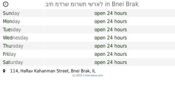
784 m
בית מדרש מורשת ישראל
HaRav Kahanman Street 114, Bnei Brak
Synagogue
read more
784 m
בית מדרש מורשת ישראל
הרב כהנמן 114, בני ברק
Synagogue
read more
787 m
בית כנסת ובית מדרש
בני ברק
Synagogue
read more
789 m
בית כנסת חמד בחורים
אצ"ל 34-36, רמת גן
Synagogue
read more
797 m
בית כנסת אריאל
סיירת דוכיפת 9, רמת גן
Synagogue
read more
811 m
בית כנסת תפארת ישראל
פומבדיתא 7, רמת גן
Synagogue
read more
811 m
בית כנסת תפארת ישראל
Pumbedita Street 7, Ramat Gan
Synagogue
read more
844 m
בית משיח רמת עמידר
Hahermon Street 6, Ramat Gan
Synagogue
read more
875 m
בית כנסת המרכזי
הרב מאיר בר אילן 21, גבעת שמואל
Synagogue
read more
893 m
בית כנסת אור ציון
Kiryat Ono
Synagogue
read more
904 m
בית כנסת אהבת אחים
גבעת שמואל
Synagogue
read more
970 m
בית נחמן חליסה
מתתיהו 23, בני ברק
Synagogue
read more
982 m
בית כנסת זכור לאברהם
זבולון המר 2, גבעת שמואל
Synagogue
read more
1.003 km
בית הכנסת כמנהג אשכנז המובהק
הרב בן יעקב 25, בני ברק
Synagogue
read more
1.195 km
מרכז מוסדות נדבורנה
חידושי הרי"ם 16, בני ברק
Synagogue
read more
1.217 km
מרכז מוסדות נדבורנה
Khidushei ha-Rim Street 16, Bnei Brak
Synagogue
read more
1.249 km
בית הכנסת משכן יוסף ושלמה
גבעת שמואל
Synagogue
read more
1.29 km
בית כנסת לכו נרננה (קרליבך)
חיים לנדאו 2, גבעת שמואל
Synagogue
read more
📑
all categories
Accounting
Administrative area level 1
Administrative area level 2
Airport
Amusement park
Aquarium
Art gallery
Atm
Bakery
Bank
Bar
Beauty salon
Bicycle store
Book store
Bowling alley
Bus station
Cafe
Campground
Car dealer
Car rental
Car repair
Car wash
Casino
Cemetery
Church
City hall
Clothing store
Colloquial area
Convenience store
Country
Courthouse
Dentist
Department store
Doctor
Electrician
Electronics store
Embassy
Establishment
Finance
Fire station
Florist
Food
Funeral home
Furniture store
Gas station
General contractor
Grocery or supermarket
Gym
Hair care
Hardware store
Health
Hindu Temple
Home goods store
Hospital
Insurance agency
Intersection
Jewelry store
Laundry
Lawyer
Library
Light rail station
Liquor store
Local government office
Locality
Locksmith
Lodging
Meal delivery
Meal takeaway
Mosque
Movie rental
Movie theater
Moving company
Museum
Natural feature
Neighborhood
Night club
Painter
Park
Parking
Pet store
Pharmacy
Physiotherapist
Place of worship
Plumber
Point of interest
Police
Political
Post office
Premise
Real estate agency
Restaurant
Roofing contractor
Route
Rv park, camping
School
Shoe store
Shopping mall
Spa
Stadium
Storage
Store
Subpremise
Subway station
Supermarket
Synagogue
Taxi stand
Train station
Transit station
Travel agency
University
Veterinary care
Zoo
administrative area level 3
administrative area level 4
sublocality level 1
↑