Synagogue nearby Magen Avraham Synagogue
Israel
Synagogue nearby Magen Avraham Synagogue
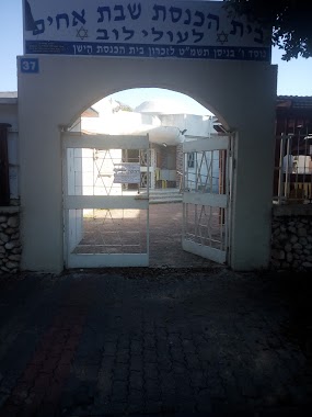
Magen Avraham Synagogue
Asdod, Israel
contacts phone
:
+972
Latitude:
31.798673
, Longitude:
34.643506
larger map & directions
read more
nearest Synagogue
487 m
בית כנסת קול יעקב
Ashdod
Synagogue
read more
487 m
בית כנסת קול יעקב
אשדוד
Synagogue
read more
536 m
בית כנסת אור אליעזר
Arieh Ben Eliezer Street 2, Ashdod
Synagogue
read more
552 m
The glory of Zion Synagogue
Ashdod
Synagogue
read more
552 m
בית כנסת אוהל שמואל
Ashdod
Synagogue
read more
673 m
מרכז תורני אבות קדושים אשדוד
ארלוזורוב 15-21, אשדוד
Synagogue
read more
673 m
מרכז תורני אבות קדושים אשדוד
Arlozorov Street 15-21, Ashdod
Synagogue
read more
711 m
בית כנסת החידא
22, Yitshak HaNassi Street, Ashdod
Synagogue
read more
716 m
בית כנסת בני קדושים
אשדוד
Synagogue
read more
746 m
Shevet Ahim Synagogue
Ashdod
Synagogue
read more
762 m
Magen David Synagogue
Ashdod
Synagogue
read more
763 m
בית כנסת אהל מועד
Ashdod
Synagogue
read more
767 m
רינת זכריה
אשדוד
Synagogue
read more
899 m
בית כנסת אוהל - יעקב
אשדוד
Synagogue
read more
932 m
בית כנסת בית ישועה אהל יצחק
Ahi Eilat Street 10, Ashdod
Synagogue
read more
932 m
בית כנסת בית ישועה אהל יצחק
אח"י אילת 10, אשדוד
Synagogue
read more
961 m
בית הכנסת לעולי בבל ששון רונין סלומון
אשדוד
Synagogue
read more
965 m
בית חבד רובע הקריה, אשדוד
תחנה מרכזית, שדרות מנחם בגין 1, אשדוד
Synagogue
read more
965 m
Chabad Center - The Kirya Quarter, Ashdod
תחנה מרכזית, שדרות מנחם בגין 1, אשדוד
Synagogue
read more
973 m
בית כנסת מגן - רפאל
אשדוד
Synagogue
read more
1.007 km
Rema Synagogue
Ashdod
Synagogue
read more
1.039 km
בית כנסת אור מכלוף ומרים
Ashdod
Synagogue
read more
1.1 km
בית כנסת שבטי ישראל
Ashdod
Synagogue
read more
1.125 km
בית כנסת פרלמן
היסמין 1, אשדוד
Synagogue
read more
1.132 km
Synagogue Siah Yitzhak
HaYasmin Street 3, Ashdod
Synagogue
read more
📑
all categories
Accounting
Administrative area level 1
Administrative area level 2
Airport
Amusement park
Aquarium
Art gallery
Atm
Bakery
Bank
Bar
Beauty salon
Bicycle store
Book store
Bowling alley
Bus station
Cafe
Campground
Car dealer
Car rental
Car repair
Car wash
Casino
Cemetery
Church
City hall
Clothing store
Colloquial area
Convenience store
Country
Courthouse
Dentist
Department store
Doctor
Electrician
Electronics store
Embassy
Establishment
Finance
Fire station
Florist
Food
Funeral home
Furniture store
Gas station
General contractor
Grocery or supermarket
Gym
Hair care
Hardware store
Health
Hindu Temple
Home goods store
Hospital
Insurance agency
Intersection
Jewelry store
Laundry
Lawyer
Library
Light rail station
Liquor store
Local government office
Locality
Locksmith
Lodging
Meal delivery
Meal takeaway
Mosque
Movie rental
Movie theater
Moving company
Museum
Natural feature
Neighborhood
Night club
Painter
Park
Parking
Pet store
Pharmacy
Physiotherapist
Place of worship
Plumber
Point of interest
Police
Political
Post office
Premise
Real estate agency
Restaurant
Roofing contractor
Route
Rv park, camping
School
Shoe store
Shopping mall
Spa
Stadium
Storage
Store
Subpremise
Subway station
Supermarket
Synagogue
Taxi stand
Train station
Transit station
Travel agency
University
Veterinary care
Zoo
administrative area level 3
administrative area level 4
sublocality level 1
↑