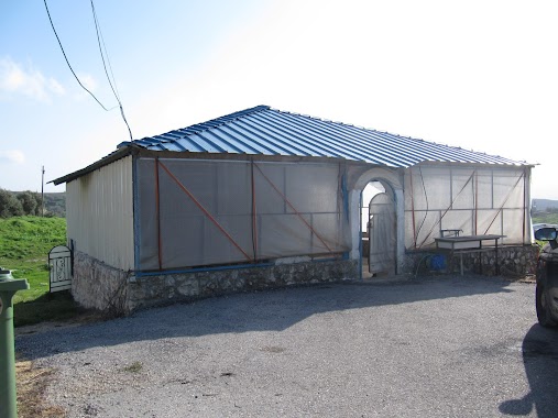
Synagogue nearby Joel the Prophet Tomb
Israel
Synagogue nearby Joel the Prophet Tomb
Joel the Prophet Tomb
Джиш, Израиль
contacts phone
:
+972
Latitude:
33.028527
, Longitude:
35.442534
larger map & directions
read more
nearest Synagogue
3.11 km
קבר רבי יוסי בן זמרא
כרם בן זמרה
Synagogue
read more
3.262 km
Mar Zutra Tomb
Israel
Synagogue
read more
3.372 km
קבר נחמן קטופא
Israel
Synagogue
read more
3.372 km
Nakhman Katufa Tomb
Israel
Synagogue
read more
4.489 km
Lights up the eyes of Israel Meron
92, Meron
Synagogue
read more
4.591 km
קבר בנאה האמוראי
Israel
Synagogue
read more
4.591 km
Benaa ha-Amorai Tomb
Israel
Synagogue
read more
4.658 km
Bnei Yossei Daman Yokeret Tomb
Israel
Synagogue
read more
4.709 km
בית כנסת
48, דלתון
Synagogue
read more
5.332 km
קבר יוסי דפקיעין
Israel
Synagogue
read more
7.952 km
בית הכנסת ומקווה טהרה טאלנא
Israel Najara Street, Safed
Synagogue
read more
7.958 km
קבר עמרם חסידא
צפת
Synagogue
read more
8.099 km
בית כנסת יוסף קארו
Beit Yosef Street 2, Safed
Synagogue
read more
9.195 km
Synagogue named Baba Sali
Kaf Bet Yaldei Ma'alot Street 220, Safed
Synagogue
read more
9.556 km
The synagogue named after Rabbi Cohen l Sassi
Safed
Synagogue
read more
9.701 km
Hall Moharan
David Remez Street 206, Safed
Synagogue
read more
10.896 km
Synagogue Honi
Hatzor HaGlilit
Synagogue
read more
11.084 km
בית כנסת שערי שלום
חצור הגלילית
Synagogue
read more
11.672 km
Tomb of Zechariah, the son rhythm
Israel
Synagogue
read more
12.116 km
Rabbi Zarik Tomb
Safed
Synagogue
read more
14.102 km
בית כנסת בן איש חי
יקינטון 21-23, מעלות תרשיחא
Synagogue
read more
14.262 km
בית הכנסת הספרדי
מעלות תרשיחא
Synagogue
read more
14.487 km
בית כנסת יהלם
קרן היסוד 6, מעלות תרשיחא
Synagogue
read more
14.714 km
מרכז רוחני זכור לאברהם
הרב משש 12, מעלות תרשיחא
Synagogue
read more
17.97 km
בית כנסת ספרדי מרכזי כרמיאל
צה"ל, כרמיאל
Synagogue
read more
📑
all categories
Accounting
Administrative area level 1
Administrative area level 2
Airport
Amusement park
Aquarium
Art gallery
Atm
Bakery
Bank
Bar
Beauty salon
Bicycle store
Book store
Bowling alley
Bus station
Cafe
Campground
Car dealer
Car rental
Car repair
Car wash
Casino
Cemetery
Church
City hall
Clothing store
Colloquial area
Convenience store
Country
Courthouse
Dentist
Department store
Doctor
Electrician
Electronics store
Embassy
Establishment
Finance
Fire station
Florist
Food
Funeral home
Furniture store
Gas station
General contractor
Grocery or supermarket
Gym
Hair care
Hardware store
Health
Hindu Temple
Home goods store
Hospital
Insurance agency
Intersection
Jewelry store
Laundry
Lawyer
Library
Light rail station
Liquor store
Local government office
Locality
Locksmith
Lodging
Meal delivery
Meal takeaway
Mosque
Movie rental
Movie theater
Moving company
Museum
Natural feature
Neighborhood
Night club
Painter
Park
Parking
Pet store
Pharmacy
Physiotherapist
Place of worship
Plumber
Point of interest
Police
Political
Post office
Premise
Real estate agency
Restaurant
Roofing contractor
Route
Rv park, camping
School
Shoe store
Shopping mall
Spa
Stadium
Storage
Store
Subpremise
Subway station
Supermarket
Synagogue
Taxi stand
Train station
Transit station
Travel agency
University
Veterinary care
Zoo
administrative area level 3
administrative area level 4
sublocality level 1
↑