Synagogue nearby בית כנסת ומרכז קהילתי מקור חיים
Israel
Synagogue nearby בית כנסת ומרכז קהילתי מקור חיים
בית כנסת ומרכז קהילתי מקור חיים
נתניה, ישראל
contacts phone
:
+972
Latitude:
32.313588
, Longitude:
34.856294
larger map & directions
read more
nearest Synagogue
45 m
Synagogue Etz Chaim
Netanya
Synagogue
read more
48 m
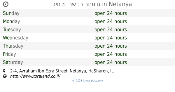
בית מדרש נר רחמים
Avraham Ibn Ezra Street 2-4, Netanya
Synagogue
read more
112 m
בית הכנסת סגולה ליהודי תימן
Ibn Gabirol Street 11, Netanya
Synagogue
read more
190 m
בית כנסת סוכת שלום
Netanya
Synagogue
read more
288 m
בית כנסת אהבת ישראל
Netanya
Synagogue
read more
288 m
בית כנסת אהבת ישראל
נתניה
Synagogue
read more
290 m
בית כנסת המרכזי עזרת אחים
Netanya
Synagogue
read more
388 m
The synagogue grace and truth
Netanya
Synagogue
read more
388 m
בית הכנסת חסד ואמת
נתניה
Synagogue
read more
412 m
בית כנסת אוהל חנין
Radak Street 1, Netanya
Synagogue
read more
412 m
בית כנסת אוהל חנין
רד"ק 1, נתניה
Synagogue
read more
695 m
בית כנסת ומרכז קהילתי תפארת בחורים
נתניה
Synagogue
read more
695 m
בית כנסת ומרכז קהילתי תפארת בחורים
Netanya
Synagogue
read more
710 m
בית כנסת שערי רחמים
נתניה
Synagogue
read more
715 m
The synagogue Ohel Yitzhak
Netanya
Synagogue
read more
715 m
בית הכנסת אהל-יצחק
נתניה
Synagogue
read more
922 m
בית כנסת אוהל יונתן - נתניה
איתמר בן-אבי 27 אצל סדון, Netanya
Synagogue
read more
964 m
Beth El Synagogue
Netanya
Synagogue
read more
964 m
בית כנסת בית אל
נתניה
Synagogue
read more
1.01 km
בית כנסת בית אליהו
Netanya
Synagogue
read more
1.105 km
בית כנסת הרחמן
21, Pierre Koenig Street 9, Netanya
Synagogue
read more
1.204 km
בית כנסת ע"ש מורדי ולוחמי הגטאות
Mordei HaGetaot Street 15, Netanya
Synagogue
read more
1.204 km
בית כנסת עש מורדי ולוחמי הגטאות
מורדי הגטאות 15, נתניה
Synagogue
read more
1.279 km
בית הכנסת היכל יעקב
מרדכי אנילביץ' 15, נתניה
Synagogue
read more
1.279 km
בית הכנסת היכל יעקב
Mordekhai Anielewicz Street 15, Netanya
Synagogue
read more
📑
all categories
Accounting
Administrative area level 1
Administrative area level 2
Airport
Amusement park
Aquarium
Art gallery
Atm
Bakery
Bank
Bar
Beauty salon
Bicycle store
Book store
Bowling alley
Bus station
Cafe
Campground
Car dealer
Car rental
Car repair
Car wash
Casino
Cemetery
Church
City hall
Clothing store
Colloquial area
Convenience store
Country
Courthouse
Dentist
Department store
Doctor
Electrician
Electronics store
Embassy
Establishment
Finance
Fire station
Florist
Food
Funeral home
Furniture store
Gas station
General contractor
Grocery or supermarket
Gym
Hair care
Hardware store
Health
Hindu Temple
Home goods store
Hospital
Insurance agency
Intersection
Jewelry store
Laundry
Lawyer
Library
Light rail station
Liquor store
Local government office
Locality
Locksmith
Lodging
Meal delivery
Meal takeaway
Mosque
Movie rental
Movie theater
Moving company
Museum
Natural feature
Neighborhood
Night club
Painter
Park
Parking
Pet store
Pharmacy
Physiotherapist
Place of worship
Plumber
Point of interest
Police
Political
Post office
Premise
Real estate agency
Restaurant
Roofing contractor
Route
Rv park, camping
School
Shoe store
Shopping mall
Spa
Stadium
Storage
Store
Subpremise
Subway station
Supermarket
Synagogue
Taxi stand
Train station
Transit station
Travel agency
University
Veterinary care
Zoo
administrative area level 3
administrative area level 4
sublocality level 1
↑