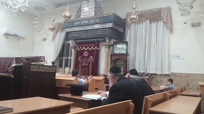
Synagogue nearby בית כנסת אהל יהונתן
Israel
Synagogue nearby בית כנסת אהל יהונתן
בית כנסת אהל יהונתן
7, עמרם גאון, ירושלים, IL ישראל
contacts phone
:
+972
Latitude:
31.7908461
, Longitude:
35.1929916
larger map & directions
read more
nearest Synagogue
82 m
בית כנסת משכן באבד
בעל השאילתות 25, ירושלים
Synagogue
read more
90 m
מגדל אשר
Shafran Street, Jerusalem
Synagogue
read more
107 m
בית כנסת ישראל הצעיר Young Israel of Claremont Parkway
בן ציון 28, ירושלים
Synagogue
read more
171 m
Synagogue Zupnik
Giv'at Sha'ul Street 7, Jerusalem
Synagogue
read more
171 m
בית כנסת זופניק
גבעת שאול 7, ירושלים
Synagogue
read more
227 m
עץ יוסף
בעל השאילתות 14, ירושלים
Synagogue
read more
233 m
Kurdish - Magen Avraham
Natronai Gaon Street 15, Jerusalem
Synagogue
read more
245 m
נועם אשכנזי
חיים ויטל 32, ירושלים
Synagogue
read more
245 m
נועם אשכנזי
Khayim Vital Street 32, Jerusalem
Synagogue
read more
273 m
The synagogue was Simeon
Jerusalem
Synagogue
read more
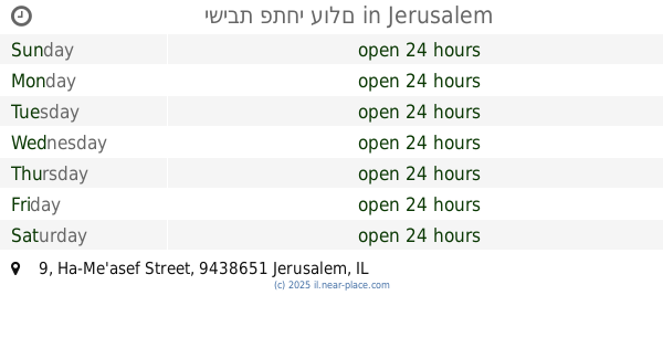
278 m
ישיבת פתחי עולם
Ha-Me'asef Street 9, Jerusalem
Synagogue
read more
320 m
בית כנסת כתר אליהו
Ha-Rav Pinkhas Kehati Street 15, Jerusalem
Synagogue
read more
330 m
יחי ראובן
Ha-Rav Pinkhas Kehati Street 15, Jerusalem
Synagogue
read more
330 m
יחי ראובן
הרב פנחס קהתי 15, ירושלים
Synagogue
read more
342 m
בית הכנסת איגוד רבני קהילות ליפתא
Ben Gurion Boulevard 128, Jerusalem
Synagogue
read more
408 m
היכל יעקב
הרב ריינס 17, ירושלים
Synagogue
read more
422 m
מניין קרליבך קמש
בן ציון 7, ירושלים
Synagogue
read more
547 m
בית כנסת זכרון קדושים
דגל ראובן, ירושלים
Synagogue
read more
568 m
בית כנסת הבית הלבן
גת 8, ירושלים
Synagogue
read more
697 m
ביהכנסשערי תורה
Kiryat Moshe Street 1, Jerusalem
Synagogue
read more
709 m
Moses Midrash Synagogue
Kosovski Street 9, Jerusalem
Synagogue
read more
759 m
בית כנסת בית יהודה
Shoshana Polyakov Street 18, Jerusalem
Synagogue
read more
818 m
תפילה למשה
הברון הירש 3, ירושלים
Synagogue
read more
834 m
בית הכנסת שארית ישראל
Rishon LeTsiyon Street 10, Jerusalem
Synagogue
read more
843 m
Beit Omer
Jerusalem
Synagogue
read more
📑
all categories
Accounting
Administrative area level 1
Administrative area level 2
Airport
Amusement park
Aquarium
Art gallery
Atm
Bakery
Bank
Bar
Beauty salon
Bicycle store
Book store
Bowling alley
Bus station
Cafe
Campground
Car dealer
Car rental
Car repair
Car wash
Casino
Cemetery
Church
City hall
Clothing store
Colloquial area
Convenience store
Country
Courthouse
Dentist
Department store
Doctor
Electrician
Electronics store
Embassy
Establishment
Finance
Fire station
Florist
Food
Funeral home
Furniture store
Gas station
General contractor
Grocery or supermarket
Gym
Hair care
Hardware store
Health
Hindu Temple
Home goods store
Hospital
Insurance agency
Intersection
Jewelry store
Laundry
Lawyer
Library
Light rail station
Liquor store
Local government office
Locality
Locksmith
Lodging
Meal delivery
Meal takeaway
Mosque
Movie rental
Movie theater
Moving company
Museum
Natural feature
Neighborhood
Night club
Painter
Park
Parking
Pet store
Pharmacy
Physiotherapist
Place of worship
Plumber
Point of interest
Police
Political
Post office
Premise
Real estate agency
Restaurant
Roofing contractor
Route
Rv park, camping
School
Shoe store
Shopping mall
Spa
Stadium
Storage
Store
Subpremise
Subway station
Supermarket
Synagogue
Taxi stand
Train station
Transit station
Travel agency
University
Veterinary care
Zoo
administrative area level 3
administrative area level 4
sublocality level 1
↑