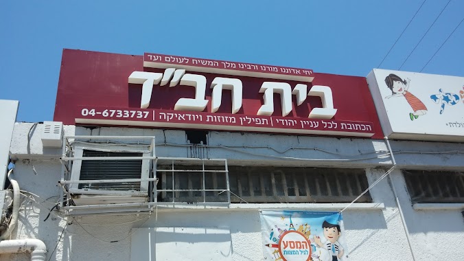
Synagogue nearby בית חבד חיפה
Israel
Synagogue nearby בית חבד חיפה
בית חבד חיפה
69, Tchernikhovski Street, Haifa, Haifa, IL Израиль
contacts phone
:
+972 4-673-3737
website:
chabadcarmel.org
Latitude:
32.8246555
, Longitude:
34.9706959
larger map & directions
read more
nearest Synagogue
בית חבד חיפה
טשרניחובסקי 69, חיפה
Synagogue
read more
245 m
מרכז חינוך ליאו באק
דרך צרפת 90, חיפה
Synagogue
read more
245 m
בית כנסת אהל אברהם
דרך צרפת 90, חיפה
Synagogue
read more
245 m
Leo Baeck Education Center
Tzorfat Road 90, Haifa
Synagogue
read more
245 m
בית כנסת אהל אברהם
Tzorfat Road 90, Haifa
Synagogue
read more
378 m
Synagogue Shaarei Teshuva
Edmond Fleg Street 60, Haifa
Synagogue
read more
378 m
בית כנסת שערי תשובה
אדמונד פלג 60, חיפה
Synagogue
read more
566 m
Chabad House Synagogue Hall Park '
Tzorfat Road 79, Haifa
Synagogue
read more
566 m
בית חבד ובית כנסת 'היכל חנה'
דרך צרפת 79, חיפה
Synagogue
read more
790 m
Ha-Tikva Synagogue
Haifa
Synagogue
read more
840 m
בית הכנסת רבי חיים חביב
דרך אלנבי 126, חיפה
Synagogue
read more
840 m
בית הכנסת רבי חיים חביב
Derech Allenby 126, Haifa
Synagogue
read more
858 m
בית כנסת תורה ותפילה
HaHayil Street 28, Haifa
Synagogue
read more
858 m
בית כנסת תורה ותפילה
החי"ל 28, חיפה
Synagogue
read more
1.076 km
Yitskhak Binding Synagogue
Haifa
Synagogue
read more
1.135 km
בית כנסת ובית מדרש רבי שמעון בר-יוחאי
חיפה
Synagogue
read more
1.227 km
Ha-Tishbi Ohel Yitskhak Synagogue
Haifa
Synagogue
read more
1.538 km
Община Возвращенные на Сион
Haifa
Synagogue
read more
1.732 km
West Carmel synagogue
Haifa
Synagogue
read more
1.855 km
בית כנסת שוירץ
HaNassi Boulevard, 67חיפה
Synagogue
read more
1.855 km
בית כנסת שוירץ
שדרות הנשיא, 67חיפה
Synagogue
read more
1.895 km
Netzach Israel The German Colony Haifa
Sderot Ben Gurion 57, Haifa
Synagogue
read more
1.992 km
בית אליהו
מאיר רוטברג 43, חיפה
Synagogue
read more
1.992 km
Beit Eliahu
Me'ir Rutberg Street 43, Haifa
Synagogue
read more
2.221 km
תורת חיים
HaMelech David Street 4, Haifa
Synagogue
read more
📑
all categories
Accounting
Administrative area level 1
Administrative area level 2
Airport
Amusement park
Aquarium
Art gallery
Atm
Bakery
Bank
Bar
Beauty salon
Bicycle store
Book store
Bowling alley
Bus station
Cafe
Campground
Car dealer
Car rental
Car repair
Car wash
Casino
Cemetery
Church
City hall
Clothing store
Colloquial area
Convenience store
Country
Courthouse
Dentist
Department store
Doctor
Electrician
Electronics store
Embassy
Establishment
Finance
Fire station
Florist
Food
Funeral home
Furniture store
Gas station
General contractor
Grocery or supermarket
Gym
Hair care
Hardware store
Health
Hindu Temple
Home goods store
Hospital
Insurance agency
Intersection
Jewelry store
Laundry
Lawyer
Library
Light rail station
Liquor store
Local government office
Locality
Locksmith
Lodging
Meal delivery
Meal takeaway
Mosque
Movie rental
Movie theater
Moving company
Museum
Natural feature
Neighborhood
Night club
Painter
Park
Parking
Pet store
Pharmacy
Physiotherapist
Place of worship
Plumber
Point of interest
Police
Political
Post office
Premise
Real estate agency
Restaurant
Roofing contractor
Route
Rv park, camping
School
Shoe store
Shopping mall
Spa
Stadium
Storage
Store
Subpremise
Subway station
Supermarket
Synagogue
Taxi stand
Train station
Transit station
Travel agency
University
Veterinary care
Zoo
administrative area level 3
administrative area level 4
sublocality level 1
↑