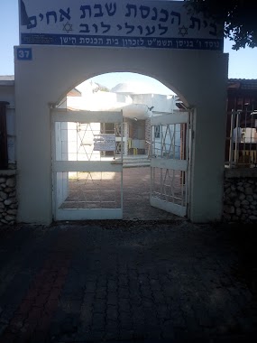
Synagogue nearby Ashdod Church
Israel
Synagogue nearby Ashdod Church
Ashdod Church
אשדוד, ישראל
contacts phone
:
+972
Latitude:
31.8105483
, Longitude:
34.6475498
larger map & directions
read more
nearest Synagogue
175 m
Seed of Abraham Synagogue
Ashdod
Synagogue
read more
247 m
בית כנסת אביר יעקב
Ha-Rishonim Street 17, Ashdod
Synagogue
read more
249 m
בית כנסת ענן הנשיא
HaEtsel Street 7, Ashdod
Synagogue
read more
249 m
בית כנסת ענן הנשיא
האצ"ל 7, אשדוד
Synagogue
read more
411 m
בית כנסת אור מכלוף ומרים
Ashdod
Synagogue
read more
463 m
בית כנסת מגן - רפאל
אשדוד
Synagogue
read more
505 m
בית כנסת בית ישועה אהל יצחק
אח"י אילת 10, אשדוד
Synagogue
read more
505 m
בית כנסת בית ישועה אהל יצחק
Ahi Eilat Street 10, Ashdod
Synagogue
read more
574 m
בית הכנסת היכל אירית
Ashdod
Synagogue
read more
574 m
בית הכנסת היכל אירית
אשדוד
Synagogue
read more
614 m
בית כנסת זכרון יוסף
אשדוד
Synagogue
read more
621 m
Magen David Synagogue
Ashdod
Synagogue
read more
638 m
Shevet Ahim Synagogue
Ashdod
Synagogue
read more
645 m
Miami Hotel-מלון מי עמי אשדוד
Max Nordau Street 24, Ashdod
Synagogue
read more
645 m
Miami Hotel-מלון מי עמי אשדוד
מקס נורדאו 24, אשדוד
Synagogue
read more
686 m
בית כנסת אוהל - יעקב
אשדוד
Synagogue
read more
773 m
Sing Isaac Synagogue
Ashdod
Synagogue
read more
907 m
בית כנסת אור אליעזר
Arieh Ben Eliezer Street 2, Ashdod
Synagogue
read more
965 m
בית הכנסת לעולי בבל ששון רונין סלומון
אשדוד
Synagogue
read more
966 m
בית כנסת אהל מועד
Ashdod
Synagogue
read more
996 m
בית כנסת שבטי ישראל
Ashdod
Synagogue
read more
1.009 km
היכל דוד
Ashdod
Synagogue
read more
1.009 km
היכל דוד
אשדוד
Synagogue
read more
1.111 km
בית כנסת אוהל שמואל
Ashdod
Synagogue
read more
1.33 km
Swieca Hall
Ashdod
Synagogue
read more
📑
all categories
Accounting
Administrative area level 1
Administrative area level 2
Airport
Amusement park
Aquarium
Art gallery
Atm
Bakery
Bank
Bar
Beauty salon
Bicycle store
Book store
Bowling alley
Bus station
Cafe
Campground
Car dealer
Car rental
Car repair
Car wash
Casino
Cemetery
Church
City hall
Clothing store
Colloquial area
Convenience store
Country
Courthouse
Dentist
Department store
Doctor
Electrician
Electronics store
Embassy
Establishment
Finance
Fire station
Florist
Food
Funeral home
Furniture store
Gas station
General contractor
Grocery or supermarket
Gym
Hair care
Hardware store
Health
Hindu Temple
Home goods store
Hospital
Insurance agency
Intersection
Jewelry store
Laundry
Lawyer
Library
Light rail station
Liquor store
Local government office
Locality
Locksmith
Lodging
Meal delivery
Meal takeaway
Mosque
Movie rental
Movie theater
Moving company
Museum
Natural feature
Neighborhood
Night club
Painter
Park
Parking
Pet store
Pharmacy
Physiotherapist
Place of worship
Plumber
Point of interest
Police
Political
Post office
Premise
Real estate agency
Restaurant
Roofing contractor
Route
Rv park, camping
School
Shoe store
Shopping mall
Spa
Stadium
Storage
Store
Subpremise
Subway station
Supermarket
Synagogue
Taxi stand
Train station
Transit station
Travel agency
University
Veterinary care
Zoo
administrative area level 3
administrative area level 4
sublocality level 1
↑