School nearby תיכון עבדאללה אבן חוסיין
Israel
School nearby תיכון עבדאללה אבן חוסיין
תיכון עבדאללה אבן חוסיין
ירושלים
contacts phone
:
+972
Latitude:
31.7974875
, Longitude:
35.2295602
larger map & directions
read more
nearest School
366 m
תיכון רנה קאסן
קרל נטר 1, ירושלים
School
read more
366 m
Rene Cassin High School
Karl Netter Street 1, Jerusalem
School
read more
540 m
ישיבת אור שמח
שמעון הצדיק 22, ירושלים
School
read more
545 m
ביס פרדס
ירושלים
School
read more
545 m
Pardis School
Jerusalem
School
read more
631 m
ביס מלד
זלמן ארן 7, Jerusalem
School
read more
642 m
מ.ת.מ. : מרכזי תמיכה משלבים - בית-הילדים
Etsyon Gever Street 5, Jerusalem
School
read more
681 m
ביס פרנקל
אצ"ל 20, ירושלים
School
read more
681 m
Frankel School
Etsel Street 20, Jerusalem
School
read more
693 m
בית ספר על יסודי לבנות בית-חנה
Shim'on ha-Tsadik Street 23, Jerusalem
School
read more
739 m
جمعية الشابات المسيحيات YWCA
אבן ג'ובייר, ירושלים
School
read more
801 m
תיכון בית חנה
Shmu'el ha-Navi Street 72, Jerusalem
School
read more
814 m
Mosdos Bais Yosef Tzvi Dushinsky
שמואל הנביא 52, ירושלים
School
read more
830 m
ישיבת הרעיון היהודי
Shmarya Street 8, Jerusalem
School
read more
838 m
גן ילדים עץ הדעת
אחינועם 13, ירושלים
School
read more
854 m
Yeshiva Derech Hachaim
שמואל הנביא 46, ירושלים
School
read more
907 m
Talmud Tora Kdushat ha-Tora
Jerusalem
School
read more
936 m
בית מרגלית
Jerusalem
School
read more
946 m
Talmud Torah Karlin Stolin
Shimshon Polanski Street 2, Jerusalem
School
read more
981 m
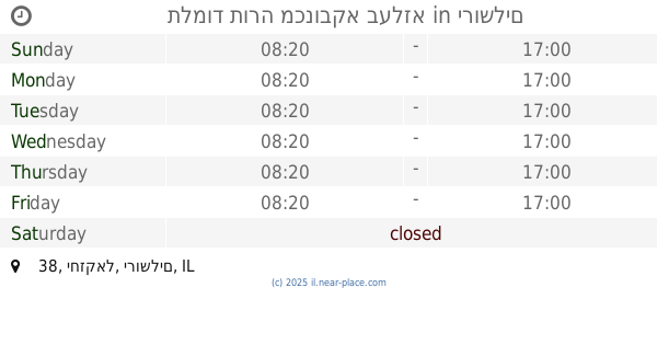
תלמוד תורה מכנובקא בעלזא
יחזקאל 38, ירושלים
School
read more
1.037 km
תלמוד תורה שמע
Rabenu Gershom Street 15, Jerusalem
School
read more
1.049 km
ישיבת חכמה ודעת
Avraham Talmudi Street 13, Jerusalem
School
read more
1.119 km
ישיבת מיר - מרכזי
Beit Yisra'el Street 3, Jerusalem
School
read more
1.142 km
Mir Yeshiva Bais Shalom
האדמו"ר רבי שלמה 1, ירושלים
School
read more
1.263 km
שאו מרום עיניכם
שערי פינה 1-3, ירושלים
School
read more
📑
all categories
Accounting
Administrative area level 1
Administrative area level 2
Airport
Amusement park
Aquarium
Art gallery
Atm
Bakery
Bank
Bar
Beauty salon
Bicycle store
Book store
Bowling alley
Bus station
Cafe
Campground
Car dealer
Car rental
Car repair
Car wash
Casino
Cemetery
Church
City hall
Clothing store
Colloquial area
Convenience store
Country
Courthouse
Dentist
Department store
Doctor
Electrician
Electronics store
Embassy
Establishment
Finance
Fire station
Florist
Food
Funeral home
Furniture store
Gas station
General contractor
Grocery or supermarket
Gym
Hair care
Hardware store
Health
Hindu Temple
Home goods store
Hospital
Insurance agency
Intersection
Jewelry store
Laundry
Lawyer
Library
Light rail station
Liquor store
Local government office
Locality
Locksmith
Lodging
Meal delivery
Meal takeaway
Mosque
Movie rental
Movie theater
Moving company
Museum
Natural feature
Neighborhood
Night club
Painter
Park
Parking
Pet store
Pharmacy
Physiotherapist
Place of worship
Plumber
Point of interest
Police
Political
Post office
Premise
Real estate agency
Restaurant
Roofing contractor
Route
Rv park, camping
School
Shoe store
Shopping mall
Spa
Stadium
Storage
Store
Subpremise
Subway station
Supermarket
Synagogue
Taxi stand
Train station
Transit station
Travel agency
University
Veterinary care
Zoo
administrative area level 3
administrative area level 4
sublocality level 1
↑