School nearby مدرسة حباد
Israel
School nearby مدرسة حباد
مدرسة حباد
43, Shlomo ha-Melekh Street, Ashdod, Ashkelon, IL Israel
contacts phone
:
+972 8-864-9504
website:
www.chabad.org.il
Latitude:
31.7714723
, Longitude:
34.643544
larger map & directions
read more
nearest School
359 m
School colors
HaAnavim Street 1, Ashdod
School
read more
389 m
משפחתון דובוני אכפת לי
אמציה המלך 9, אשדוד
School
read more
562 m
אשדוד מקיף ח
Barak Ben Avinoam Street 10, Ashdod
School
read more
664 m
ביס רתמים
המלך חזקיה 22, אשדוד
School
read more
677 m
בית ספר רימונים
אשדוד
School
read more
711 m
משפחתון קשת בענן Мишпахтон RaINBOW
יהושפט המלך 4, אשדוד
School
read more
748 m
גן אחווה
אשדוד
School
read more
749 m
גן ברוש אשדוד
David HaMelech Street 12, Ashdod
School
read more
756 m
יב ליד בית הספר אורות
Shevet Yissachar Street 1, Ashdod
School
read more
759 m
גן רעות
אשדוד
School
read more
759 m
גן רעות
Ashdod
School
read more
911 m
ביס שקד
רחבעם המלך 15, אשדוד
School
read more
918 m
פעוטון אשדוד גן ילדים גן האגדות
ישעיהו הנביא 25, אשדוד
School
read more
930 m
детский сад В гостях у сказки
אליהו הנביא 23, אשדוד
School
read more
947 m
שרונה עידן - תרפיסטית בשיטת ABA
רוטשילד 42 אשדוד IL 7751631, Sderot Rothschild 42, Ashdod
School
read more
966 m
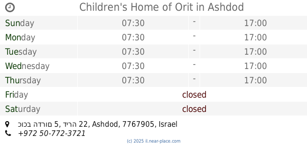
Children's Home of Orit
כוכב הדרום 5, דירה 22, Ashdod
School
read more
966 m
המשפחתון של אורית
כוכב הדרום 5, דירה 22, אשדוד
School
read more
1.052 km
Amirim School
Ha-Aliya Street 3, Ashdod
School
read more
1.052 km
בי"ס יסודי אמירים
העלייה 3, אשדוד
School
read more
1.075 km
גן ילדים שמש
שבט ראובן 3, אשדוד
School
read more
1.075 km
גן ילדים שמש
Shevet Re'uven Street 3, Ashdod
School
read more
1.095 km
TET HIGH SCHOOL
Shevet Re'uven Street, Ashdod
School
read more
1.095 km
TET HIGH SCHOOL
שבט ראובן, אשדוד
School
read more
1.193 km
מקיף ט'
Shevet Re'uven Street 2, Ashdod
School
read more
1.193 km
מקיף ט'
שבט ראובן 2, אשדוד
School
read more
📑
all categories
Accounting
Administrative area level 1
Administrative area level 2
Airport
Amusement park
Aquarium
Art gallery
Atm
Bakery
Bank
Bar
Beauty salon
Bicycle store
Book store
Bowling alley
Bus station
Cafe
Campground
Car dealer
Car rental
Car repair
Car wash
Casino
Cemetery
Church
City hall
Clothing store
Colloquial area
Convenience store
Country
Courthouse
Dentist
Department store
Doctor
Electrician
Electronics store
Embassy
Establishment
Finance
Fire station
Florist
Food
Funeral home
Furniture store
Gas station
General contractor
Grocery or supermarket
Gym
Hair care
Hardware store
Health
Hindu Temple
Home goods store
Hospital
Insurance agency
Intersection
Jewelry store
Laundry
Lawyer
Library
Light rail station
Liquor store
Local government office
Locality
Locksmith
Lodging
Meal delivery
Meal takeaway
Mosque
Movie rental
Movie theater
Moving company
Museum
Natural feature
Neighborhood
Night club
Painter
Park
Parking
Pet store
Pharmacy
Physiotherapist
Place of worship
Plumber
Point of interest
Police
Political
Post office
Premise
Real estate agency
Restaurant
Roofing contractor
Route
Rv park, camping
School
Shoe store
Shopping mall
Spa
Stadium
Storage
Store
Subpremise
Subway station
Supermarket
Synagogue
Taxi stand
Train station
Transit station
Travel agency
University
Veterinary care
Zoo
administrative area level 3
administrative area level 4
sublocality level 1
↑