School nearby גן מרגנית
Coronavirus disease (COVID-19) Situation
confirmed cases
4841772
deaths
12707
Israel
School nearby גן מרגנית
גן מרגנית
21, Ben Zion Israeli Street, Giv'atayim, IL Israel
contacts phone
:
+972 3-673-4460
Latitude:
32.0779437
, Longitude:
34.8120881
larger map & directions
read more
nearest School
298 m
עדי ילין - שיעורי פיתוח קול בגבעתיים
כצנלסון 118, גבעתיים
School
read more
388 m
גן סביון
Po'alei ha-Rakevet Street 24, Giv'atayim
School
read more
415 m
גן איריס
המעורר 11, גבעתיים
School
read more
415 m
גן אלה
המעורר 11, גבעתיים
School
read more
491 m
הפעוטון הספרותי
קלאוזנר 11, רמת גן
School
read more
626 m
גן סנונית
רותם 4, גבעתיים
School
read more
730 m
חלילית - גן ילדים פרטי
Sderot HaYeled 21, Ramat Gan
School
read more
731 m
חלילית - גן ילדים פרטי
21, Sderot HaYeled, Ramat Hasharon
School
read more
746 m
גן שיבולת
Ha-Matmid Street 14, Ramat Gan
School
read more
778 m
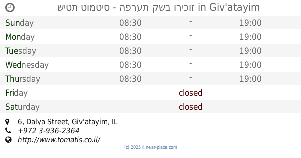
שיטת טומטיס - הפרעת קשב וריכוז
Dalya Street 6, Giv'atayim
School
read more
796 m
גן דגנית
פטאי 12, גבעתיים
School
read more
920 m
Rainbow Garden
תיאטרון רמת גן, חיבת ציון 18, רמת גן
School
read more
920 m
גן עגור
חורגין 11, רמת גן
School
read more
938 m
Yo Ave Guitar Lessons
36 Taiber Street, APT 3, Gyvatayim
School
read more
940 m
ORT Technicum Givatayim
Golomb Street 15, Giv'atayim
School
read more
940 m
אורט טכניקום גבעתיים
גולומב 15, גבעתיים
School
read more
958 m
התופיה סטודיו לתופים
רח' זאב ז'בוטינסקי 7, רמת גן
School
read more
963 m
גן שקדיה
מוריה 25, רמת גן
School
read more
984 m
גן ילדים בייבי קלאב
אלעזר ויינשל 4, רמת גן
School
read more
1.013 km
ספריית בית רוזן
Bialik Street 89, Ramat Gan
School
read more
1.015 km
מקום לגדול - גן מונטיסורי
דרך בן גוריון 226, גבעתיים
School
read more
1.023 km
הגן של רחלי
Weizman Street 58, Giv'atayim
School
read more
1.023 km
גן ילדים בגבעתיים
וייצמן 58, גבעתיים
School
read more
1.112 km
המרכז לגיל הרך גבעתיים, גן "הפעוטון שלנו"
Eilat Street 8, Giv'atayim
School
read more
1.143 km
גן בוטיק
HaNegba Street 6, Giv'atayim
School
read more
📑
all categories
Accounting
Administrative area level 1
Administrative area level 2
Airport
Amusement park
Aquarium
Art gallery
Atm
Bakery
Bank
Bar
Beauty salon
Bicycle store
Book store
Bowling alley
Bus station
Cafe
Campground
Car dealer
Car rental
Car repair
Car wash
Casino
Cemetery
Church
City hall
Clothing store
Colloquial area
Convenience store
Country
Courthouse
Dentist
Department store
Doctor
Electrician
Electronics store
Embassy
Establishment
Finance
Fire station
Florist
Food
Funeral home
Furniture store
Gas station
General contractor
Grocery or supermarket
Gym
Hair care
Hardware store
Health
Hindu Temple
Home goods store
Hospital
Insurance agency
Intersection
Jewelry store
Laundry
Lawyer
Library
Light rail station
Liquor store
Local government office
Locality
Locksmith
Lodging
Meal delivery
Meal takeaway
Mosque
Movie rental
Movie theater
Moving company
Museum
Natural feature
Neighborhood
Night club
Painter
Park
Parking
Pet store
Pharmacy
Physiotherapist
Place of worship
Plumber
Point of interest
Police
Political
Post office
Premise
Real estate agency
Restaurant
Roofing contractor
Route
Rv park, camping
School
Shoe store
Shopping mall
Spa
Stadium
Storage
Store
Subpremise
Subway station
Supermarket
Synagogue
Taxi stand
Train station
Transit station
Travel agency
University
Veterinary care
Zoo
administrative area level 3
administrative area level 4
sublocality level 1
↑