Restaurant nearby צ'פלין אשדוד
Israel
Restaurant nearby צ'פלין אשדוד
צ'פלין אשדוד
בני ברית פינת פינת מנחם בגין, אשדוד ישראל
contacts phone
:
+972
Latitude:
31.7870004
, Longitude:
34.6464682
read more
nearest Restaurant
97 m
שווארמה הנסיך
Tashah Street, Ashdod
Restaurant
read more
116 m
Burgers Ashdod
Tashah Street 7, Ashdod
Restaurant
read more
173 m
השבע-שווארמה
Ashdod
Restaurant
read more
214 m
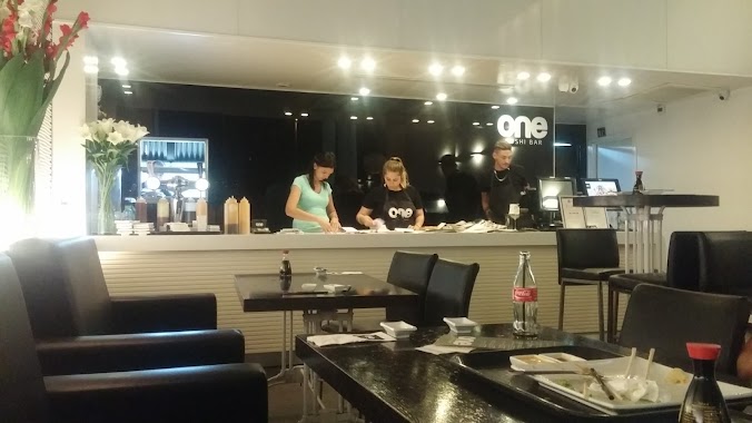
One Sushi Bar
Ha-Tsiyonut Street 13, Ashdod
Restaurant
read more
486 m
דודא לפיצה
Menachem Begin Boulevard 1, Ashdod
Restaurant
read more
502 m
עידן הפיצה אשדוד
שדרות הפרחים 20, אשדוד
Restaurant
read more
779 m
Макдоналдс
קניון הסיטי, שדרות מנחם בגין, אשדוד
Restaurant
read more
848 m
בונה פיצה
HaNevi'im Street 21, Ashdod
Restaurant
read more
900 m
בני הדייג אשדוד
גן העיר, הגדוד העברי 5, אשדוד
Restaurant
read more
906 m
Pizza Fargo
Ha-Gdud ha-Ivri Street, Ashdod
Restaurant
read more
912 m
Bleecker Bakery Ashdod
Ha-Gdud ha-Ivri Street, Ashdod
Restaurant
read more
912 m
בורגרס בר אשדוד
Ha-Gdud ha-Ivri Street, Ashdod
Restaurant
read more
917 m
אצה אשדוד
Ha-Gdud ha-Ivri Street, Ashdod
Restaurant
read more
919 m
מסעדת שיפודים גן העיר
Ashdod
Restaurant
read more
941 m
Hummus Cohen
Tsahal Street 1, Ashdod
Restaurant
read more
954 m
Ресторан Дежавю
Ashdod
Restaurant
read more
967 m
בוטרא אשדוד
אדר 4, אשדוד
Restaurant
read more
967 m
פרי מור בעיר
סי מול, הגדוד העברי 6, אשדוד
Restaurant
read more
1000 m
בגטוס
Adar Street 4, Ashdod
Restaurant
read more
1000 m
Cheese Pizza
Adar Street 4, Ashdod
Restaurant
read more
1.004 km
קופיקס
אשדוד
Restaurant
read more
1.009 km
פיצריה דהרי
Dov Gur Street 24, Ashdod
Restaurant
read more
1.009 km
פיצריה דהרי
דב גור 24, אשדוד
Restaurant
read more
1.075 km
דדיאני, אוכל גרוזיני
הבנים 5, אשדוד
Restaurant
read more
1.106 km
Pizza Borough Park
Shlomo Ben Yosef Street 27, Ashdod
Restaurant
read more
📑
all categories
Accounting
Administrative area level 1
Administrative area level 2
Airport
Amusement park
Aquarium
Art gallery
Atm
Bakery
Bank
Bar
Beauty salon
Bicycle store
Book store
Bowling alley
Bus station
Cafe
Campground
Car dealer
Car rental
Car repair
Car wash
Casino
Cemetery
Church
City hall
Clothing store
Colloquial area
Convenience store
Country
Courthouse
Dentist
Department store
Doctor
Electrician
Electronics store
Embassy
Establishment
Finance
Fire station
Florist
Food
Funeral home
Furniture store
Gas station
General contractor
Grocery or supermarket
Gym
Hair care
Hardware store
Health
Hindu Temple
Home goods store
Hospital
Insurance agency
Intersection
Jewelry store
Laundry
Lawyer
Library
Light rail station
Liquor store
Local government office
Locality
Locksmith
Lodging
Meal delivery
Meal takeaway
Mosque
Movie rental
Movie theater
Moving company
Museum
Natural feature
Neighborhood
Night club
Painter
Park
Parking
Pet store
Pharmacy
Physiotherapist
Place of worship
Plumber
Point of interest
Police
Political
Post office
Premise
Real estate agency
Restaurant
Roofing contractor
Route
Rv park, camping
School
Shoe store
Shopping mall
Spa
Stadium
Storage
Store
Subpremise
Subway station
Supermarket
Synagogue
Taxi stand
Train station
Transit station
Travel agency
University
Veterinary care
Zoo
administrative area level 3
administrative area level 4
sublocality level 1
↑