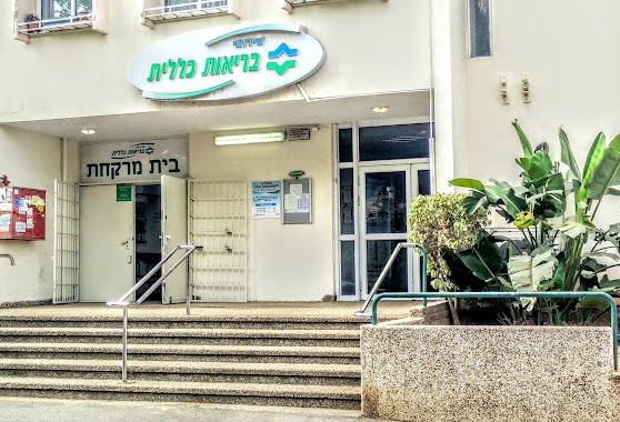
Pharmacy nearby שור טבצ'ניק כפר סבא
Coronavirus disease (COVID-19) Situation
confirmed cases
4841772
deaths
12707
Israel
Pharmacy nearby שור טבצ'ניק כפר סבא
שור טבצ'ניק כפר סבא
כפר סבא, ישראל
contacts phone
:
+972
Latitude:
32.174398
, Longitude:
34.890992
larger map & directions
read more
nearest Pharmacy
399 m
בית מרקחת מדיקסטור
Tchernichovsky Street 24, Kefar Sava
Pharmacy
read more
399 m
בית מרקחת מדיקסטור
טשרניחובסקי 24, כפר סבא
Pharmacy
read more
411 m
מדיקסטור
כפר סבא
Pharmacy
read more
914 m
גלעד כפר סבא
כפר סבא
Pharmacy
read more
934 m
New Pharm
Tchernichovsky Street 55, Kefar Sava
Pharmacy
read more
934 m
ניו פארם
Tchernichovsky Street 55, Kefar Sava
Pharmacy
read more
934 m
ניו פארם
טשרניחובסקי 55, כפר סבא
Pharmacy
read more
1.002 km
כללית - בית מרקחת
טשרניחובסקי 59, כפר סבא
Pharmacy
read more
1.002 km
Clalit Pharmacy
Tchernichovsky Street 59, Kefar Sava
Pharmacy
read more
1.166 km
סופר-פארם קניון ערים כפר סבא
ויצמן 63, כפר סבא
Pharmacy
read more
1.166 km
Супер-Фарм
Weizmann Street 63, Kefar Sava
Pharmacy
read more
1.181 km
Поликлиника Клалит
ברל כצנסלון 14, קניון ערים, Kefar Sava
Pharmacy
read more
1.289 km
Super-Pharm
Ahuza Street 83, Ra'anana
Pharmacy
read more
1.289 km
Супер-Фарм
Ahuza Street 83, Ra'anana
Pharmacy
read more
1.375 km
Супер-Фарм
Weizmann Street 78, Kefar Sava
Pharmacy
read more
1.613 km
סופר פארם
בית הבד 2, הוד השרון
Pharmacy
read more
1.693 km
Maccabi Kfar Saba
Rothschild Street 56, Kefar Sava
Pharmacy
read more
1.695 km
כללית - בית מרקחת
בן גוריון 43, כפר סבא
Pharmacy
read more
1.728 km
דר' סמואלוב
אחוזה 120, רעננה
Pharmacy
read more
1.744 km
Поликлиника Клалит
HaRashut Street 8, Hod Hasharon
Pharmacy
read more
1.775 km
בית מרקחת כנרת
Weizmann Street 119, Kefar Sava
Pharmacy
read more
1.775 km
בית מרקחת כנרת
ויצמן 119, כפר סבא
Pharmacy
read more
1.923 km
Arza
Ostrovsky Street, Ra'anana
Pharmacy
read more
1.927 km
סופר-פארם כפר סבא הירוקה
רח' רפפורט 19, כפר סבא
Pharmacy
read more
1.971 km
בית מרקחת מגדיאל
Derech Magdiel 54, Hod Hasharon
Pharmacy
read more
📑
all categories
Accounting
Administrative area level 1
Administrative area level 2
Airport
Amusement park
Aquarium
Art gallery
Atm
Bakery
Bank
Bar
Beauty salon
Bicycle store
Book store
Bowling alley
Bus station
Cafe
Campground
Car dealer
Car rental
Car repair
Car wash
Casino
Cemetery
Church
City hall
Clothing store
Colloquial area
Convenience store
Country
Courthouse
Dentist
Department store
Doctor
Electrician
Electronics store
Embassy
Establishment
Finance
Fire station
Florist
Food
Funeral home
Furniture store
Gas station
General contractor
Grocery or supermarket
Gym
Hair care
Hardware store
Health
Hindu Temple
Home goods store
Hospital
Insurance agency
Intersection
Jewelry store
Laundry
Lawyer
Library
Light rail station
Liquor store
Local government office
Locality
Locksmith
Lodging
Meal delivery
Meal takeaway
Mosque
Movie rental
Movie theater
Moving company
Museum
Natural feature
Neighborhood
Night club
Painter
Park
Parking
Pet store
Pharmacy
Physiotherapist
Place of worship
Plumber
Point of interest
Police
Political
Post office
Premise
Real estate agency
Restaurant
Roofing contractor
Route
Rv park, camping
School
Shoe store
Shopping mall
Spa
Stadium
Storage
Store
Subpremise
Subway station
Supermarket
Synagogue
Taxi stand
Train station
Transit station
Travel agency
University
Veterinary care
Zoo
administrative area level 3
administrative area level 4
sublocality level 1
↑